
High pressure keeps Wednesday calm and comfortable, but unsettled weather is ahead
Humid air returns Thursday into the weekend
Go Deeper.
Create an account or log in to save stories.
Like this?
Thanks for liking this story! We have added it to a list of your favorite stories.


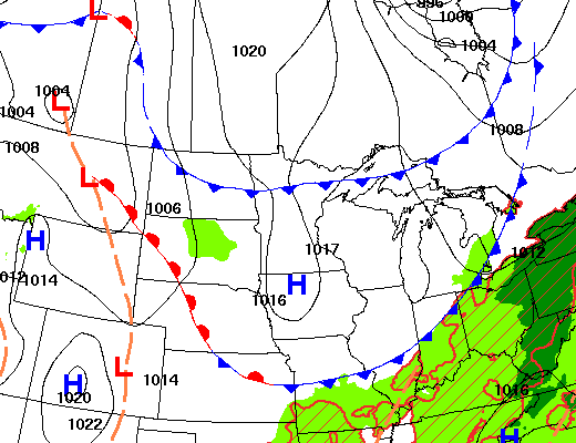
Surface high pressure will keep things dry and comfortable Wednesday. Humid air returns Thursday into the weekend, increasing the chances of storms with potentially heavy rainfall.
Sun, dry weather Wednesday but changes are coming
Other than wildfire smoke drifting around the state, it will be a comfortable day. Dew points will remain in the 50s for most and afternoon highs will again range from the low 70s north to the low 80s south with plenty of sunshine.
Our latest round of wildfire smoke should dissipate over the next 24 hours. Air quality alerts remain in place for northern Minnesota all day Wednesday.
Check the latest air quality conditions, alerts and forecasts here:
Turn Up Your Support
MPR News helps you turn down the noise and build shared understanding. Turn up your support for this public resource and keep trusted journalism accessible to all.
High pressure will drift east, allowing the return of warmer and more humid air and setting the stage for an unsettled pattern as the upper levels of the atmosphere become more active.
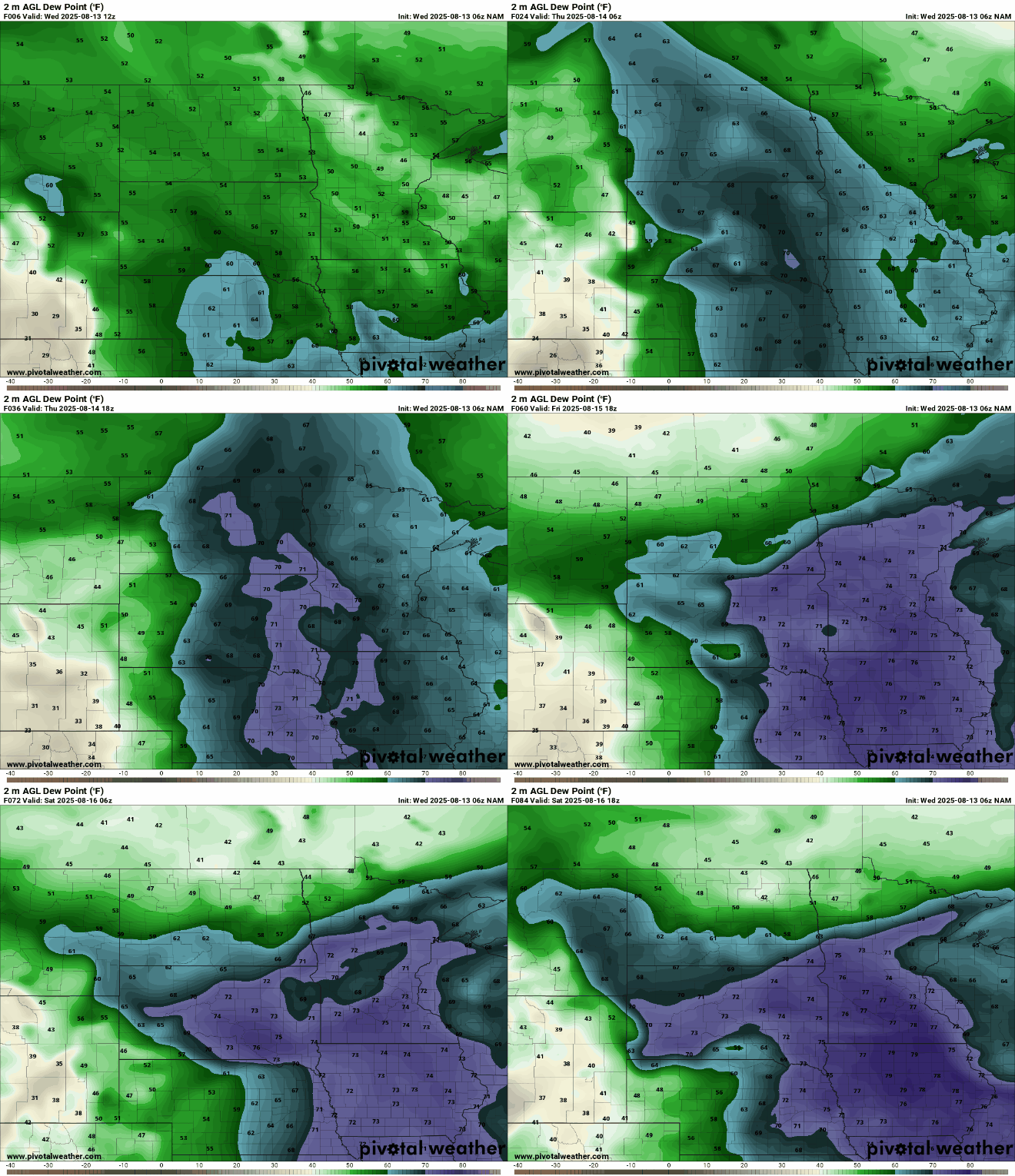
Dew points will climb into the 60s by Thursday to near 70 west. Friday into the weekend will see tropical moisture with dew points mainly in the low 70s for central and southern Minnesota.
The first round of potential showers and thunderstorms will develop in the Dakotas and move into primarily western Minnesota late Wednesday night into early Thursday. Some showers could hold together and reach eastern Minnesota Thursday morning.
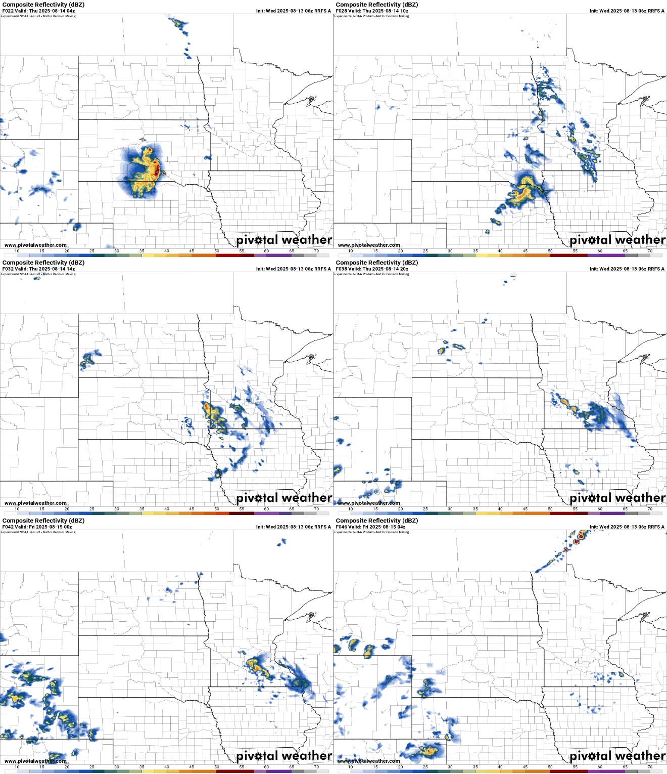
It’s just the first chance of several for showers and thunderstorms heading into the weekend.
It’ll become pretty steamy again with highs well into the 80s, if not near 90 degrees Friday. It will all depend on any left over morning showers and clouds from overnight storm chances.
While we may not quite hit 90 degrees Friday, it will feel like the 90s with the high dew points.

The best chance of more widespread showers and thunderstorms will come for the weekend. Timing and location of most storms will be difficult to pinpoint precisely more than 24 to 36 hours in advance in this volatile pattern, unfortunately.
Friday will likely yield at least some spotty thunder, especially for northern Minnesota. The best chances statewide come Friday night and Saturday night.
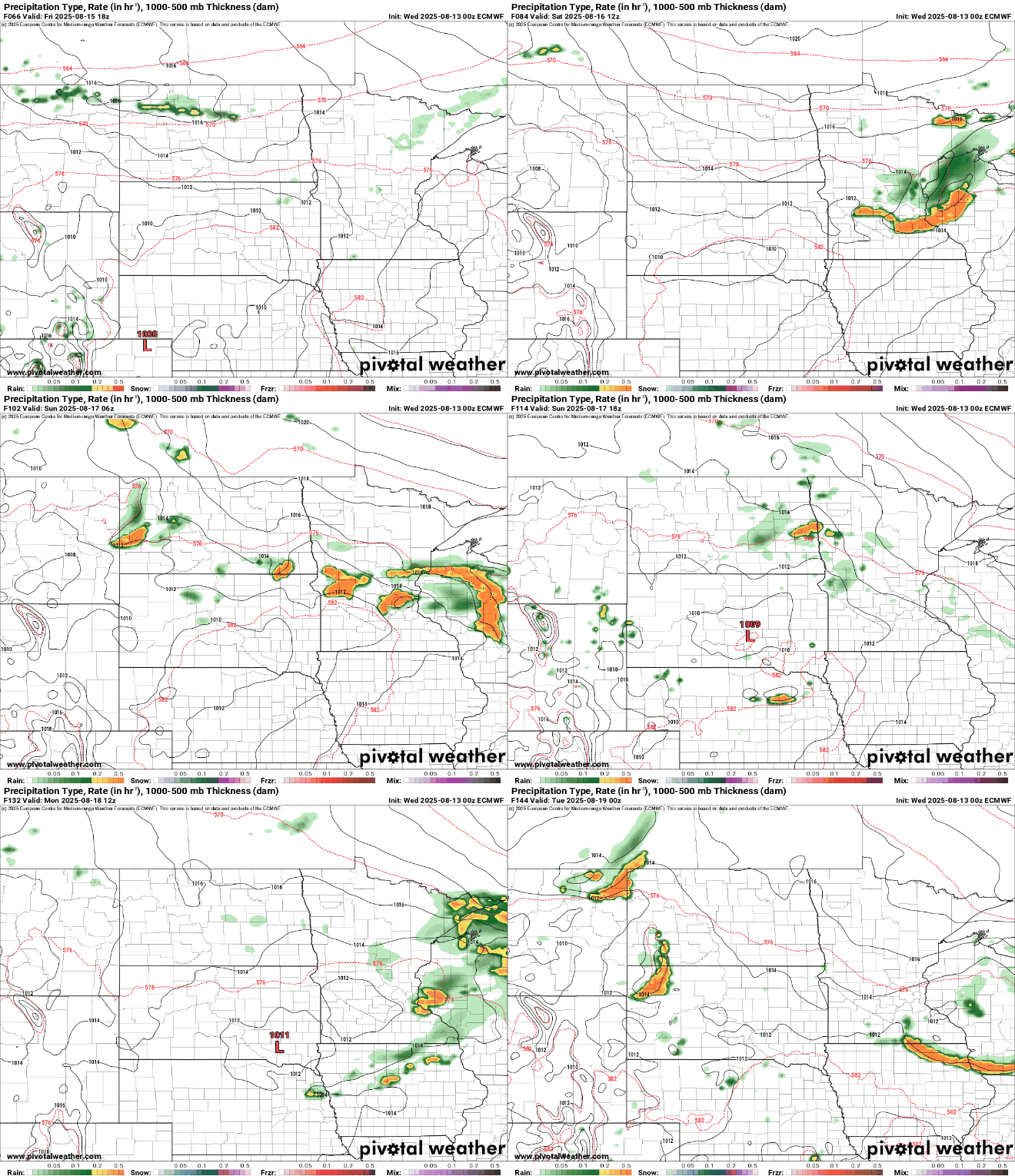
There’s the potential for some pretty heavy rainfall in portions of the region.
Again, pinpointing where the heaviest rain sets up will not be possible until we get closer to the weekend. The map below shows one forecast model scenario for total rainfall through Monday. The actual placement will depend on numerous factors.


