
Humid air returns along with chances of showers and storms
Heavy rainfall is possible over the weekend
Go Deeper.
Create an account or log in to save stories.
Like this?
Thanks for liking this story! We have added it to a list of your favorite stories.


Humid air is moving back into the region Thursday into Friday. The increased moisture combined with several disturbances will also increase the chance for showers and thunderstorms.
Humid air moves back in, bring the increased chance of showers, storms
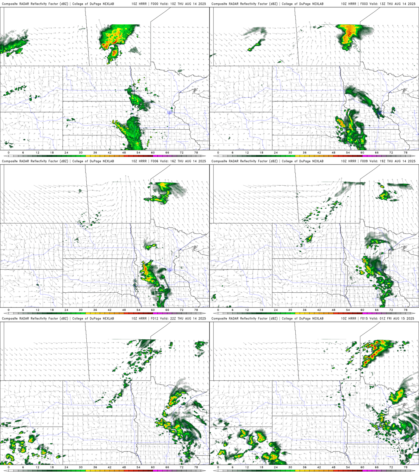
A cluster of spotty, ongoing showers in eastern South Dakota and southwest Minnesota will continue to drift eastward and largely fizzle out. That general area of instability will potentially spawn more spotty thundershowers this afternoon and evening across south central and east central Minnesota into western Wisconsin later Thursday.
While it won’t be warmer than the last couple of days, it will be more humid. Afternoon highs will be in the 70s and 80s, with the warmest readings in western Minnesota where things will clear out quicker.

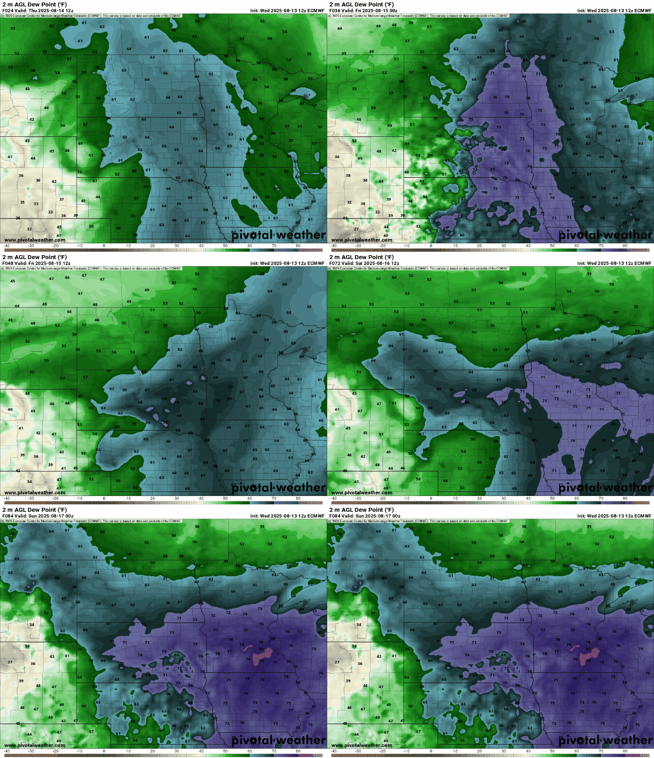
Dew points will continue to increase Thursday into Friday, bringing back tropical, low 70s dew points.
Turn Up Your Support
MPR News helps you turn down the noise and build shared understanding. Turn up your support for this public resource and keep trusted journalism accessible to all.
That tropical moisture will help fuel more chances at storms in the coming days. Storms will also develop in eastern North Dakota and northwest Minnesota Thursday evening and overnight. While there could be ongoing spotty storms in eastern and southeastern Minnesota into early Friday morning.
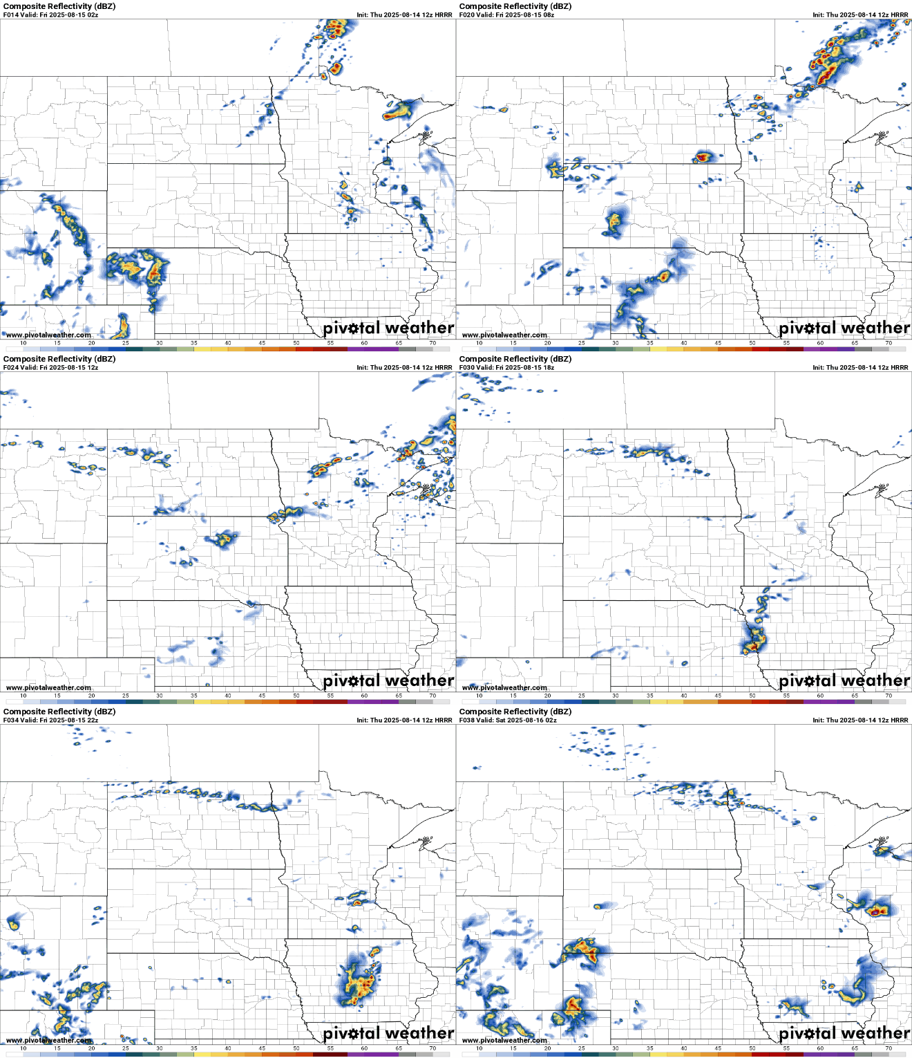
Storms that develop Thursday night in northwest Minnesota could become strong. There’s a slight risk (level 2 of 5) for severe storms there into Thursday night. The risk is marginal (level 1 of 5) elsewhere.

We’ll need to monitor where things setup and additional forecast models to see which area has the potential for the heaviest multiday rainfall totals. Through Monday, it’s possible to see several inches of total rainfall somewhere in central Minnesota and western Wisconsin.

There’s a slight excessive rainfall risk for east central Minnesota into western Wisconsin Friday into early Saturday:

In the meantime, Friday will be quite steamy across southern Minnesota and potentially Saturday, too, if morning showers and clouds clear out quickly enough. Some areas will be in the upper 80s to near 90 degrees for highs both days.

The pattern remains unsettled into early next week as the humid air and instability lingers.

