
Another soaker on the way for an already saturated Minnesota
Heavy rains stretch into the weekend
Go Deeper.
Create an account or log in to save stories.
Like this?
Thanks for liking this story! We have added it to a list of your favorite stories.


There are no signs of drought heading into mid-August as another round of heavier rainfall sets its sights on central and eastern Minnesota. Humid conditions will lead to multiple chances for rainfall through the weekend.
Drought-free heading into mid-August
Minnesota is now drought-free with only two abnormally dry areas, one in northwestern Minnesota and another just south of Duluth, according to this week’s U.S. Drought Monitor report.

It’s been a wet stretch across Minnesota. Here’s a look at some of the standout rainfall totals from the past 30 days:
Mankato, 9.81 inches
Grand Meadow, 8.97 inches
Glenwood, 8.81 inches
Northfield, 8.49 inches
Alexandria, 8.12 inches
Albert Lea, 7.85 inches
St. Paul, 7.76 inches
Rainfall racks up through the weekend
A meandering frontal boundary will stall near the Iowa–Minnesota border through the weekend, with a low-pressure system positioned just north of the Canadian border. This setup will support multiple rounds of showers and thunderstorms with the best chances currently expected overnight and into the early morning hours.
Turn Up Your Support
MPR News helps you turn down the noise and build shared understanding. Turn up your support for this public resource and keep trusted journalism accessible to all.
There’s a lot of moisture in the air through the weekend. Look at the dew points in the graphic below showing levels reaching into the 60s and 70s.
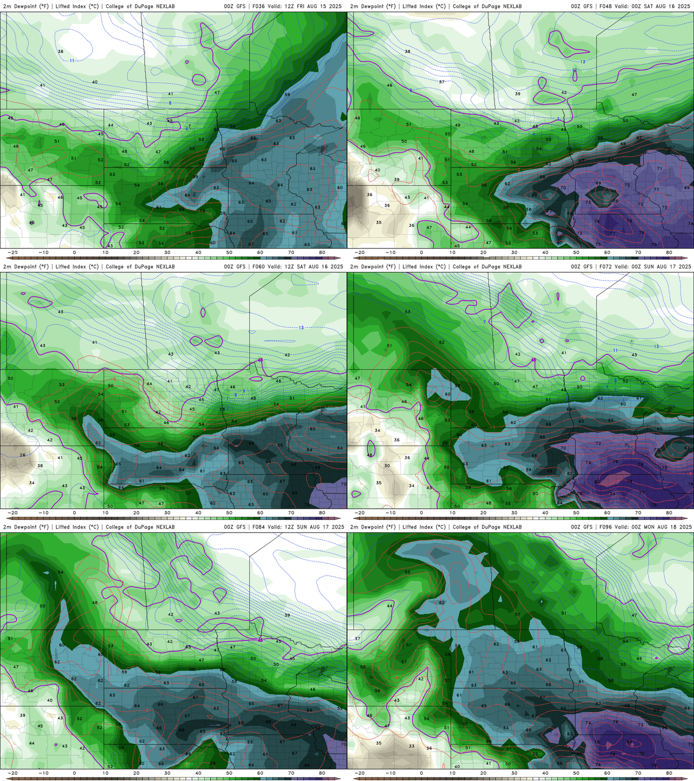
Given the stalled front and high moisture content, conditions are favorable for excessive rainfall. The National Oceanic and Atmospheric Administration’s Weather Prediction Center has already flagged central and eastern Minnesota for this potential.

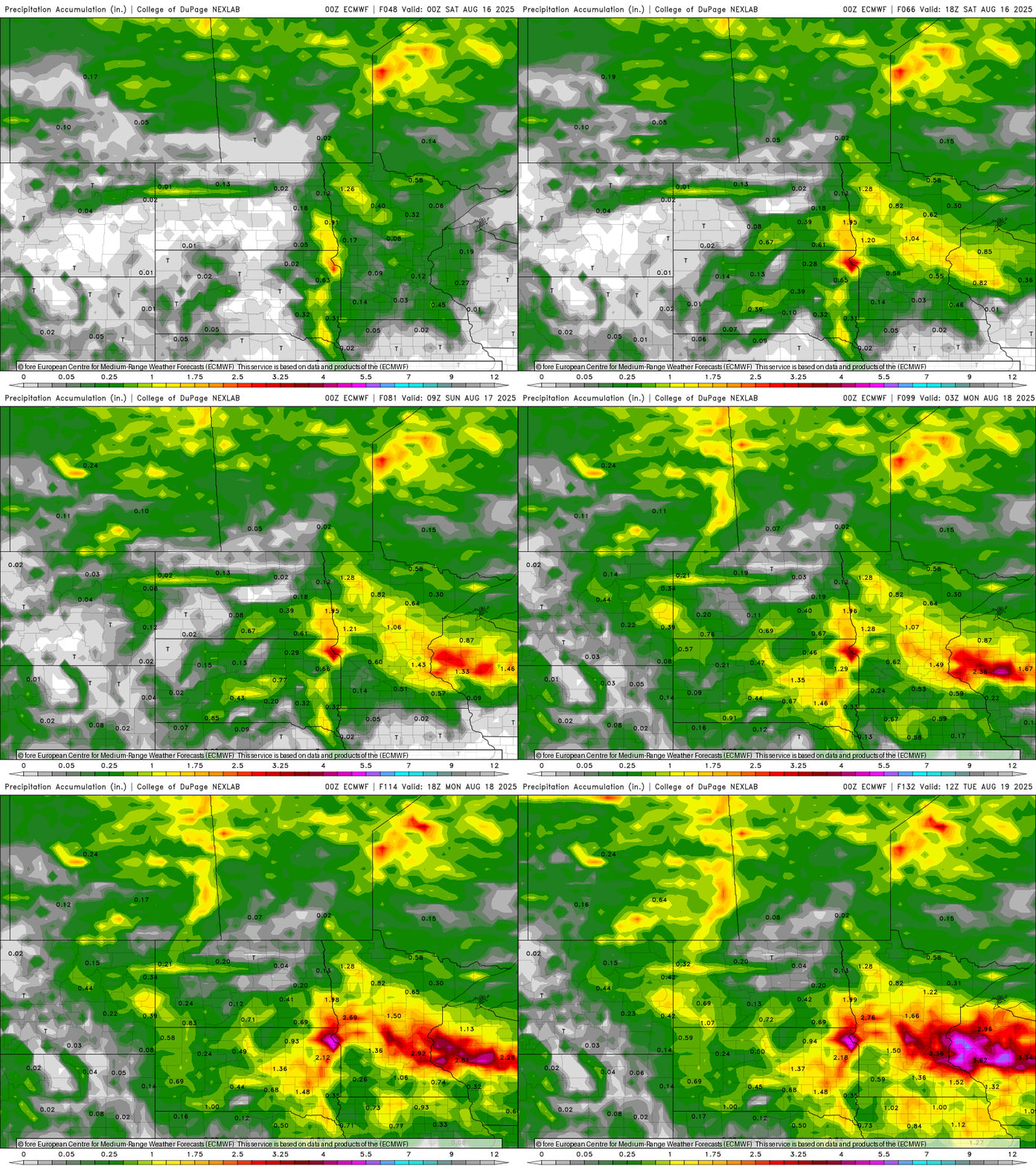
Some computer models are showing rainfall accumulations between 2 and 4 inches through the upcoming weekend.
Our active weather pattern continues into early next week. Make sure to keep that umbrella handy for any weekend plans.

