
Persistent overnight rain could trigger flash flooding
Training storms may drop 2-4 inches of rain
Go Deeper.
Create an account or log in to save stories.
Like this?
Thanks for liking this story! We have added it to a list of your favorite stories.


As a frontal boundary stalls across the state, it will help fuel rounds of showers and thunderstorms, with heavy rainfall expected. Rainfall totals of 2 to 4 inches are possible in some areas, raising concerns for flash flooding.
Another round of heavy rainfall
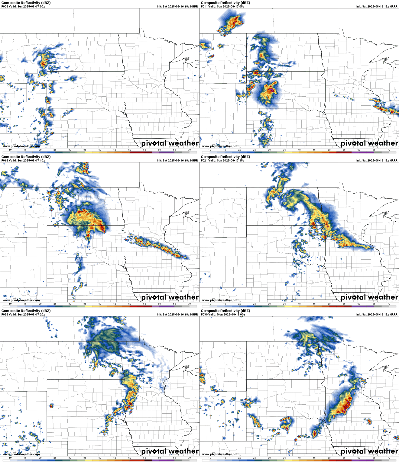
After a brief drying period Saturday afternoon and evening, another round of showers and thunderstorms is expected to develop along a nearly stationary frontal boundary. Forecast models indicate storm development after midnight, with activity focused mainly across the upper Minnesota River Valley into southeastern Minnesota.
Showers and thunderstorms will continue into early Sunday morning, followed by another lull in the activity during the afternoon. However, yet another round of showers and storms is expected to develop Sunday night and continue into Monday morning.
Turn Up Your Support
MPR News helps you turn down the noise and build shared understanding. Turn up your support for this public resource and keep trusted journalism accessible to all.
Heavier rainfall amounts are once again possible through Monday morning, with some forecast models indicating totals of 2 to 4 inches, and locally higher amounts of 4 inches or more.
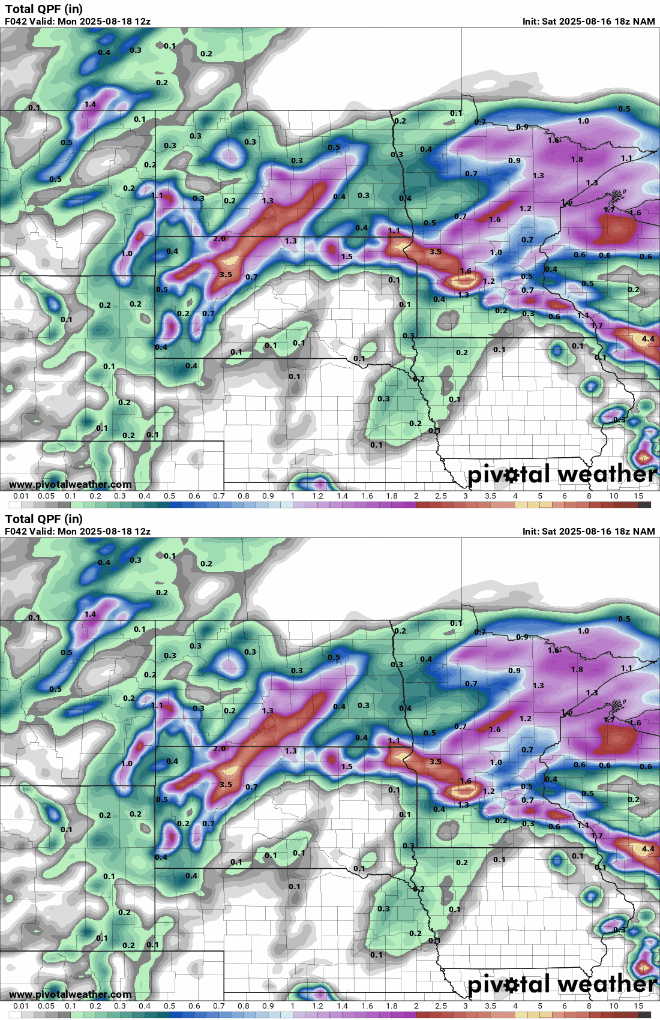
The potential for flash flooding increases where thunderstorms are forecast to train over the same areas.
A slight risk for stronger storms remains in place for the southeastern corner of the state through Sunday morning. The main threats are hail and strong winds.

Temperatures will drop into the mid-60s overnight, with upper 60s across southern Minnesota and cooler lows in the lower to mid-50s up north.

Highs on Sunday will warm into the upper 70s across much of the region, despite early morning showers and lingering cloud cover. It will remain hot and steamy in southwestern Minnesota, where highs are forecast to reach the upper 80s to low 90s, with dew points remaining in the 70s.


