
Stormy Saturday rolls in: rain soakers and morning gusts
Another chance for showers and thunderstorms late tonight
Go Deeper.
Create an account or log in to save stories.
Like this?
Thanks for liking this story! We have added it to a list of your favorite stories.


Heavy rains soaked the region at daybreak, with rumbling skies and strong gusts sweeping through at times. After a brief lull in the action, another round of showers and thunderstorms is possible late Saturday night, mainly targeting the south metro and southern Minnesota.
Early wake-up call
A strong mesoscale convective system (MCS) rolled through the state overnight, producing strong winds gusts of 75 mph in Granite Falls, and 79 mph in Hanley Falls. There was also significant tree damage reported in Lyon County.
As the storms moved eastward, they weakened below severe criteria but still produced heavy rainfall rates of up to 3 inches per hour.
Turn Up Your Support
MPR News helps you turn down the noise and build shared understanding. Turn up your support for this public resource and keep trusted journalism accessible to all.
A meandering frontal boundary stretches across the state and will remain the focus for additional showers and thunderstorms throughout the weekend.

Our showers and thunderstorms on Saturday are expected to clear by midday, with some afternoon sunshine possible as temperatures warm into the low 80s across the metro area. In the warm sector of the front, southern Minnesota will see temperatures climb into the mid to upper 80s, while cooler conditions prevail in the north with highs in the low to mid-70s.

Ongoing showers and thunderstorms are possible late Saturday night into Sunday morning along the frontal boundary, mainly targeting the southern metro and southern Minnesota.
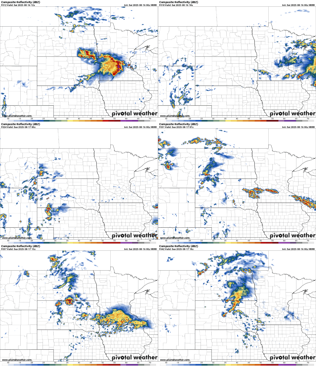
Another chance for excessive rainfall is expected in southern Minnesota, including parts of the metro, as training thunderstorms move through the area.

Our unsettled weather pattern continues into Sunday and early Monday before high pressure moves in by Tuesday, bringing clearing skies and seasonal temperatures in the upper 70s to low 80s.

