
Flood watch issued ahead of Sunday night rainfall
Heavy rain and severe weather possible

Go Deeper.
Create an account or log in to save stories.
Like this?
Thanks for liking this story! We have added it to a list of your favorite stories.


Heavy rain is expected to return late Sunday night, prompting a flood watch for portions of the state. Another round of showers and thunderstorms will move through the area, bringing the potential for heavy rainfall and possibly severe weather. Flash flooding, gusty winds, and localized downpours will be the main concerns heading into Monday.
Flood watch
Our final round of heavy showers and storms is expected to move in late Sunday night. While the exact placement of the heaviest storms remains uncertain, a broad area from central to southern Minnesota is under a flood watch due to the risk of additional flooding.
Multiple rounds of rain on Friday and Saturday have left much of southern Minnesota, including the Twin Cities metro area, thoroughly soaked. Rainfall totals between 3 and 6 inches have already been recorded, and several more inches are possible as additional storms move through.
Turn Up Your Support
MPR News helps you turn down the noise and build shared understanding. Turn up your support for this public resource and keep trusted journalism accessible to all.
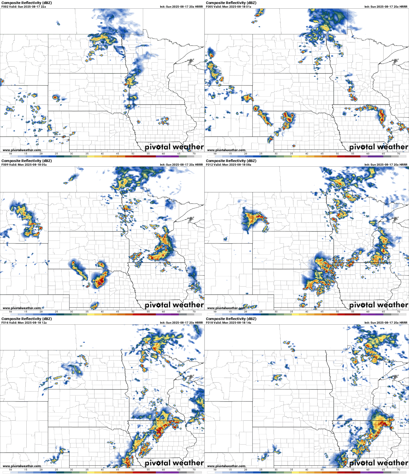
Some of these storms could become severe, with gusty winds as the main threat, primarily across southwestern Minnesota.

Low temperatures Sunday night will dip into the upper 60s across the metro, with lows in the low 70s to the south, and even some 50s expected in northern Minnesota.

Monday’s temperatures will warm slightly as the warm front shifts northward. Expect lower to mid-80s across the southern half of the state, while northern areas will remain cooler in the 60s and 70s.

Our wet weather pattern will finally come to an end by Tuesday as high pressure builds in, bringing seasonal temperatures in the upper 70s to low 80s and dry conditions for the workweek ahead.

