
Heavy rains and flash flooding drench parts of the state
Rainfall amounts between 3-5 inches with more on the way
Go Deeper.
Create an account or log in to save stories.
Like this?
Thanks for liking this story! We have added it to a list of your favorite stories.


Heavy rains continue to pour across the state, with rainfall amounts between 3-5 inches triggering flash flooding in several areas. More rain is expected later Sunday, some of which could be heavy and accompanied by gusty winds.
Flash flooding concerns
Another round of heavy rainfall blanketed the southern portions of the state overnight into early Sunday morning. Preliminary reports indicate rainfall amounts exceeded 3-5 inches in some areas, with the following cities reporting:
Janesville—4.87 inches
Mankato—3.94 inches
Waltham—3.66 inches
Harmony—3.45 inches
Waseca—3.02 inches
Flash flood warnings have been issued for numerous southern counties as the heavy rains lead to flooding on streets and bridges.
Turn Up Your Support
MPR News helps you turn down the noise and build shared understanding. Turn up your support for this public resource and keep trusted journalism accessible to all.

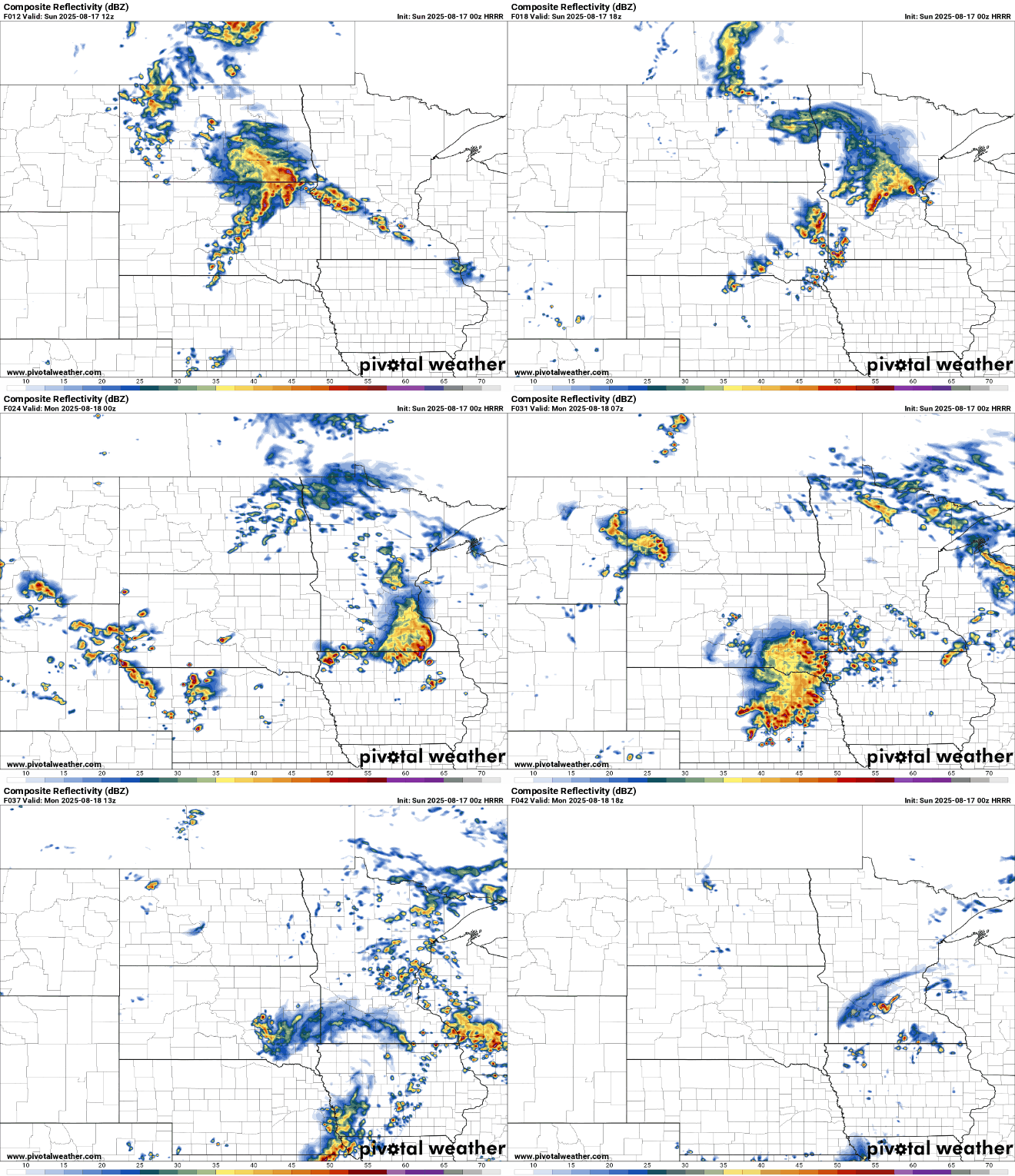
The early showers and thunderstorms in southern Minnesota will taper off by late Sunday morning, providing a brief lull before more showers and storms develop across the Dakotas into Sunday afternoon.
Another round of showers and thunderstorms will persist into Sunday evening and linger through Monday. With more widespread coverage, excessive rainfall is possible once again.

By Monday morning, the warm front of the lingering frontal boundary will drift northward as a surface low pressure system tracks northeast across central and northern Minnesota.

Sunday’s temperatures will climb into the upper 70s, with some areas reaching into the upper 80s and low 90s, especially in southwestern Minnesota. Meanwhile, more comfortable temperatures in the 70s and mid-60s will be found up north.

Monday will bring slightly warmer temperatures as the front lifts north, with mid-80s expected for the metro area and south, while northern regions will remain in the 60s and 70s.

A dry period is expected to settle in by Tuesday as high pressure moves in. Temperatures will range from the upper 70s to low 80s throughout the workweek, with dew points in the 60s.


