
Above-normal temps through Thursday before a cool weekend
Temperatures will be average for late September by Sunday

Go Deeper.
Create an account or log in to save stories.
Like this?
Thanks for liking this story! We have added it to a list of your favorite stories.


It will still be muggy Wednesday and Thursday, although not as humid as Tuesday. Areas of morning fog will burn off, giving way to sunshine. Much cooler air moves in this weekend.
Warm, a bit muggy through Thursday; much cooler this weekend
Areas of fog will burn off Wednesday morning giving way to sunshine most of the day. Dew points will be a little lower than Tuesday but still muggy in the 60s mostly. Afternoon highs will be mostly in the low 80s for all but the North Shore.

Thursday is the start of the Minnesota State Fair and it will be similar to Wednesday with highs mostly in the low 80s and dew points in the 60s with more abundant sunshine.

A cold front will touch off scattered showers and storms in northwestern Minnesota that will then sweep south and southeast overnight into early Friday. Most precipitation should be pretty modest.
Turn Up Your Support
MPR News helps you turn down the noise and build shared understanding. Turn up your support for this public resource and keep trusted journalism accessible to all.
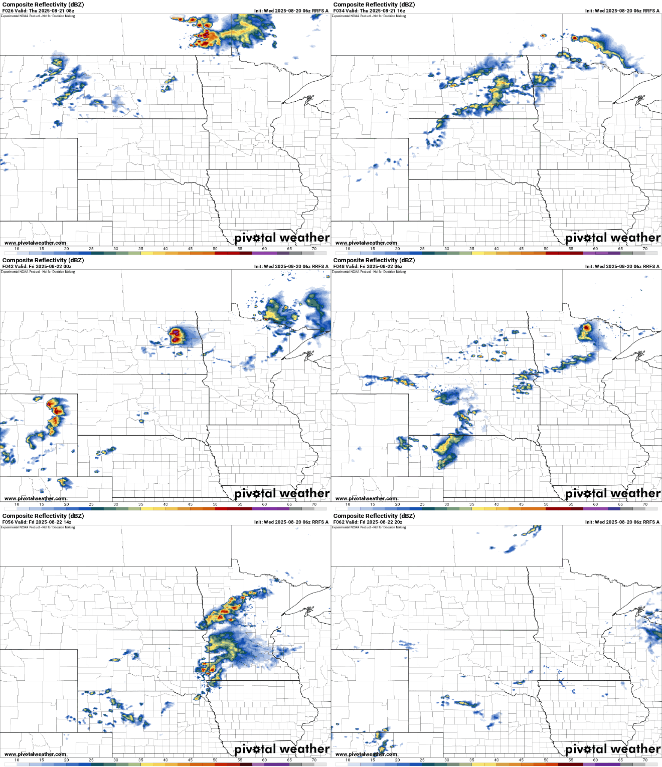
Our only real chances of rainfall in the next seven to 10 days will come Thursday night and Friday, and rainfall amounts will be modest. Most of us will see under one-quarter inch of rainfall with the potential for more in west-central Minnesota.

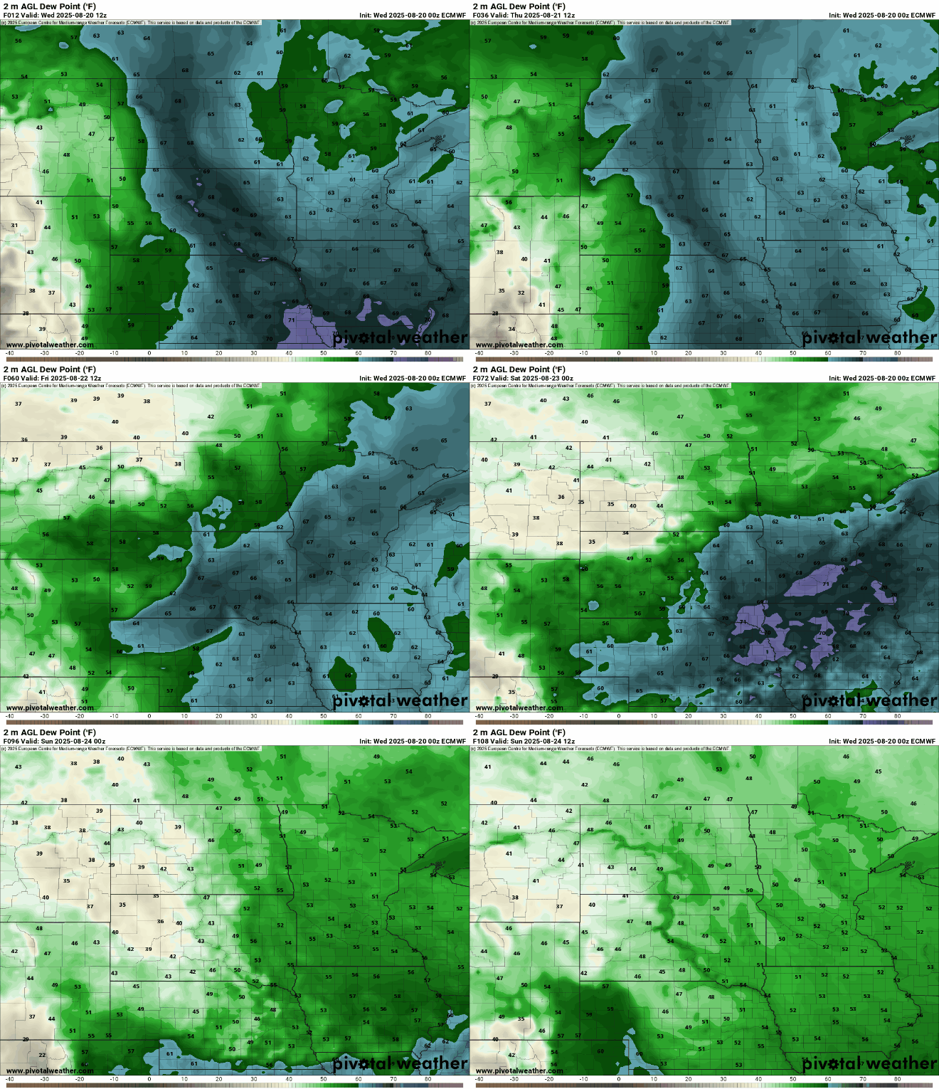
The air will remain muggy Wednesday and Thursday with dew points mostly in the 60s across southern Minnesota. Behind that front, dew points will finally drop into the 40s and 50s Saturday, which will make it feel fall-like, especially combined with much cooler air.
Highs Sunday will be just in the 60s for most of the state, which is about 10 to 15 degrees below normal.

That will set us up for a chilly Sunday night, the coolest we’ve seen since late May for many. Overnight lows Sunday night will be mainly in the 40s with low 50s just in the urban heat island core of the Twin Cities.


