
‘Backdoor’ cool front touches off showers, brings more cool air
The holiday weekend looks pleasant and mainly dry for most
Go Deeper.
Create an account or log in to save stories.
Like this?
Thanks for liking this story! We have added it to a list of your favorite stories.


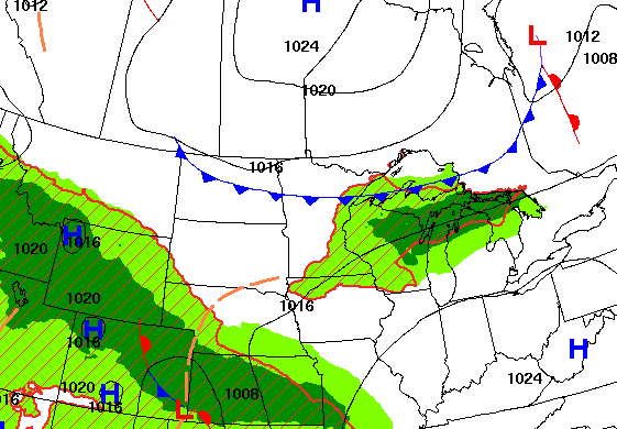
A cool front diving south Wednesday will touch off some showers in parts of Minnesota and western Wisconsin. Today will be our warmest day ahead of it before temperatures dip a bit Thursday.
Some showers north ahead of another shot of cool air
Today will likely be our warmest day this week. Afternoon highs will range from the low 80s in northwest Minnesota, in the Red River valley, to the low 70s northeast. Twin Cities high temperatures will be in the upper 70s to near 80 degrees with partly cloudy skies.

A “backdoor” cool front moving in from the north and northeast will touch off some scattered showers and even a couple of thunderstorms Wednesday into the night across mainly northern and far southern Minnesota and western Wisconsin.
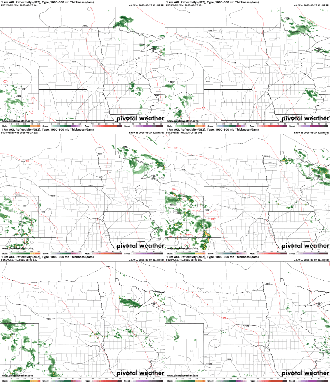
Rainfall will be light and is the only real chance of rainfall until after the holiday weekend for most of Minnesota.
Behind the front, temperatures will dip back slightly for Thursday and Friday. Afternoon highs Thursday will likely not warm out of the 60s in northeast Minnesota with low to mid-70s south. It will set us up for another chilly night in the northeast part of the state, especially with lows in the 30s again for some there.

The holiday weekend still looks mostly pleasant. Highs will range from the low 70s south to upper 70s south. We should also see more sun than clouds. We’ll need to keep an eye on a developing system to the west that could creep east and bring some showers for the weekend’s second half in southwest and southern Minnesota.
Turn Up Your Support
MPR News helps you turn down the noise and build shared understanding. Turn up your support for this public resource and keep trusted journalism accessible to all.

