
High pressure holds with late-summer sun
Fall temperatures arrive midweek

Go Deeper.
Create an account or log in to save stories.
Like this?
Thanks for liking this story! We have added it to a list of your favorite stories.


Late-summer weather continues to wrap up our long holiday weekend, with sunshine and seasonable temperatures in the mid to upper 70s thanks to high pressure centered over the Great Lakes. A taste of fall is on the way by midweek, bringing much cooler temperatures.
High pressure holding
Our current weather picture features a high pressure system over the Great Lakes region and a disturbance in the Central Plains.

The influence of high pressure will keep most of the state under clear skies, calm winds, and seasonable temperatures. However, areas in extreme southwestern Minnesota may see some lingering cloud cover and very isolated showers.
Turn Up Your Support
MPR News helps you turn down the noise and build shared understanding. Turn up your support for this public resource and keep trusted journalism accessible to all.
An interesting temperature trend is setting up today, with the northern half of the state running warmer than the southern half. Temperatures in the metro will be near average in the upper 70s, while northern counties climb into the low 80s. The northwestern corner of the state will once again be the warm spot, reaching into the mid-80s!
Our long Labor Day weekend will end on a high note with continued sunshine and late-summer temperatures.

Midweek cooldown
Behind the front, much cooler air settles in. Gusty northwest winds will kick up from Wednesday through Friday, with Thursday likely being our coldest day.

Morning temperatures could dip into the upper 30s and low 40s, and highs might struggle to reach 60 for the Twin Cities.
This cold front will move through Tuesday afternoon and evening, bringing a better chance of widespread rain, though rainfall amounts are expected to be limited and there is no threat of severe weather.
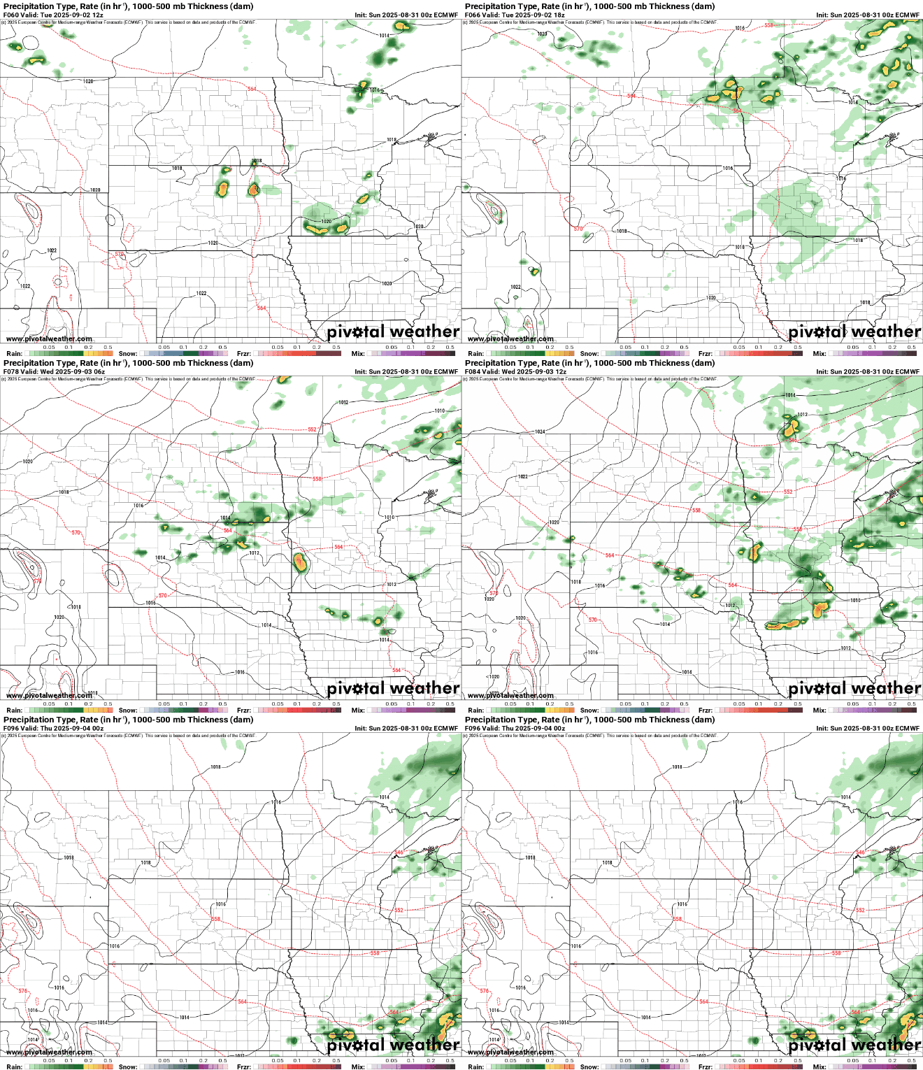
We'll gradually start to warm up heading into next weekend, though temperatures will likely remain below our typical early September highs. After the midweek cold front passes through, a dry and quiet weather pattern looks to settle in once again, with no significant precipitation expected in the extended forecast.

