
Sunny Labor Day, then a taste of fall and storms this week
Happy first day of meteorological fall!
Go Deeper.
Create an account or log in to save stories.
Like this?
Thanks for liking this story! We have added it to a list of your favorite stories.


Labor Day will feel like late summer, but by midweek, expect a shift to fall-like temperatures and the possibility of storms across the region.
Happy first day of meteorological fall! August is behind us, and the month ended about a degree above average, but with 3/4 of an inch less rainfall than usual. After a long dry stretch, that’s about to change this week, as a potent cold front moves in, bringing cooler temperatures and the return of precipitation.
Bright Labor Day
High pressure over the Great Lakes will bring continued sunshine to wrap up our long holiday weekend. Temperatures will be just right for early September, with highs reaching the mid to upper 70s.

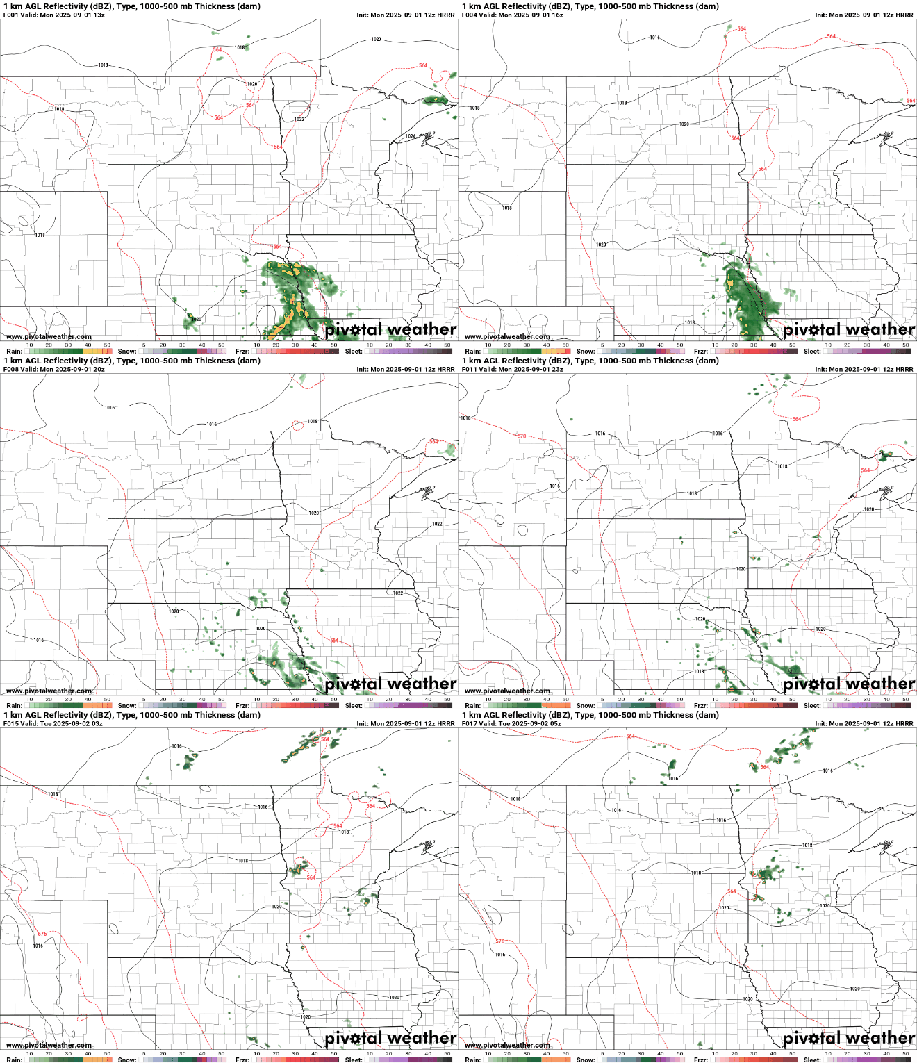
By Monday afternoon, a bit of instability could trigger isolated to scattered showers into the evening. While this activity is mainly expected west of the Twin Cities, it’s not out of the question for it to drift eastward.
Turn Up Your Support
MPR News helps you turn down the noise and build shared understanding. Turn up your support for this public resource and keep trusted journalism accessible to all.
Cool temps and stormy skies
Our next big weather feature will approach central Minnesota by Tuesday afternoon. Ahead of this front, dew points will climb into the low to mid-60s, creating enough instability for a broken line of storms to form.
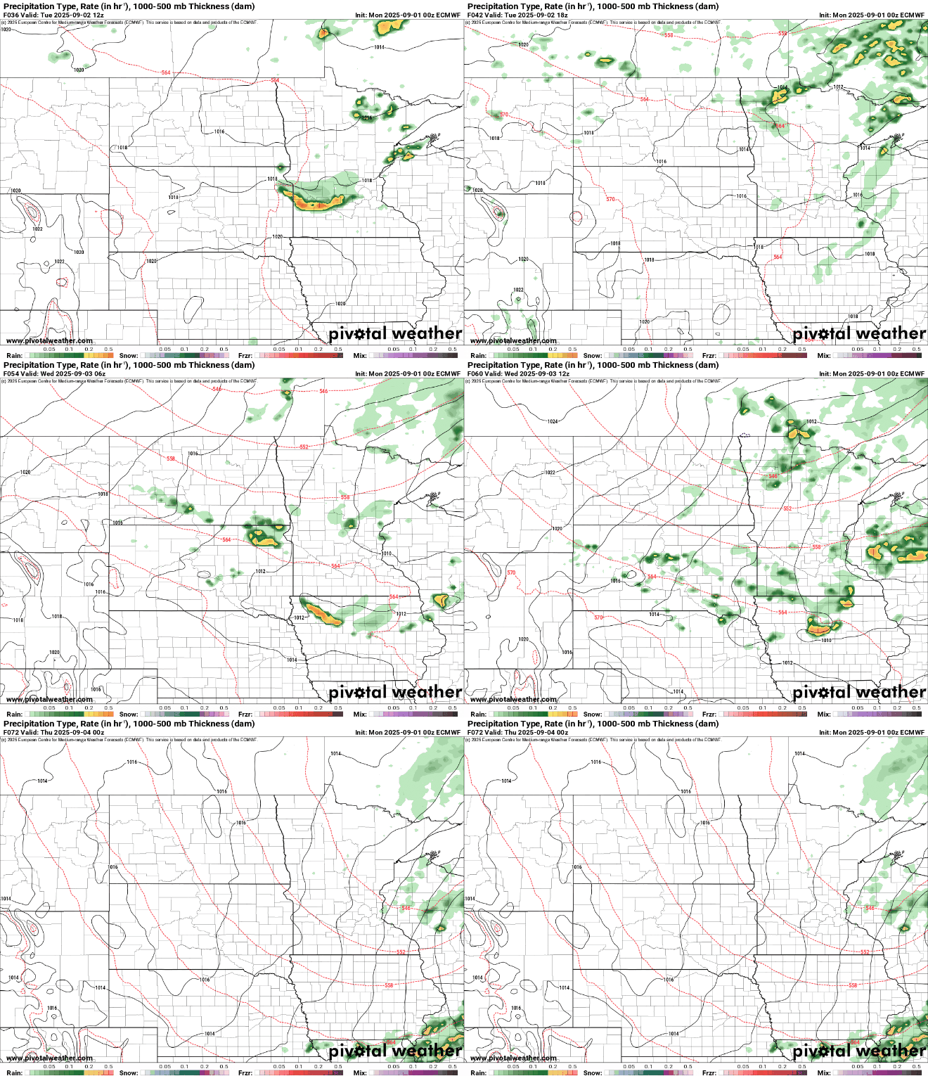
These storms will move southeast through Tuesday evening and night. As the front moves through, gusty winds could pose a threat. The Storm Prediction Center (SPC) has issued a Marginal Risk (level 1 out of 5) for severe storms in parts of the area.

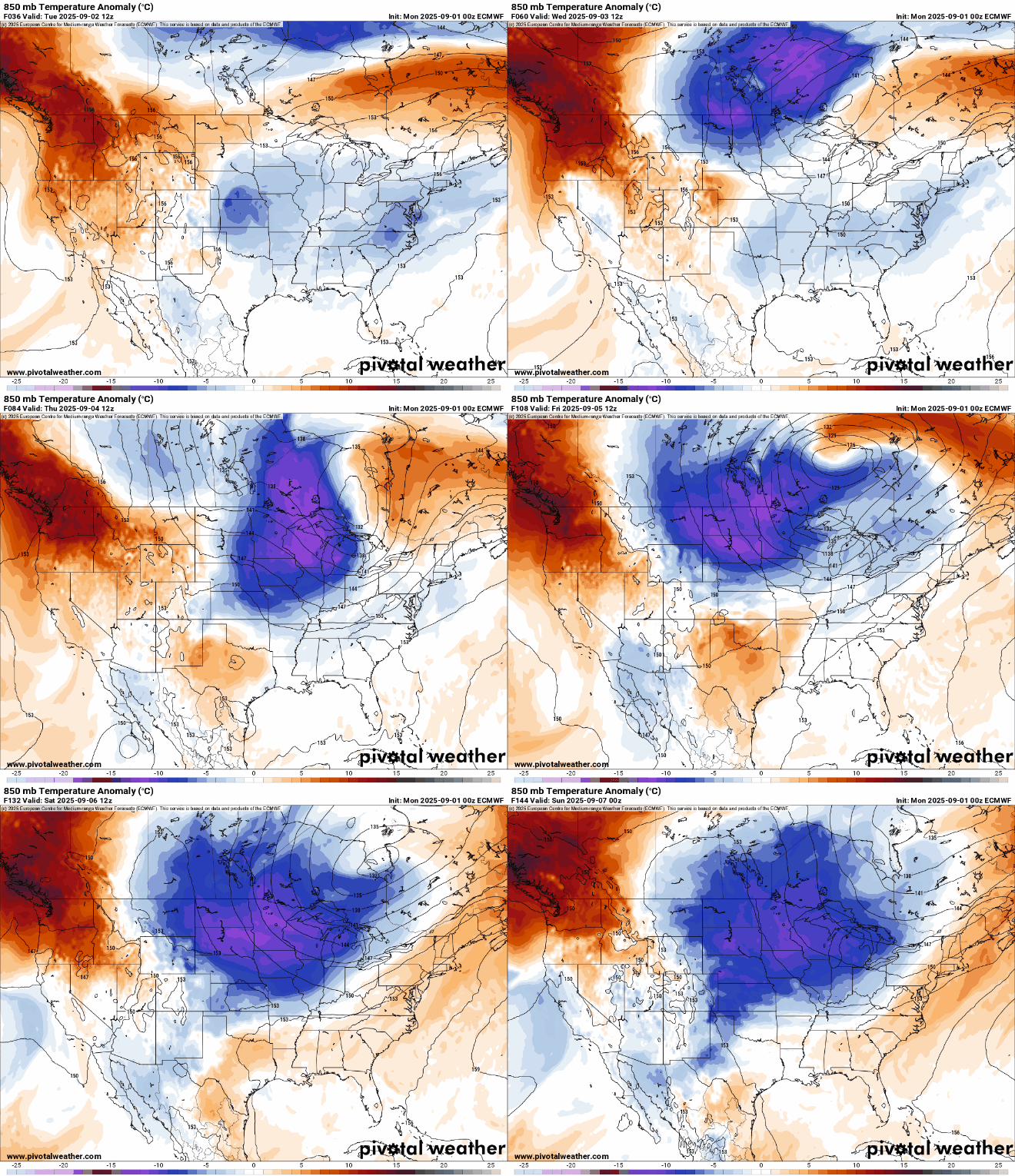
From Wednesday through Saturday, expect fall-like conditions as a low-pressure system between Lake Superior and Hudson Bay brings cooler air and a chance for showers. 850 millibar temperature anomalies show a significant dip as seen below. Our surface temperatures are expected to be 20-30 degrees below average.
By Sunday, southerly winds will return, warming us up with highs back in the 70s to start next week.

