Clipper rolls in with rain, thunder and a fall-like chill
Cool days ahead but sunshine returns for the weekend
Go Deeper.
Create an account or log in to save stories.
Like this?
Thanks for liking this story! We have added it to a list of your favorite stories.


A clipper system will bring widespread showers and a few rumbles of thunder across the state, ushering in cooler air to close out the week. The weekend will stay cool but brighter, with more sunshine in the forecast.
Rain tonight, cool temperatures to follow
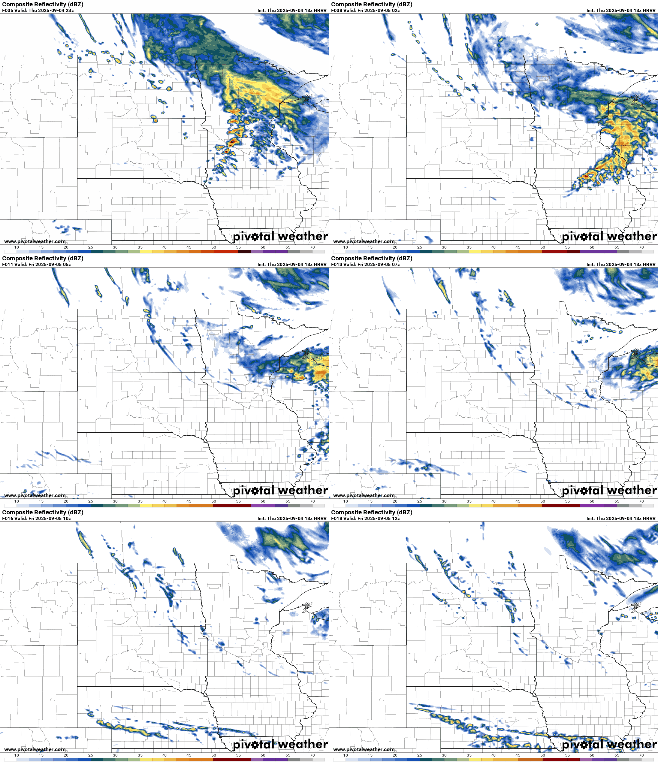
Widespread rain showers thunderstorms will continue Thursday night as a Clipper system moves eastward. Northern and central Minnesota can expect over a quarter-inch of rain, with western Wisconsin seeing closer to half an inch.
There’s even a chance for a few thunderstorms ahead of the cold front moving through southwestern Minnesota. A couple of these storms could be on the stronger side, with damaging wind gusts being the main concern.

Behind the clipper, northwesterly winds will kick up and become quite strong with wind gusts of 25 to 40 mph, especially in western and southern Minnesota.
Turn Up Your Support
MPR News helps you turn down the noise and build shared understanding. Turn up your support for this public resource and keep trusted journalism accessible to all.
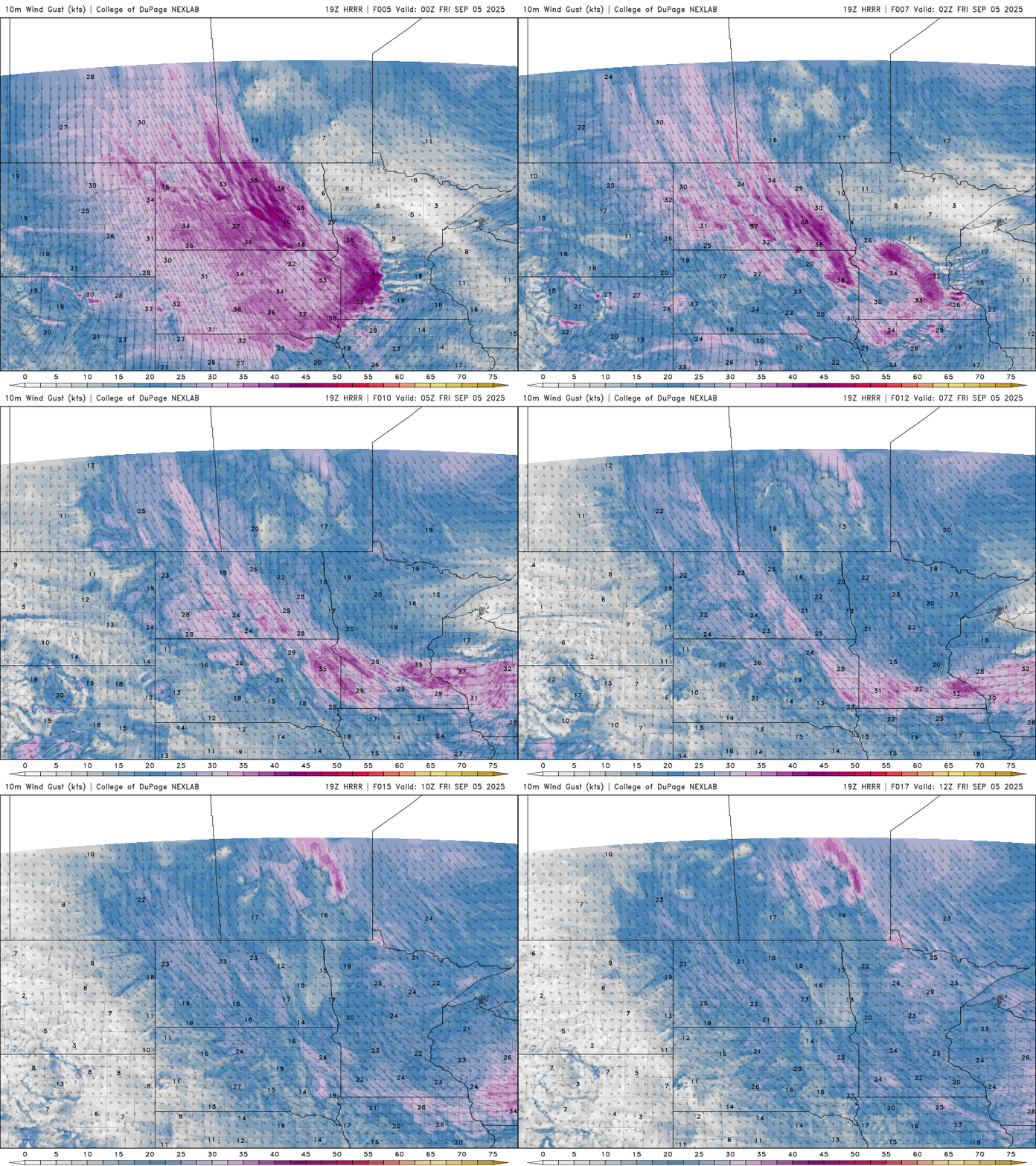
A wind advisory is in effect for western Minnesota until 10 p.m. with gusts over 40 mph possible.

Low temperatures will fall into the upper 40s around the metro area, with lows in the low to mid-40s statewide, and some spots in the Arrowhead region could dip into the upper 30s.

As the low-pressure system moves east into the Upper Great Lakes on Friday, lingering rain showers are expected in eastern Minnesota and western Wisconsin. Despite a mix of clouds and sunshine, temperatures in the Twin Cities will struggle to reach 60 degrees. Highs will generally be in the upper 50s to low 60s, with breezy west-northwest winds.

Cool and bright for the weekend
The first full weekend of September will bring plenty of sunshine and slightly warmer temperatures, with highs in the low to mid-60s. A few isolated, spotty showers are possible on Saturday, but most areas will stay dry. Overnight lows will dip back into the 30s and 40s, bringing another chance for frost in the cooler spots.
A warming trend is expected next week, with highs climbing back into the 70s by midweek as upper-level winds shift from a northwest flow to a more zonal pattern.