
Cool Thursday with more rain developing
The weekend looks dry, bright and cool
Go Deeper.
Create an account or log in to save stories.
Like this?
Thanks for liking this story! We have added it to a list of your favorite stories.


After a chilly start, clouds will increase Thursday morning with rain developing later in the afternoon into tonight. Friday will be chilly before sun returns this weekend.
Chilly start with more rain later Thursday
It’s a chilly start to the day Thursday. Morning lows were in the 30s and 40s — the coolest yet for most since May. Afternoon highs will remain cool in just the 50s north to low to mid-60s south, though far southwest Minnesota could hit 70 degrees.

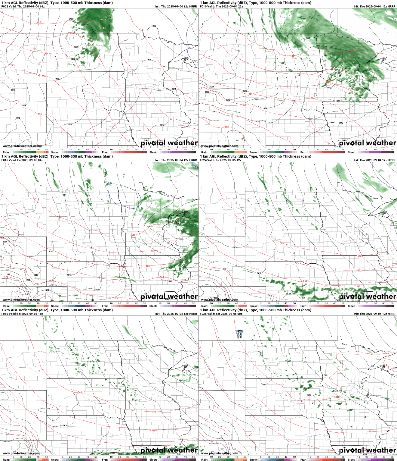
After sunshine to start, clouds increase ahead of a clipper system that will deliver rain to the state later Thursday into tonight. There will be some lingering, isolated to spotty showers Friday.
A swath of 0.25 to 0.50 inches of rain is possible from northwest Minnesota through central Minnesota into western Wisconsin.
Turn Up Your Support
MPR News helps you turn down the noise and build shared understanding. Turn up your support for this public resource and keep trusted journalism accessible to all.

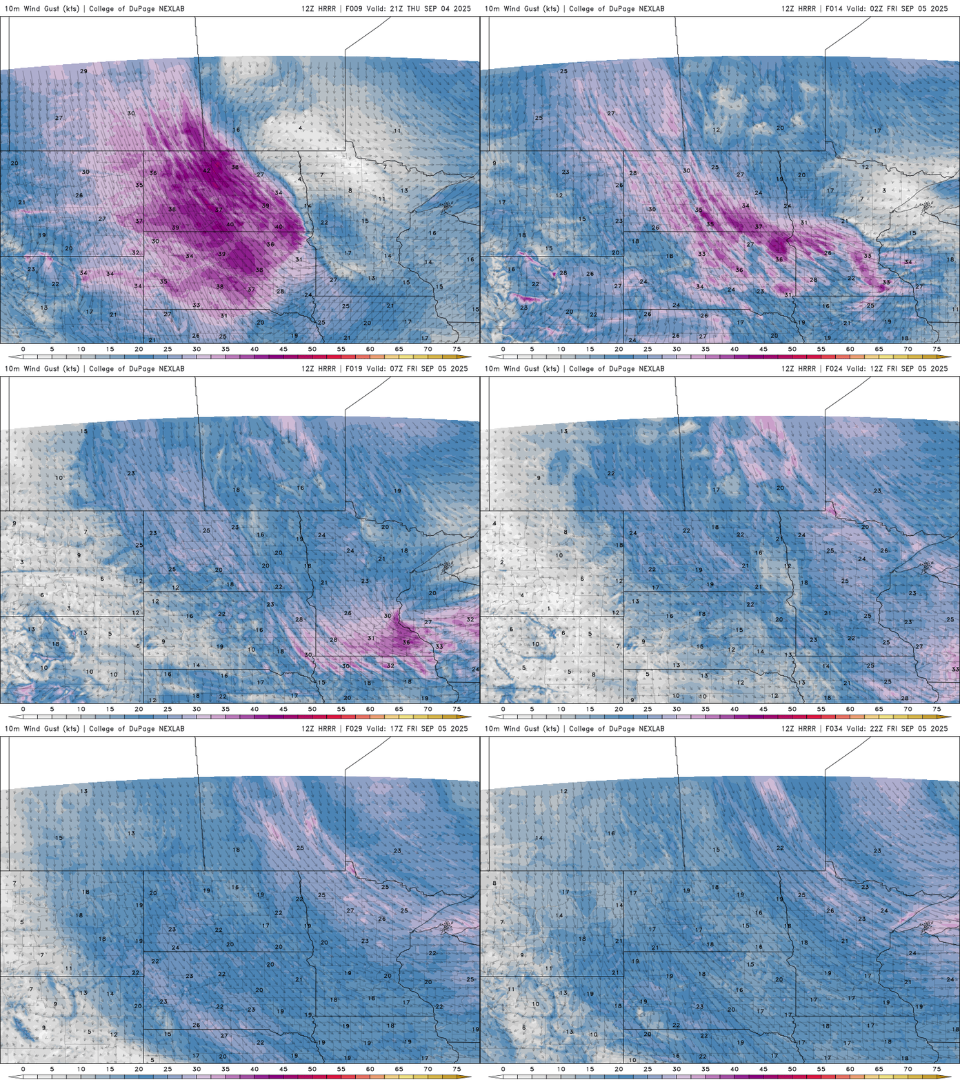
Winds will increase tonight into Friday on the backside of the clipper as well. Winds will blow from the northwest at 10-25 mph with higher gusts, especially in western Minnesota tonight and Friday.
The incoming system will also pull down more cool air making for an even chillier Friday. Afternoon highs Friday will struggle to reach the low 60s in southern Minnesota with a mix of clouds and sun.

The weekend looks bright but still cool with highs mostly in the 60s. Far northern Minnesota will remain in just the 50s for afternoon highs.
Much warmer air returns next week with 70s and even potentially 80-degree temperatures by late next week for southern Minnesota again.


