
Isolated showers wrap up tonight: clear, cold, and frosty by Sunday morning
Temperatures climb back to seasonal averages next week

Go Deeper.
Create an account or log in to save stories.
Like this?
Thanks for liking this story! We have added it to a list of your favorite stories.


Showers will wind down tonight, and as skies clear, conditions will be ripe for a cold night with patchy frost possible by Sunday morning. Sunnier skies return for the second half of the weekend, and temperatures will finally climb back to near-normal levels as we head into next week.
Frost and freeze concerns tonight
As high pressure moves in, skies will clear overnight into Sunday morning, and with calm winds in place, conditions will be ideal for frost development and even freeze concerns for two of our northeastern counties. Frost advisories and freeze warnings will take effect from 2 a.m. to 8 a.m. Sunday.
Temperatures Saturday night will drop into the low 40s in the Twin Cities, with surrounding suburbs dipping into the upper 30s. Elsewhere across the state, chilly lows in the mid to low 30s are possible.
Turn Up Your Support
MPR News helps you turn down the noise and build shared understanding. Turn up your support for this public resource and keep trusted journalism accessible to all.

Cool start, warmer finish
More sunshine is expected Sunday, helping push temperatures into the mid-60s, still below the seasonal average of 77 degrees.

As southerly flow returns to the Upper Midwest, moisture will increase, with dew points rising into the upper 50s to low 60s by Monday.
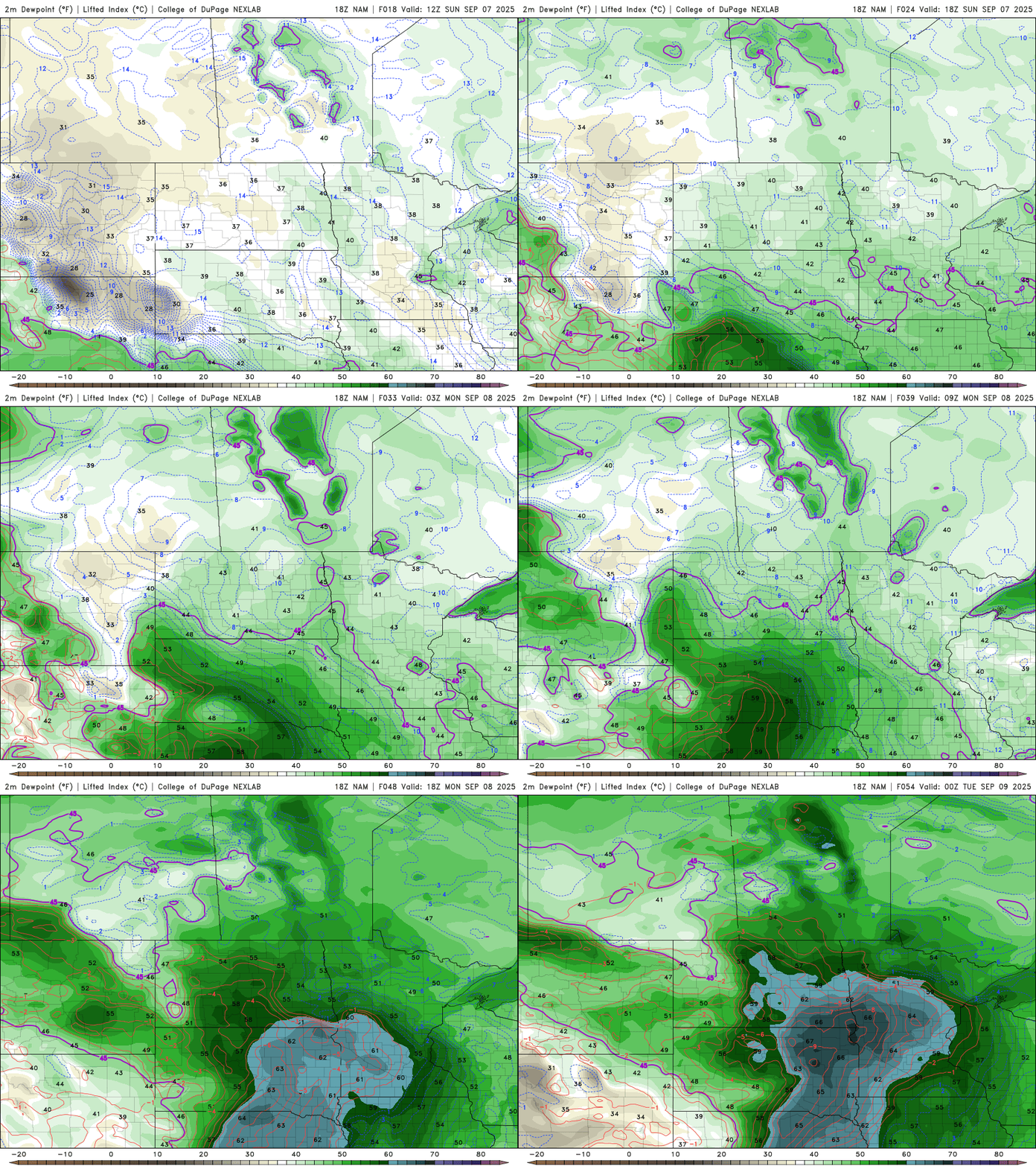
Increased moisture will lead to rising instability early next week, setting the stage for widespread showers and thunderstorms from late Monday into Tuesday morning. The best chances for storms will be across southern and eastern Minnesota.
Temperatures will finally return to more seasonal levels by Monday and Tuesday, with that near-average warmth sticking around through much of the work week.


