
Spotty thunder, warmer air return
Highs in the 70s and 80s most of the week

Go Deeper.
Create an account or log in to save stories.
Like this?
Thanks for liking this story! We have added it to a list of your favorite stories.


After a cool stretch of days, warmer air is back for Monday and the rest of the week. We’ll see some spotty thunder chances into Tuesday as moisture also increases.
Warmer air returns, bringing spotty thunder chances Monday and Tuesday
The stretch of cool days has come to an end. Afternoon highs Monday will surge into the 70s to even low 80s in southwestern Minnesota.

We’ll also see dew points increase as the dry, fall air departs. By late Monday, dew points will be in the 60s for much of southern and southwestern Minnesota especially.
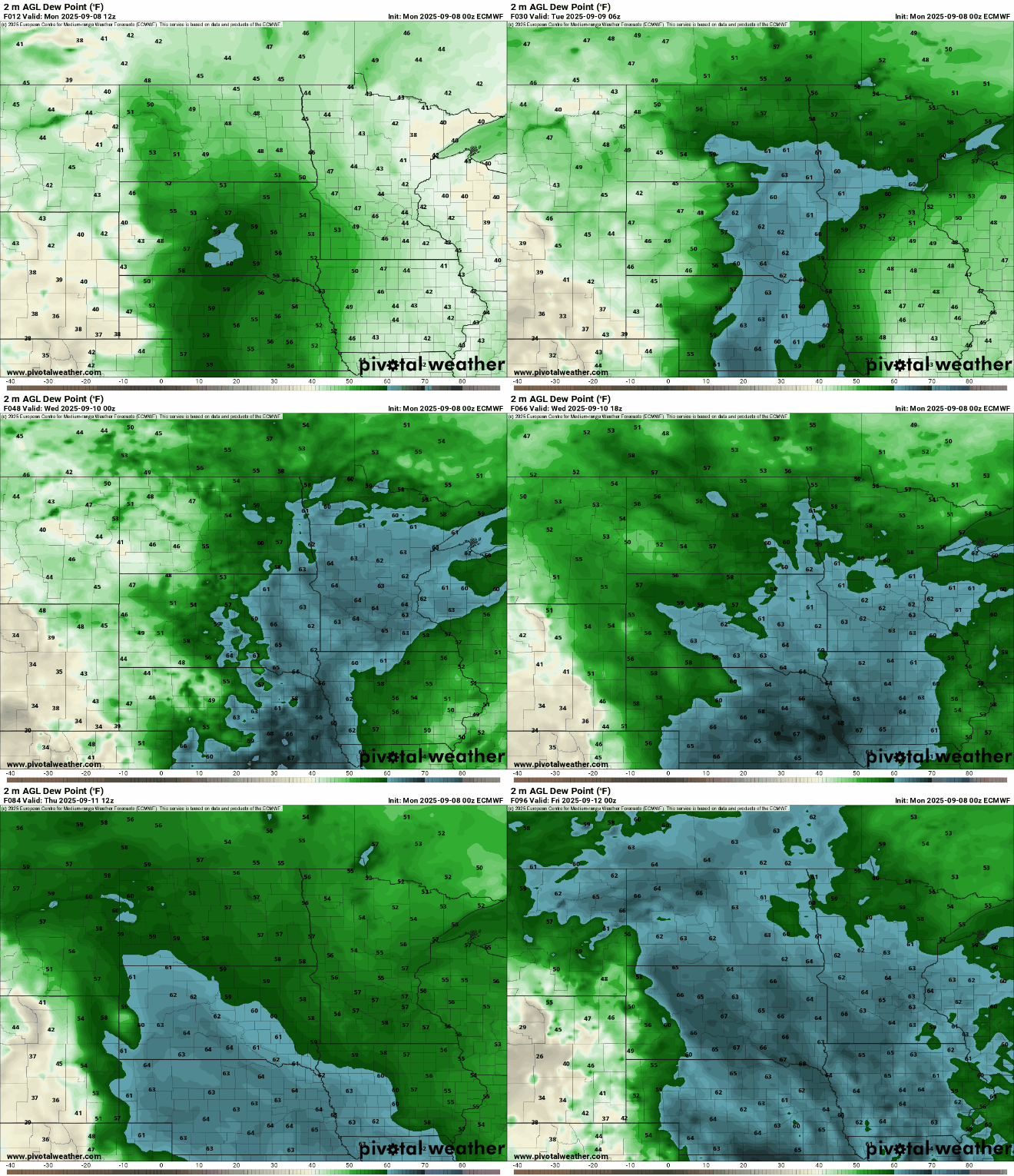
That increase in moisture and warmth will lead to some spotty shower and thunder chances into Tuesday.
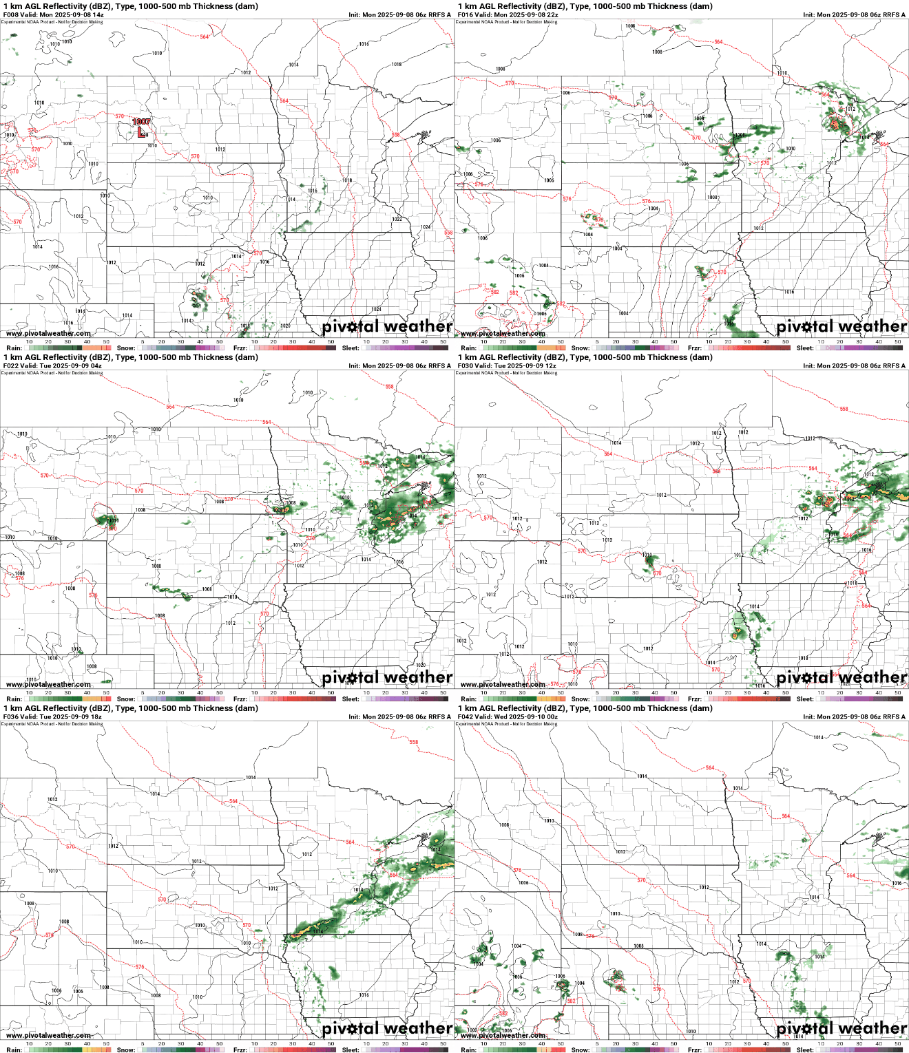
Tuesday will continue the warm weather with a mix of clouds and sun and a lingering spotty thunder chance. Afternoon highs will be mostly in the 70s to upper 60s in far northeastern Minnesota.

The rest of the week will continue to feature warm air and even above-normal temperatures. Highs will be in the 80s for central and southern Minnesota later in the week and weekend.

Turn Up Your Support
MPR News helps you turn down the noise and build shared understanding. Turn up your support for this public resource and keep trusted journalism accessible to all.

