
Warm, humid overnight with spotty thunder
We remain warm and humid through midweek
Go Deeper.
Create an account or log in to save stories.
Like this?
Thanks for liking this story! We have added it to a list of your favorite stories.


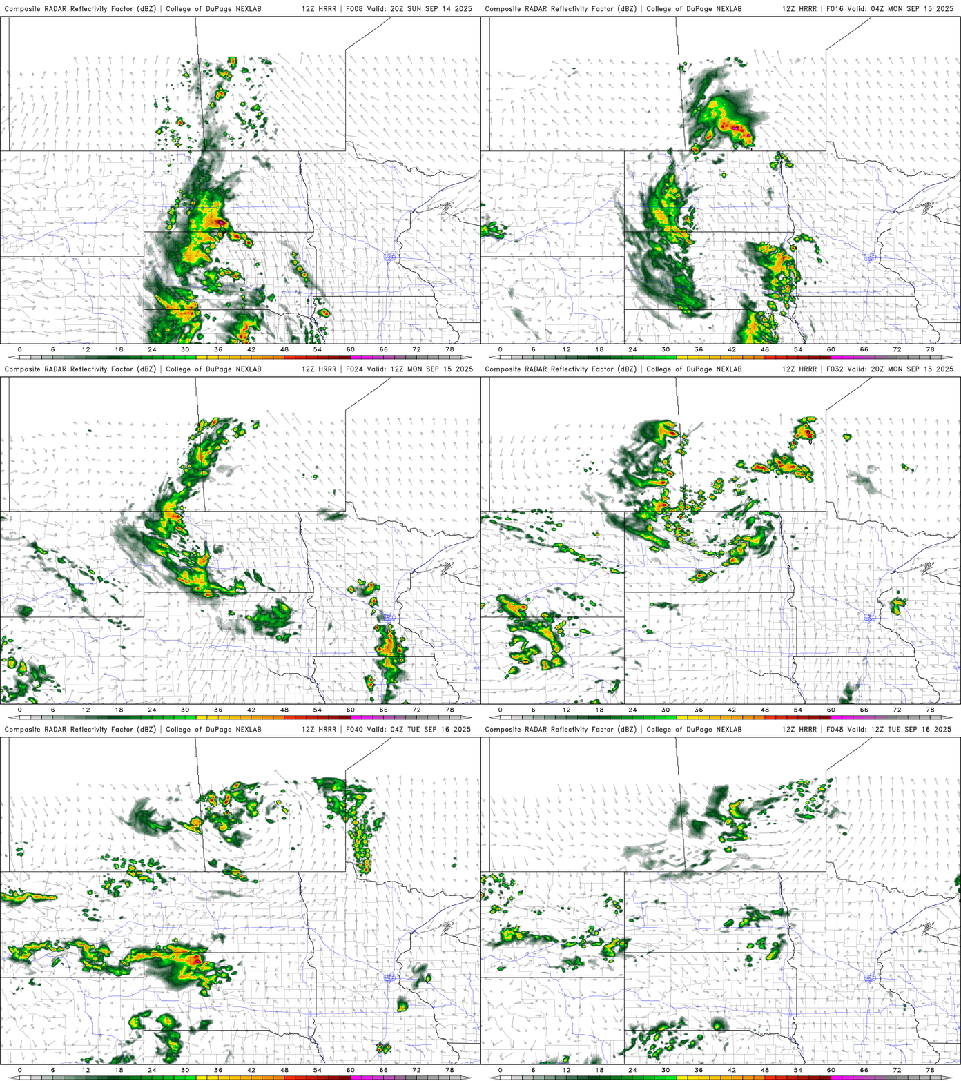
It’ll be a warm, humid overnight with spotty thunder, mainly west. Monday will see a lingering thunder chance. Cooler air arrives late week after some midweek showers.
Mild overnight with spotty thunder into Monday
It’ll feel more like a July night than mid-September. Overnight lows will drop only into the 60s and low 70s with dew points in the 60s to near 70.

Some spotty showers and storms are possible late Sunday into Sunday night across mainly western Minnesota, with chances developing east by early Monday.
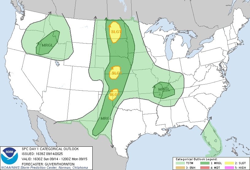
There’s a marginal (level 1 of 5) severe risk for far western Minnesota later Sunday into Sunday night. An isolated severe storm cannot be ruled out.
Highs Monday will still be very warm, in the 80s with dew points near 70 at times, with mix of clouds and sun.

We remain in the 80s and muggy through Wednesday before a cool front brings the chance of showers and cooler air for late week into the weekend. Temps will cool to normal, in the low 70s south to 60s north.
Turn Up Your Support
MPR News helps you turn down the noise and build shared understanding. Turn up your support for this public resource and keep trusted journalism accessible to all.

