
Our toasty tease continues before fall eases back in
Tuesday will be the hottest day in the forecast
Go Deeper.
Create an account or log in to save stories.
Like this?
Thanks for liking this story! We have added it to a list of your favorite stories.


Our late-summer warm stretch continues, with above-average temperatures and sticky dew points. Expect a toasty Tuesday with heat peaking before fall eases back in later this week.
Touch of summer
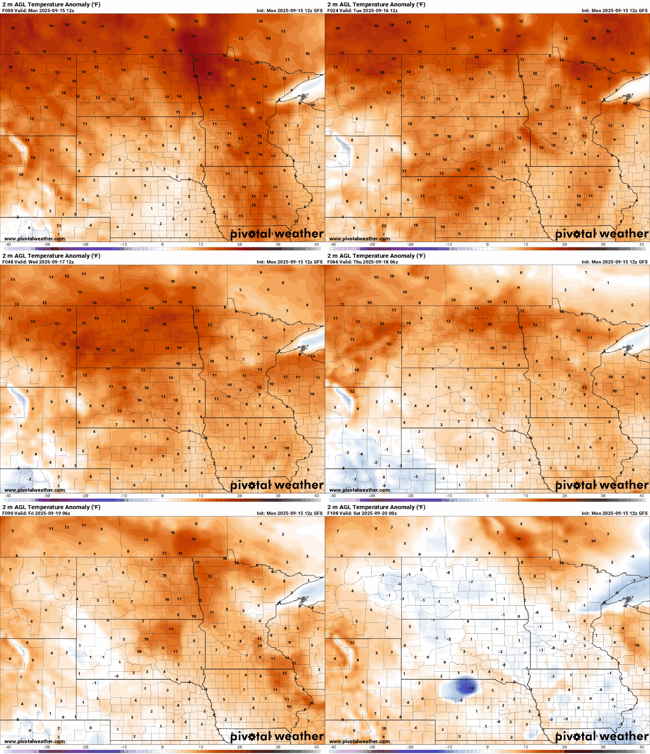
It may be mid-September on the calendar, but our weather maps suggest otherwise. A late-season heatwave continues to grip the region, with temperatures trending 10 to 15 degrees above normal through midweek.

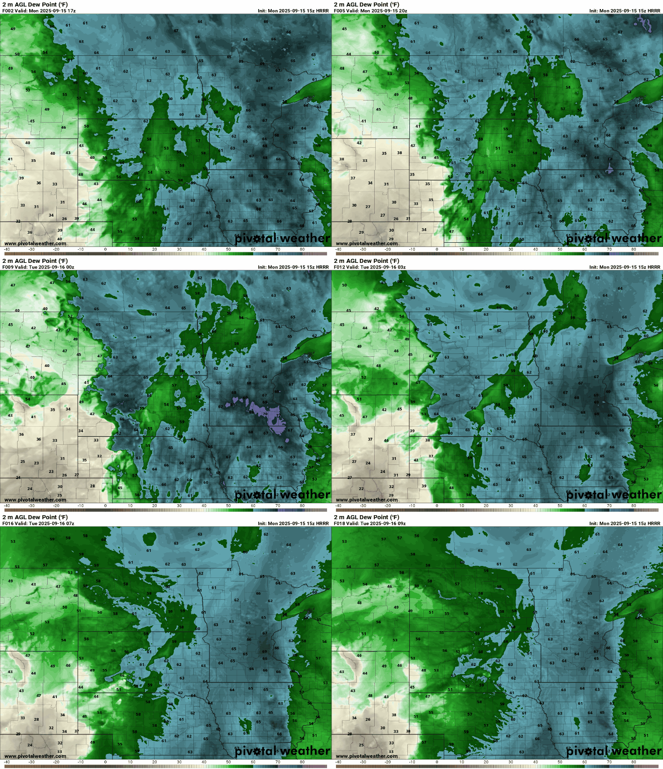
Ample moisture remains in place, with dew points surging into the 60s and 70s, adding to the summerlike feel across the region.
Monday will mark the fourth consecutive day with highs in the 80s for the Twin Cities, continuing our unseasonably warm stretch.

Tuesday will be the hottest day ahead, with the metro area aiming for a high of nearly 90 degrees.

Unseasonably warm air will persist through the week until cooler air from the Dakotas arrives by Thursday and Friday as shown on the latest surface temperature anomaly map:
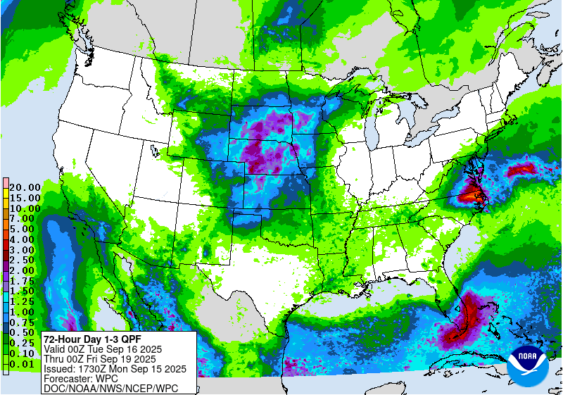
An unsettled weather pattern is expected to continue into the first half of the weekend, bringing multiple chances for showers and storms. Rainfall totals could accumulate to several inches over this period.
Turn Up Your Support
MPR News helps you turn down the noise and build shared understanding. Turn up your support for this public resource and keep trusted journalism accessible to all.

