
Incoming rainfall to help balance out drier start to September
Track the fall foliage with the latest map update
Go Deeper.
Create an account or log in to save stories.
Like this?
Thanks for liking this story! We have added it to a list of your favorite stories.


Multiple rounds of rainfall are expected to help offset the drier start to September with slowly moving or repeated showers potentially bringing several inches of moisture to the region.
Weather whiplash
The first half of September has delivered quite the weather whiplash. The month began with cool highs in the 60s and several rainy days, only to shift into a hot stretch with temperatures soaring into the 80s and even 90s, accompanied by mostly dry conditions.
Looking at accumulated precipitation from Sept. 1 to Sept. 16, most of the state has received between 1 and 3 inches of rain while southern Minnesota has seen around one-quarter inch.

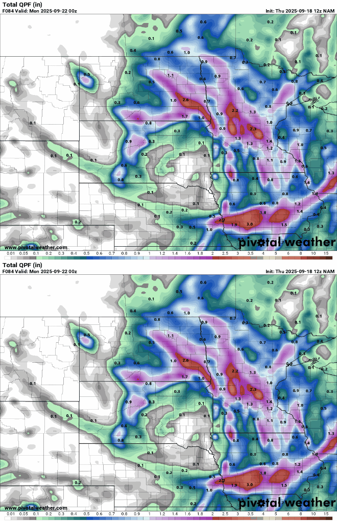
A slowly moving system will bring multiple chances of rainfall to the region from Friday into the weekend. Forecast rainfall amounts are expected to produce swaths of 1 to 2 inches.
Turn Up Your Support
MPR News helps you turn down the noise and build shared understanding. Turn up your support for this public resource and keep trusted journalism accessible to all.
This latest system should help keep Minnesota on track to have no drought conditions heading into fall, with less than 19 percent of the state experiencing abnormally dry conditions, according to the latest U.S. Drought Monitor report.

Latest fall foliage
The Minnesota Department of Natural Resources has released its latest fall foliage map, showing color change in northwestern Minnesota at mostly 25% to 50%. These colors are gradually progressing southward, reaching just north of the St. Cloud area.

Although this weekend may bring clouds and rain showers, it’s always worth taking a drive to witness the stunning seasonal changes that Mother Nature paints for us.

