
Increased sunshine Sunday with isolated severe storm potential
Slightly above normal temperatures through the week

Go Deeper.
Create an account or log in to save stories.
Like this?
Thanks for liking this story! We have added it to a list of your favorite stories.


Our slow-moving system will keep showers and thunderstorms in the forecast for Sunday afternoon and evening. A marginal risk for severe weather is in place across southern Minnesota, including portions of the southern Twin Cities metro.
Warmer, sunnier Sunday
A slow-moving upper-level low-pressure system that’s been influencing our weather over the past few days is still hanging around, currently centered near the eastern North Dakota and northwestern Minnesota border.
As the system moves eastward, it will bring another round of isolated showers and a few thunderstorms Sunday afternoon and evening, lingering into early Monday. The main impact will be across southern Minnesota, western Wisconsin and northern Minnesota.
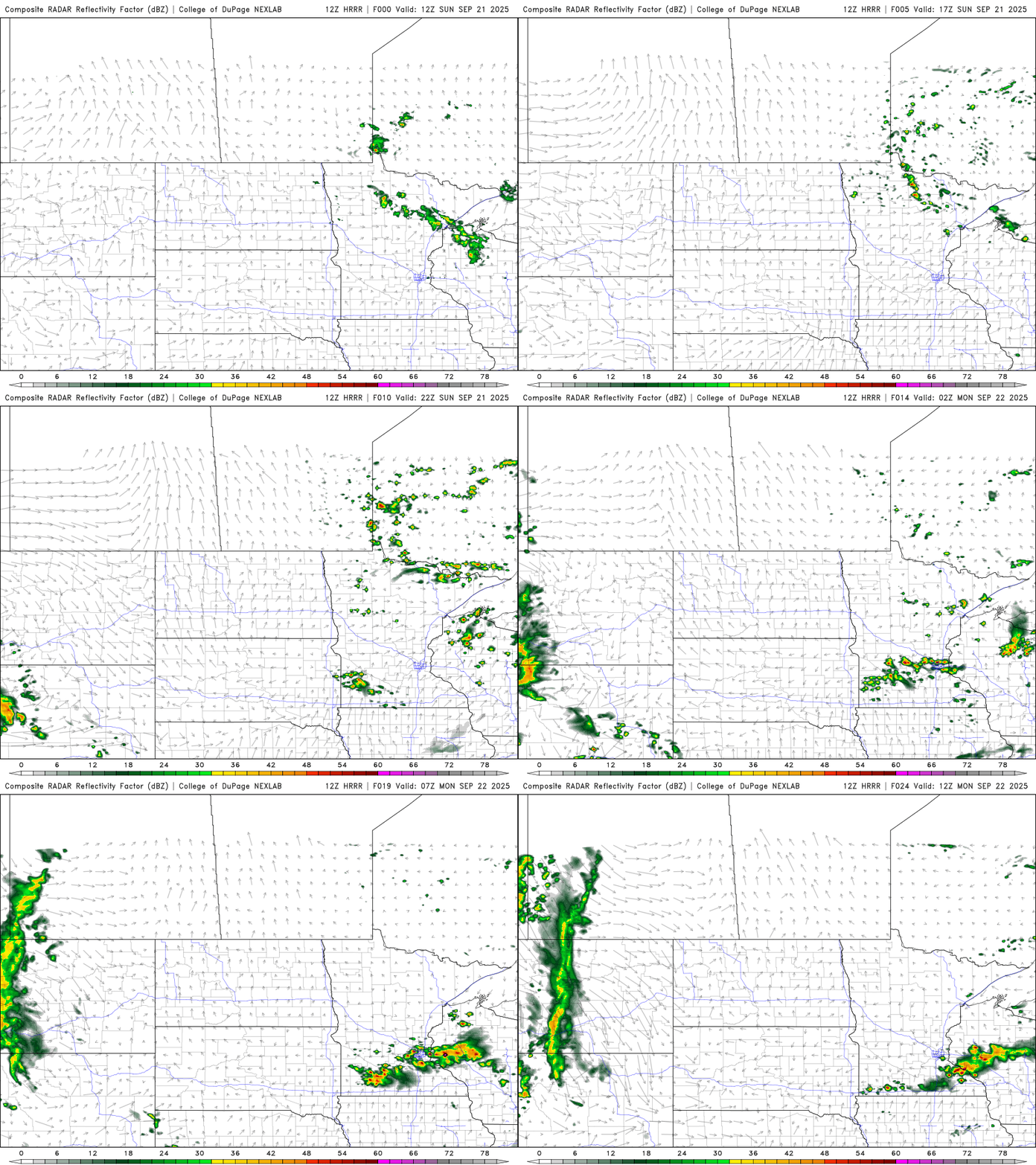
Some storms may produce hail, potentially on the larger side. As a result, the Storm Prediction Center has placed southern Minnesota, including parts of the southern Twin Cities metro, under a marginal risk for severe weather.
Warmer temperatures are expected Sunday, with highs climbing into the upper 60s to mid-70s and increased sunshine throughout the day.

Lingering showers are possible on the first day of fall Monday, with temperatures ranging from the low to mid-70s, even 60s for the North Shore.

Our slightly above-average temperatures will continue through the week with highs in the lower to mid-70s. We’ll see a decrease in dew points through the week returning to the lower to mid-50s.
Turn Up Your Support
MPR News helps you turn down the noise and build shared understanding. Turn up your support for this public resource and keep trusted journalism accessible to all.

