
Warmer-than-normal temperatures and pleasant weather this week
Isolated storms expected in Minnesota's northeast and southeast

Go Deeper.
Create an account or log in to save stories.
Like this?
Thanks for liking this story! We have added it to a list of your favorite stories.


Our unsettled weather pattern departs Monday with lingering, isolated thunder in northeastern and southeastern Minnesota.
The rest of the week is expected to be warm, dry and pleasant.
Storms and rainfall
Thunderstorms produced some locally heavy rainfall and large hail Sunday evening. Several locations within the Twin Cities metro saw hail. The largest hail of 2 inches was observed in Deephaven and Minnetonka. A brief funnel cloud was also spotted near Luverne in far southwestern Minnesota.

Rainfall varied greatly but many areas in the southeastern Twin Cities metro and also southeastern Minnesota received more than 2 inches of rainfall.
Turn Up Your Support
MPR News helps you turn down the noise and build shared understanding. Turn up your support for this public resource and keep trusted journalism accessible to all.

Warm and pleasant week ahead
After some areas of morning fog, we’ll have a mix of clouds and sun Monday with afternoon highs in the 70s for most. Northeastern Minnesota will be a bit cooler with highs in the upper 60s.

Southeastern Minnesota will see ongoing showers and storms Monday morning with more developing later in the afternoon Monday. Northeastern Minnesota could also see some pop-up showers and storms Monday afternoon.
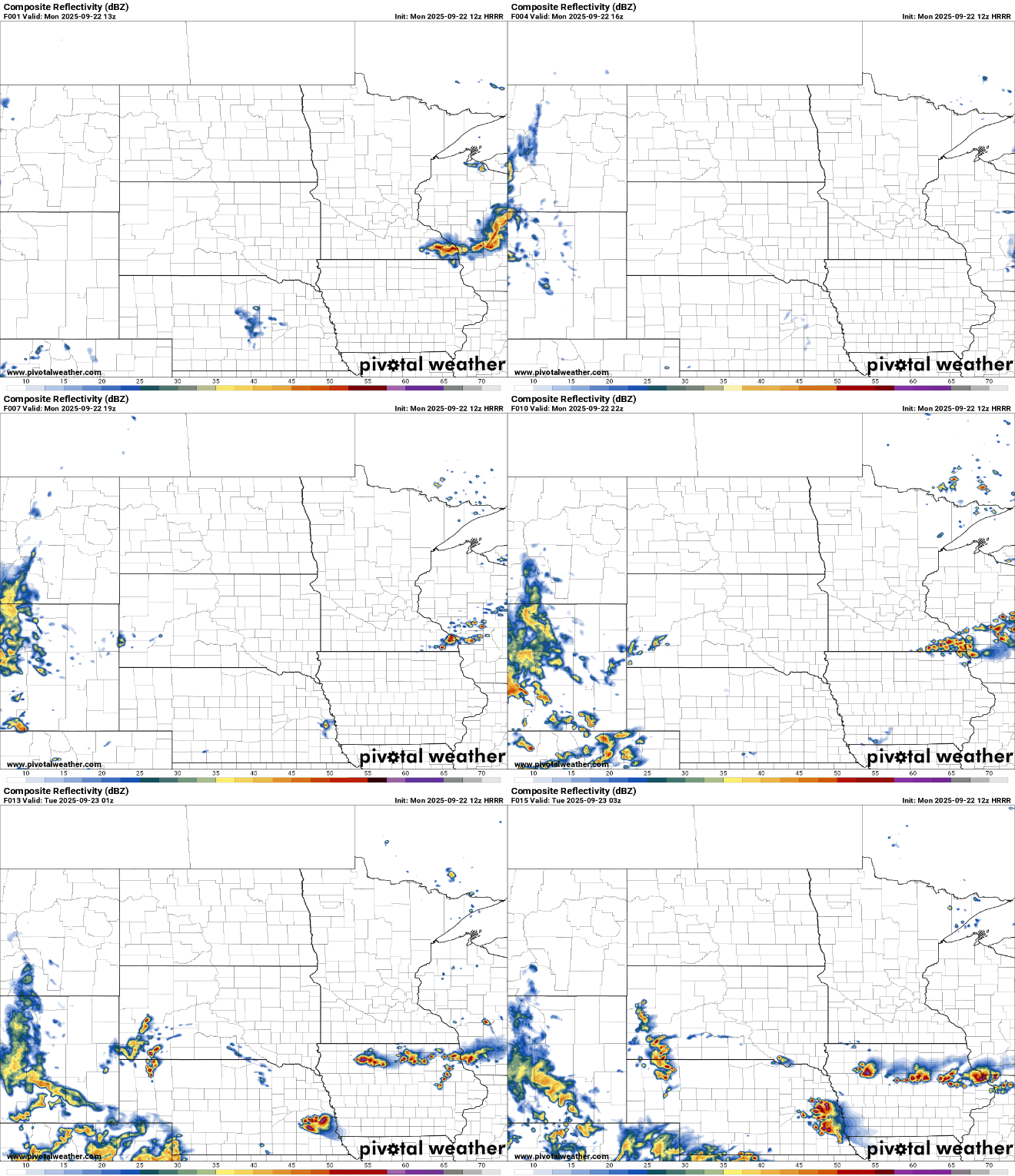
There’s a marginal risk (level 1 of 5) of severe weather across far southern Minnesota late Monday.

We’ll likely have some areas of fog Monday night and into Tuesday morning. Afternoon skies will be partly cloudy with highs back in the 70s for most of the state.

The rest of the week will be warm, dry and pleasant. By the end of the week highs could be close to 80 degrees again for southern Minnesota.

Temperatures will run 3 to 10 degrees above normal all week, guaranteeing September ends warmer than normal.
Welcome to autumn!
The autumnal equinox is at 1:19 p.m. Monday. At this time the sun’s direct rays (perpendicular, 90 degree angle) shine on the equator and then slip into the southern hemisphere for the next six months, setting the stage for winter in the Northern Hemisphere in another three months.

Due to the tilt of Earth’s axis of 23.4 degrees, we see four very different seasons. This also means that the North Pole slides into 24 hours of darkness from the autumnal equinox until the vernal (spring) equinox again in March (and from spring through autumn, 24 hours of daylight).

This also means that the Arctic rapidly develops cold air over the next several weeks, setting the stage for winter.

