
Rare Fujiwhara dance may develop between two tropical cyclones in the Atlantic
Rare interaction may alter the path of both storms

Go Deeper.
Create an account or log in to save stories.
Like this?
Thanks for liking this story! We have added it to a list of your favorite stories.


As the busy Atlantic Ocean churns with multiple storms, forecasters are closely watching for signs of a rare Fujiwhara interaction, where two cyclones begin to rotate around each other and potentially shift course.
Rare, interesting ‘dance’
The term Fujiwhara effect is named after meteorologist Sakuhei Fujiwhara, who first described the phenomenon in 1921.
Although relatively uncommon, it occurs when two storms or hurricanes spinning in the same direction come close enough to interact. When this happens, they begin to “dance” around each other, affecting each other's circulation and potentially altering their paths.
Our busy Atlantic basin currently features Hurricane Gabrielle, Tropical Storm Humberto, and Invest 94L.
Turn Up Your Support
MPR News helps you turn down the noise and build shared understanding. Turn up your support for this public resource and keep trusted journalism accessible to all.
The latest forecast from the National Hurricane Center now calls for Humberto to become a hurricane within the next day and rapidly intensify into a major hurricane (Category 3 or higher) by this weekend.
Invest 94L has a 90% chance of developing into Tropical Depression Imelda and could engage in a Fujiwhara interaction with Tropical Storm Humberto, potentially altering the paths of both storms.

Currently, Invest 94L is tracking toward the southeastern United States and the Carolina shores by early next week, but a possible interaction with Tropical Storm Humberto could influence their movement.
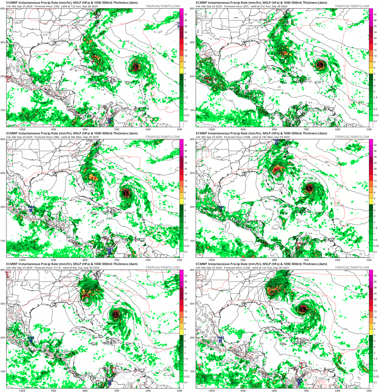
When we look at an ensemble of weather models, we can see that some suggest Invest 94L may turn to the right, likely due to a possible Fujiwhara interaction with Tropical Storm Humberto.

Whether or not this rare and mystical dance plays out remains to be seen, but the setup is one meteorologists don’t witness often.

