
Breezy start to the week with showers
Go Deeper.
Create an account or log in to save stories.
Like this?
Thanks for liking this story! We have added it to a list of your favorite stories.


Our sunny and seasonable Sunday gives way to a mostly clear night with lows in the low 30s to low 40s.

Monday features highs ranging from the 60s to mid-40s, then a cold front rolls through.

By Tuesday, we'll have a high of only 47, and it'll feel cooler factoring in a northwest wind gusting up to 35 mph.

The rest of the week will be pretty consistent with highs across the state in the 40s and 50s. The mornings will start to get frosty with a widespread freeze possible Wednesday night and Thursday night.

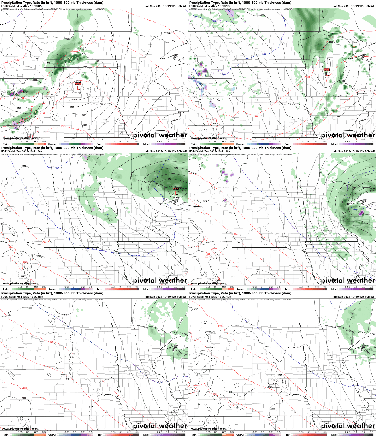
We have one rainmaker in the forecast with chances arriving from the west through the morning and afternoon Monday. Additional showers sweep the region on the backside of the system on Tuesday. By Wednesday, lingering showers will be limited to the Arrowhead.
That's where we'll see the greatest totals with up to around an inch possible near Grand Marais. Amounts drop off looking south with a good quarter inch possible from Duluth to Grand Rapids to Bemidji, and less than a tenth of an inch along and south of I-94, including the Twin Cities.

After that, a dry stretch is expected the rest of the week into the weekend.
Turn Up Your Support
MPR News helps you turn down the noise and build shared understanding. Turn up your support for this public resource and keep trusted journalism accessible to all.

