
Cool, breezy with decreasing clouds Wednesday
Thursday will be brighter with warmer temps by the weekend
Go Deeper.
Create an account or log in to save stories.
Like this?
Thanks for liking this story! We have added it to a list of your favorite stories.


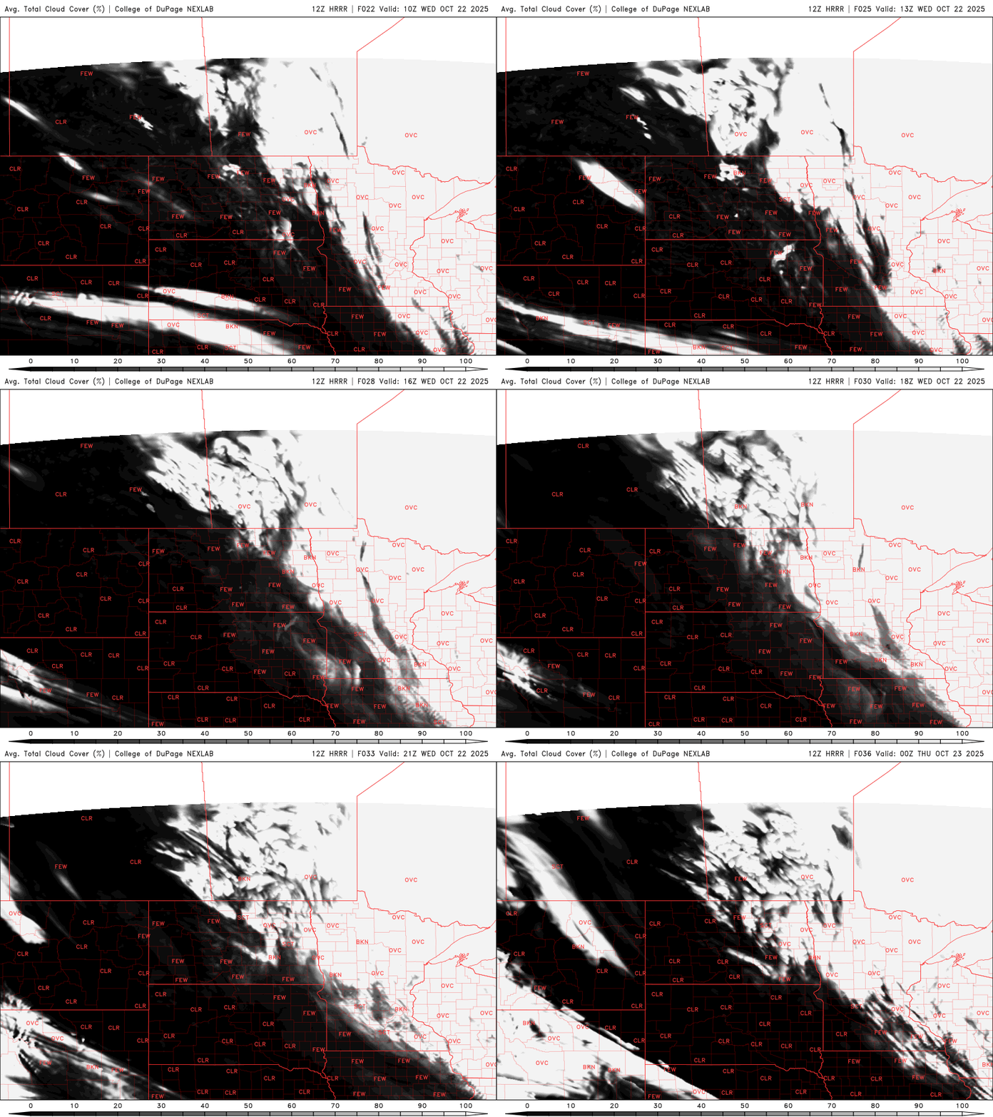
Winds and clouds will slowly decrease Wednesday. Northeastern Minnesota will see some lingering showers. Afternoon highs will reach the low 50s south but Wednesday night will be frosty for most.
Breezy and cool with some afternoon sun
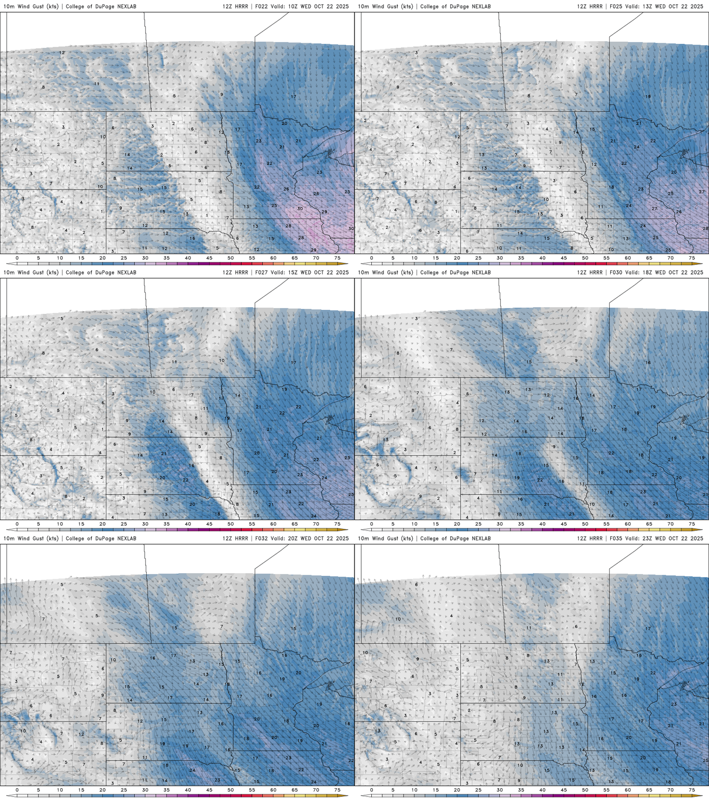
While it won’t be quite as windy Wednesday, it will still be breezy and even blustery at times with northwest winds 10 to 20 mph most of the day.
Clouds will decrease some for southern and western Minnesota, allowing temps to warm into the low 50s Wednesday afternoon. Northeastern Minnesota will remain under the clouds and colder, in the 40s.

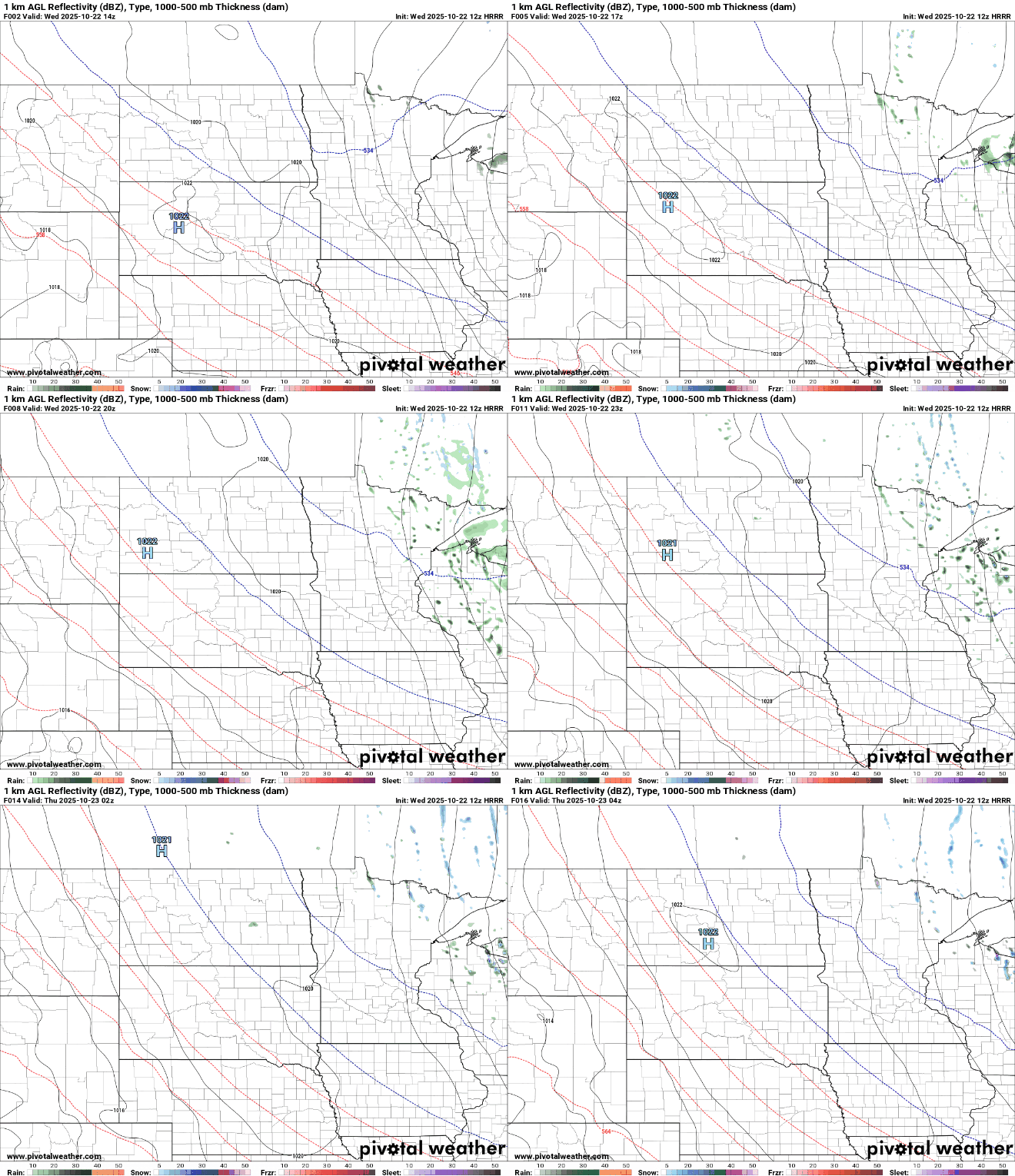
There will still be some spotty, lingering showers, possibly mixing with snowflakes, in northeastern Minnesota Wednesday:
Wednesday night will be cold with upper 20s to low to mid-30s for most of the state. Only the urban core of the Twin Cities metro area will likely remain above freezing, barely.

Thursday should yield more sunshine than Wednesday but temperatures will be similar, in the 40s and 50s. Temperatures warm Friday into the weekend when we’ll be near 60 degrees again in southern Minnesota.

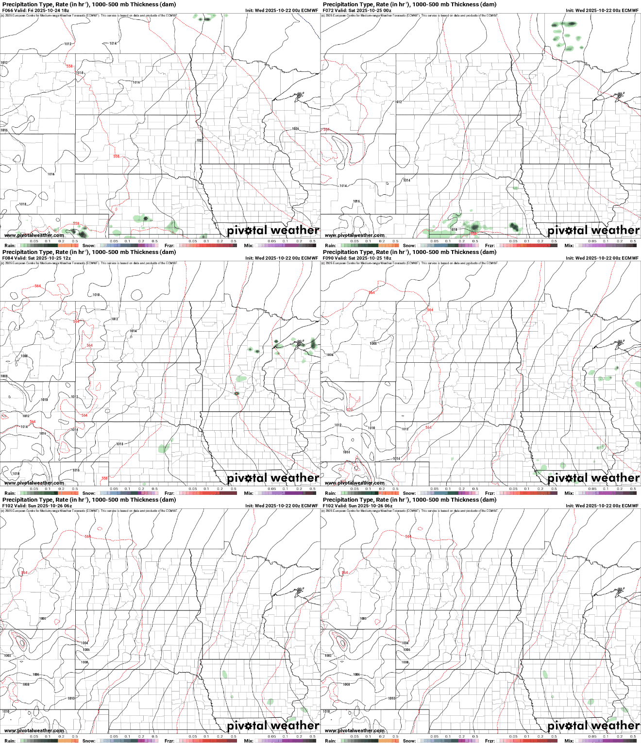
We’ll also see a few isolated to spotty showers Friday night and Saturday as a clipper system moves through the region.
Turn Up Your Support
MPR News helps you turn down the noise and build shared understanding. Turn up your support for this public resource and keep trusted journalism accessible to all.

