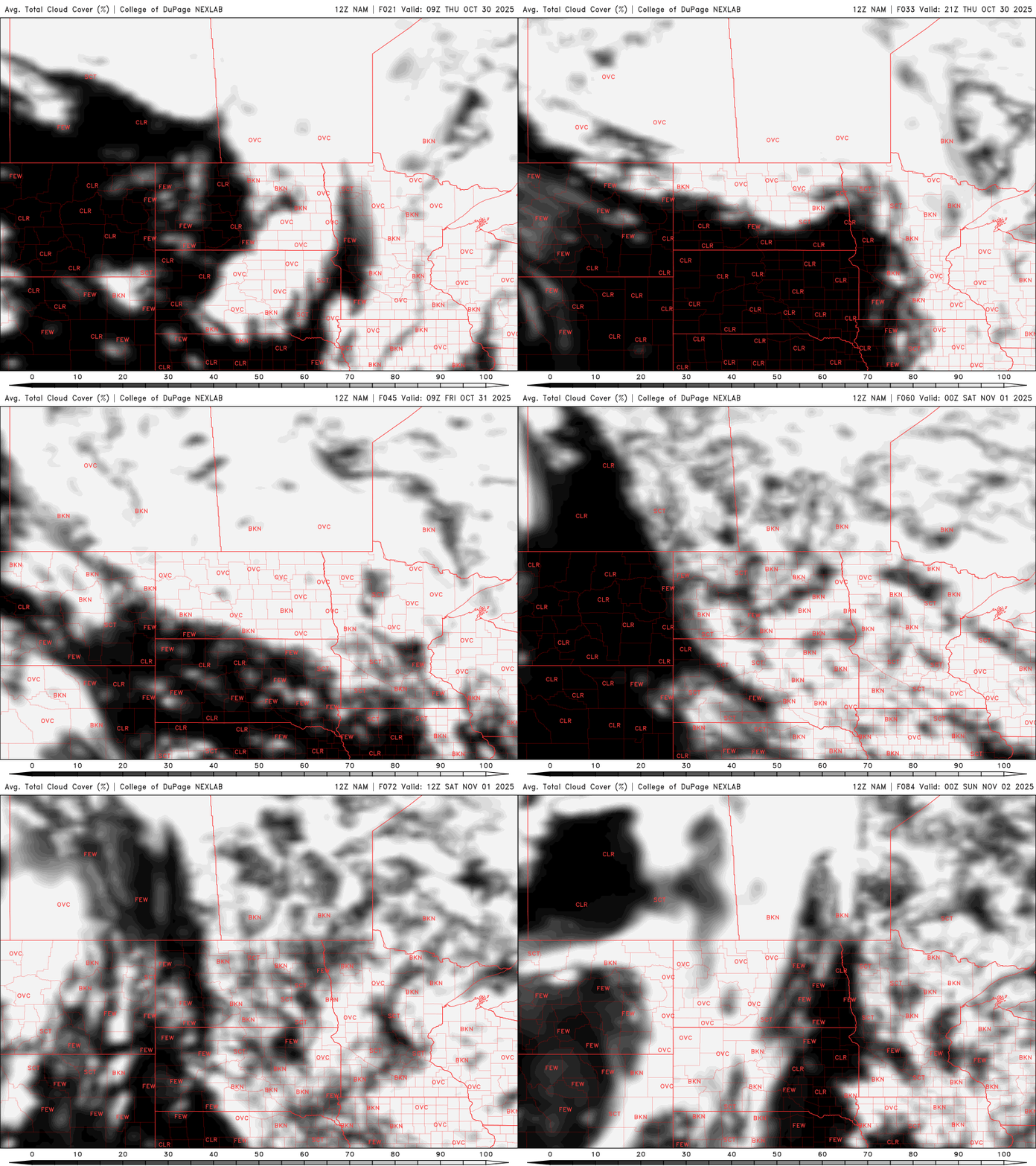
Clouds increase again for Thursday into Saturday with isolated sprinkles
Temperatures will be slightly cooler Friday but milder next week
Go Deeper.
Create an account or log in to save stories.
Like this?
Thanks for liking this story! We have added it to a list of your favorite stories.


A pair of clipper systems will bring back some increased cloud cover and isolated sprinkles Thursday into Friday and Saturday. Next week looks mild and relatively quiet.
Increasing cloud cover again Thursday into Friday and Saturday
With the clear skies overnight we have many areas of dense fog early Thursday. Most fog will burn off by mid to late morning Thursday.
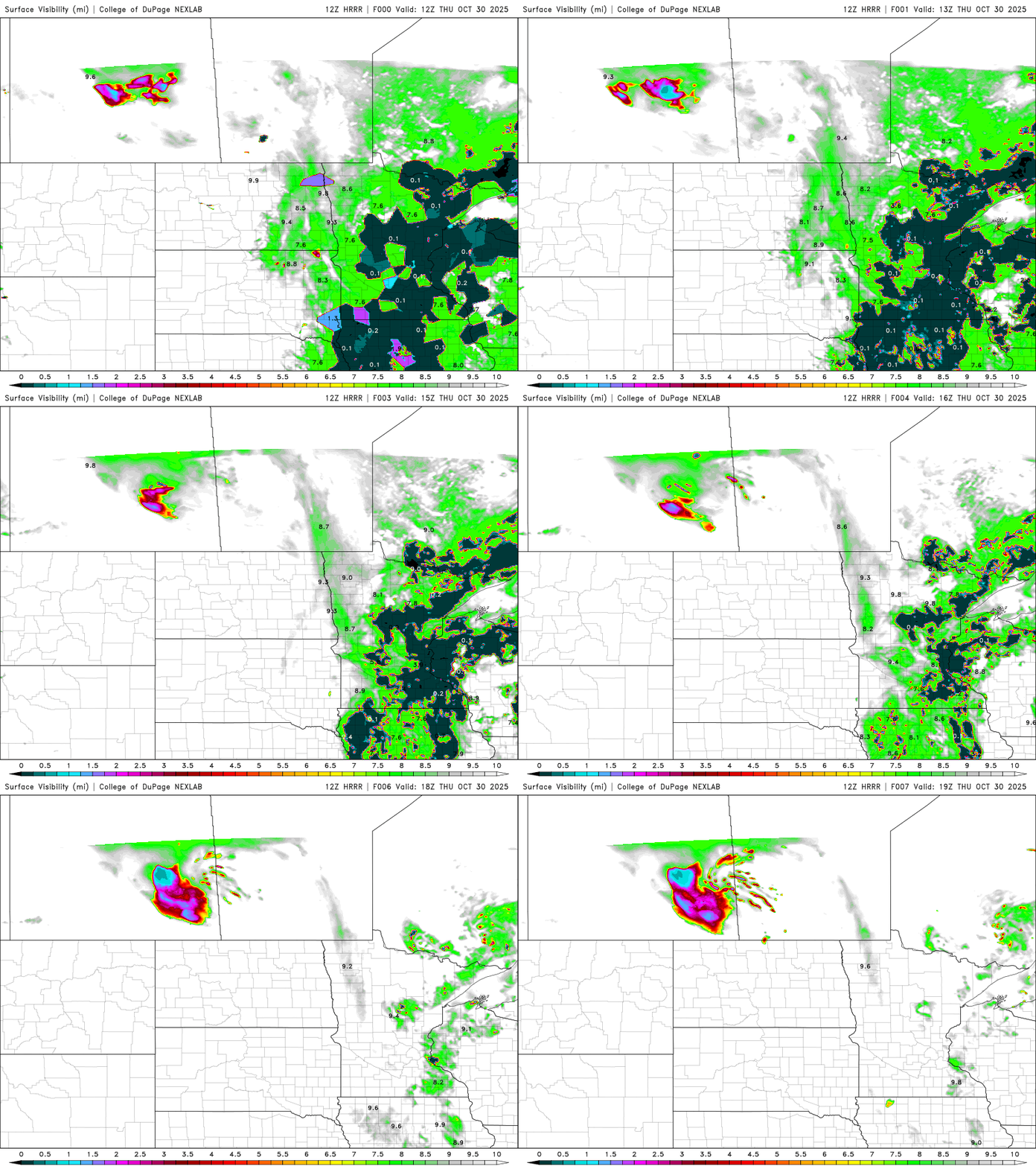
There are dense fog advisories posted for many areas through late morning Thursday:

Temperatures will be slightly cooler Thursday and the next few days as a pair of clipper systems bring increased cloud cover and pull down an air mass that will be a few degrees cooler. Afternoon highs Thursday will be near 50 in southern Minnesota with mostly 40s north.
Turn Up Your Support
MPR News helps you turn down the noise and build shared understanding. Turn up your support for this public resource and keep trusted journalism accessible to all.

Halloween will be even a couple degrees cooler with highs mostly in the 40s across the state. Trick-or-treaters can expect temperatures in the 30s north and low 40s south for evening temperatures.

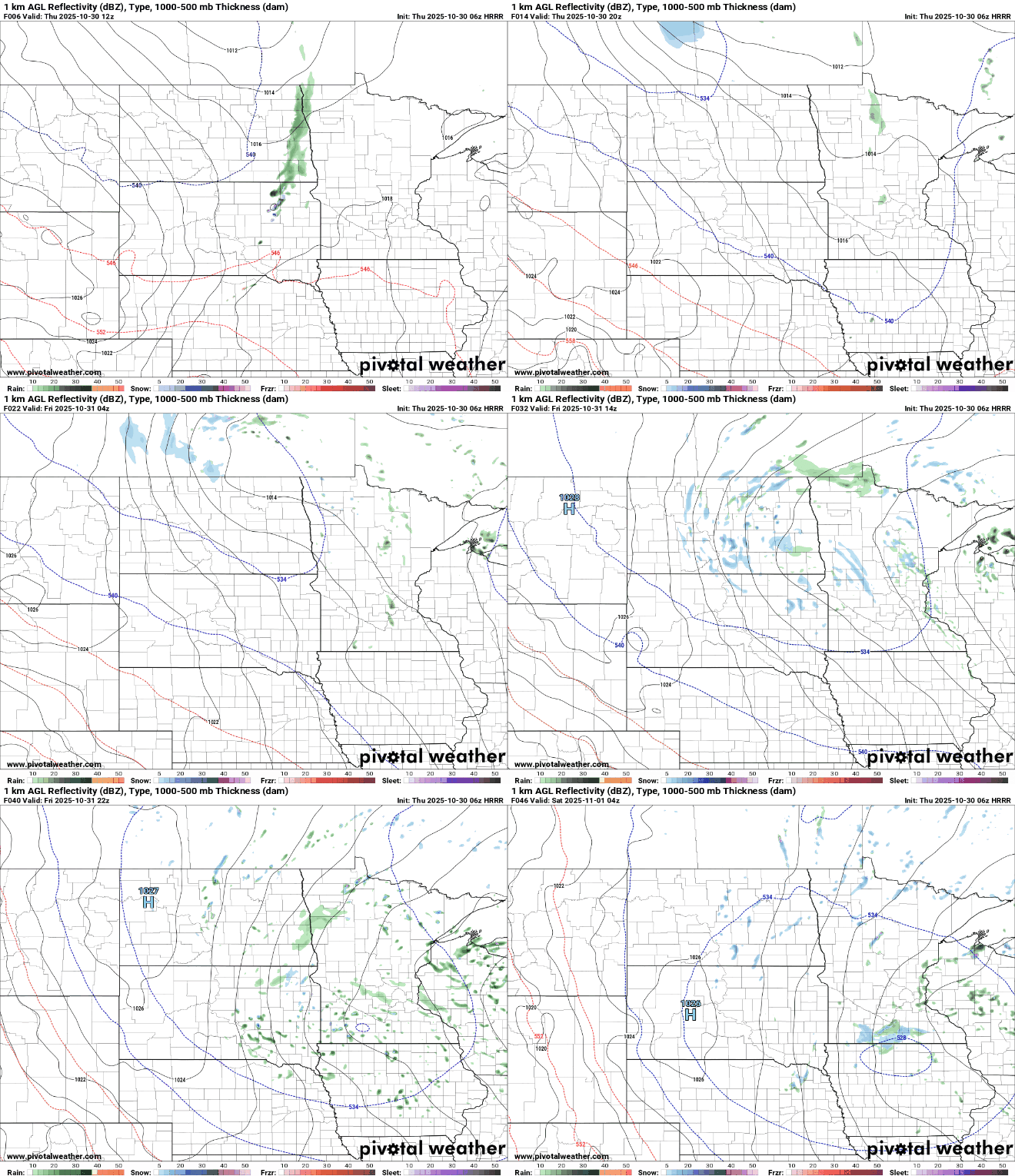
Those clipper systems won’t have a lot of moisture, so we’ll mostly see increased cloud cover. But there will be some isolated to spotty sprinkles and flurries, especially Thursday afternoon into Friday and Saturday.
Any rainfall will be brief and light. We could see our first flakes flying around Friday in parts of central and southern Minnesota, especially early in the day and in the evening hours, but no accumulations are expected.
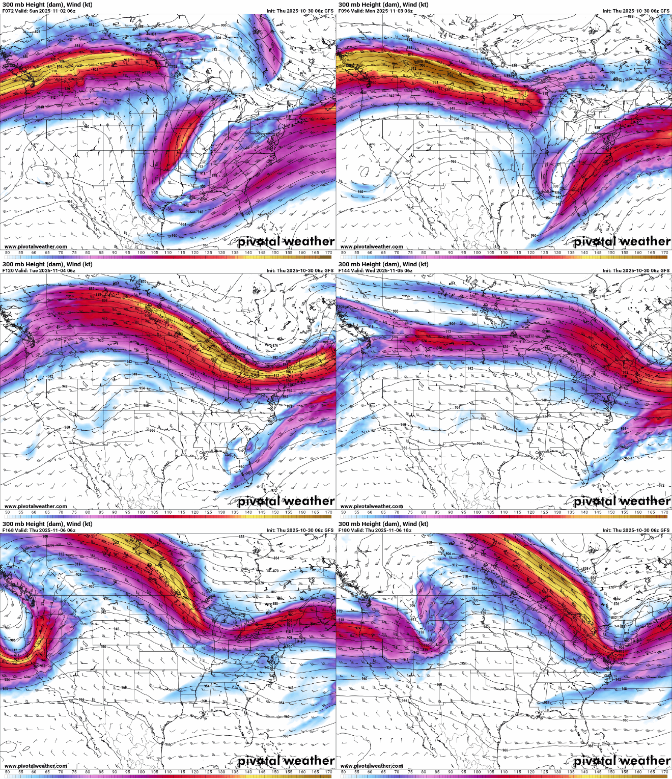
Next week the jet stream is riding high into mostly southern Canada, meaning we’ll be relatively mild with no major weather systems in the region.
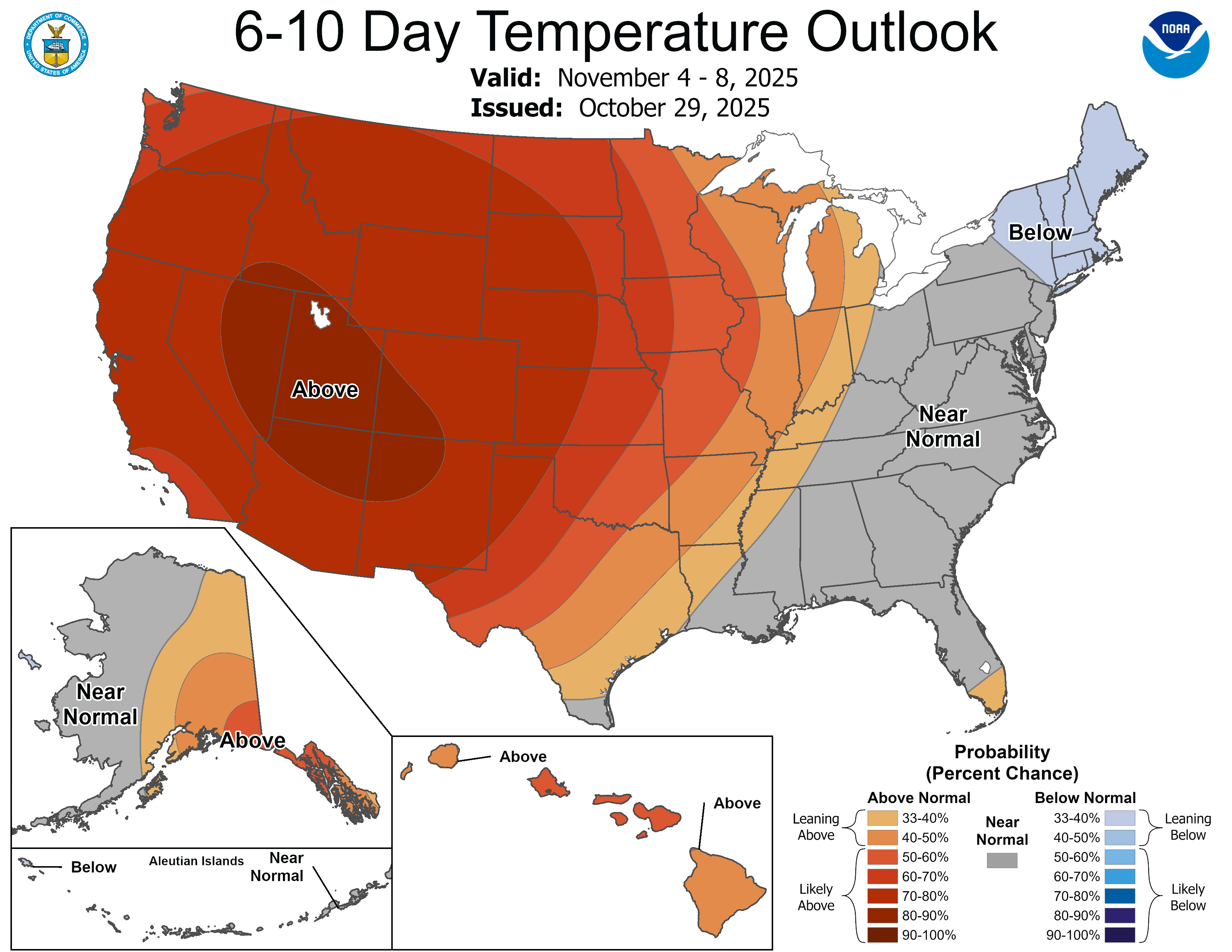
The six to 10-day temperature outlook calls for a high likelihood of above normal temperatures. That equates to highs mostly in the 50s to near 60-degrees for much of central and southern Minnesota next week. Normal highs are in the 40s next week.