
Cool Halloween with occasional sprinkles, flurries
Mild temperatures prevail next week for November’s start
Go Deeper.
Create an account or log in to save stories.
Like this?
Thanks for liking this story! We have added it to a list of your favorite stories.


Clouds and occasional sprinkles and flurries will linger across Minnesota Friday and Saturday. Milder weather develops next week with little precipitation.
Clouds with occasional sprinkles, flurries Friday and Saturday
It’ll be a little on the cooler side of normal Friday for Halloween and the last day of what’s been a very warm month. It’s a far cry from the temperatures in the 80s and 90s we had in the first several days of the month. We’ll see highs mostly in the 40s, a few degrees below normal.

We’ll continue to see mostly cloudy skies Friday into Saturday with just some peeks of sun. Sunday will likely start out brighter before clouds move in yet again with yet another clipper system.
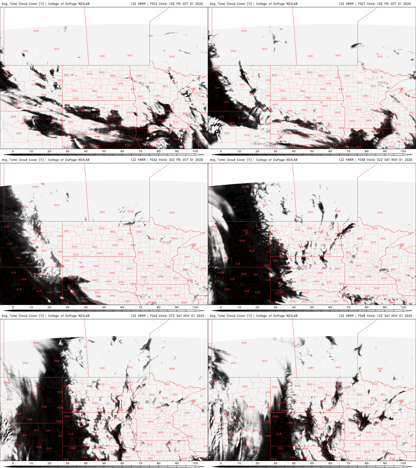
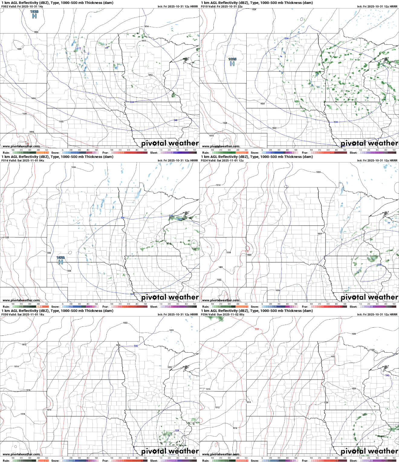
In those clouds we’ll have some occasional scattered sprinkles and flurries Friday into Friday night and Saturday as this clipper system slowly moves out of the region.
Turn Up Your Support
MPR News helps you turn down the noise and build shared understanding. Turn up your support for this public resource and keep trusted journalism accessible to all.
Some of those sprinkles will occasionally mix with snow flakes at the cooler times of the day — early in the morning, in the evening and overnight.
It’ll be another chilly and frosty night Friday into Saturday with most areas falling again into the low 30s with 20s north.

Saturday will be pretty similar to Friday with more clouds than sun and some lingering sprinkles and flurries. Highs will again be mostly in the 40s.

Sunday will be milder, but will also feature the arrival of yet another clipper system increasing cloud cover later in the day after some sunshine to start. We’ll also likely see more spotty showers late Sunday into Sunday night.
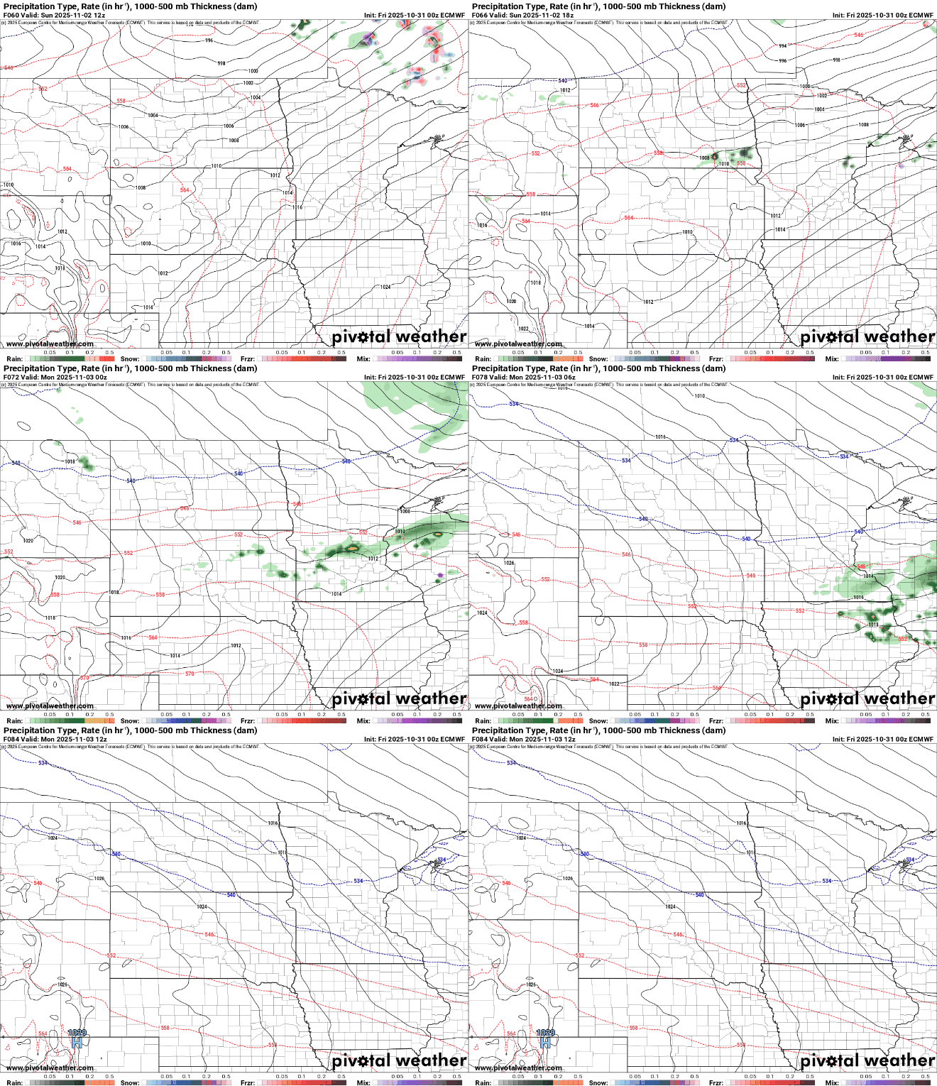
Next week will be mild overall with highs in the 50s to near 60 degrees across central and southern Minnesota. A couple of systems will mostly affect far northern Minnesota as the jet stream and main storm track blast across southern Canada.

Those temperatures Tuesday will be nearly 10 degrees above normal. Normal highs next week are mostly in the 40s.


