
Mild again Tuesday with a disturbance affecting northern Minnesota late
Much colder with snow flakes by the weekend
Go Deeper.
Create an account or log in to save stories.
Like this?
Thanks for liking this story! We have added it to a list of your favorite stories.


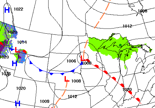
We’ll have another mild day with more sun in southern Minnesota. Clouds increase north with the next disturbance bringing some showers to northern Minnesota late Tuesday.
Mild, brighter south with clouds. Showers north later Tuesday
It’ll be another relatively mild day with highs into the low 60s across southern Minnesota. Northern Minnesota will be a bit cooler, closer to 50 degrees with more cloud cover there. All readings are well above normal by 5 to 15 degrees.

The clouds are a result of the latest disturbance moving through. It’ll bring some scattered to spotty light rain showers late Tuesday into the overnight for mainly northern Minnesota. Amounts will generally be pretty light at one-tenth inch or less.
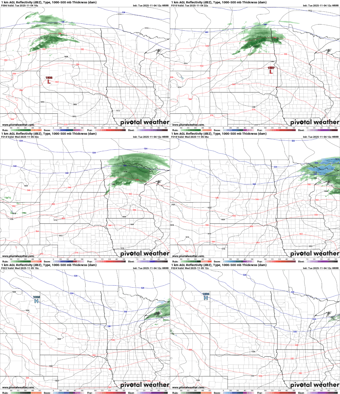
High pressure builds back in for Wednesday bringing abundant sunshine back for almost the entire state of Minnesota. Afternoon highs remain mild, in the low to mid-50s south, but a bit cooler north, mainly in the 40s.

Clouds increase yet again Thursday into Friday as yet another disturbance moves into the region. This one could bring some spotty showers again, potentially mixing with snow flakes north.
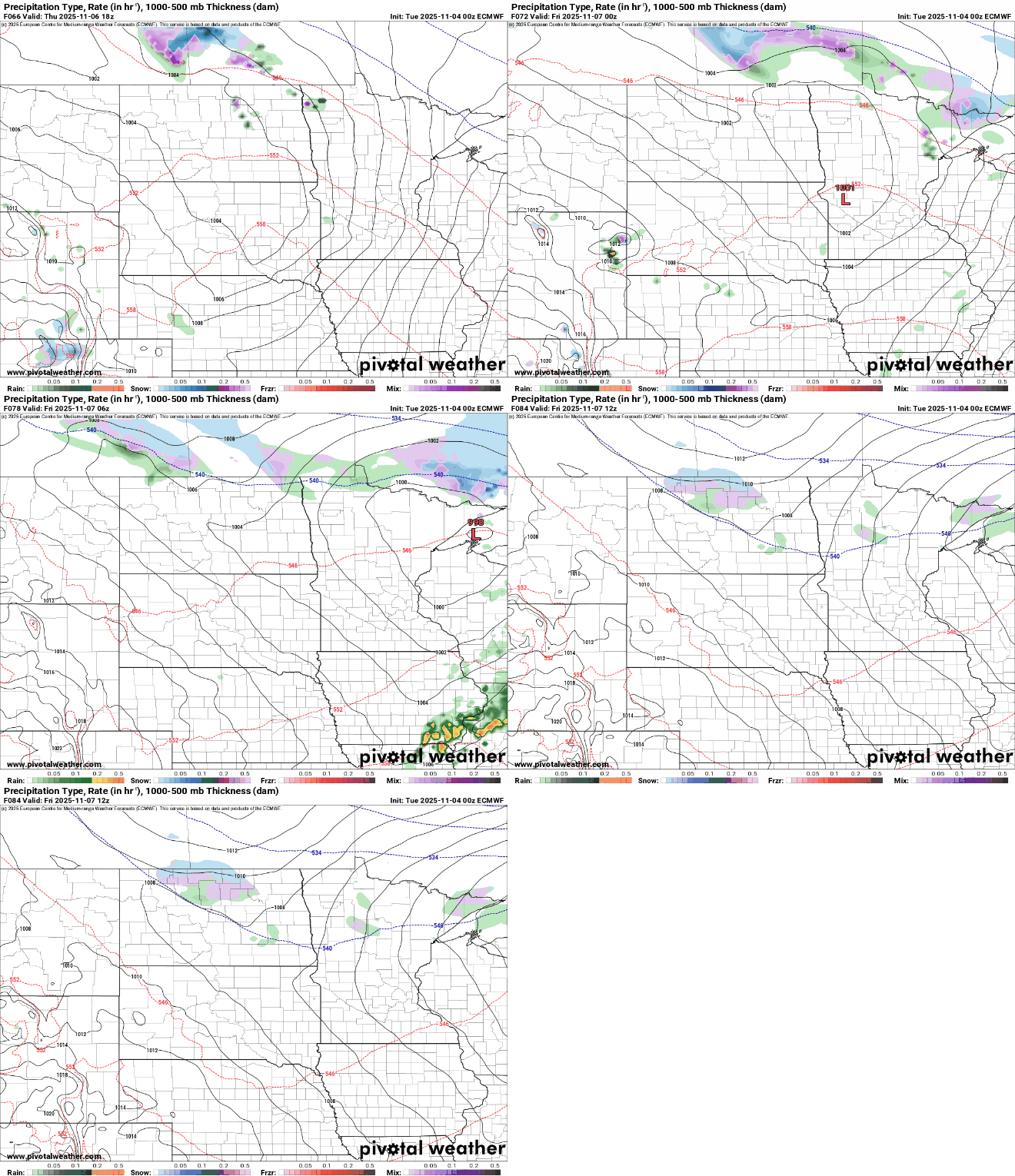
The Thursday system will draw in colder air for Friday and the weekend, setting the stage for a potential mix of rain and snow Saturday into Sunday with our third disturbance of the week moving through.
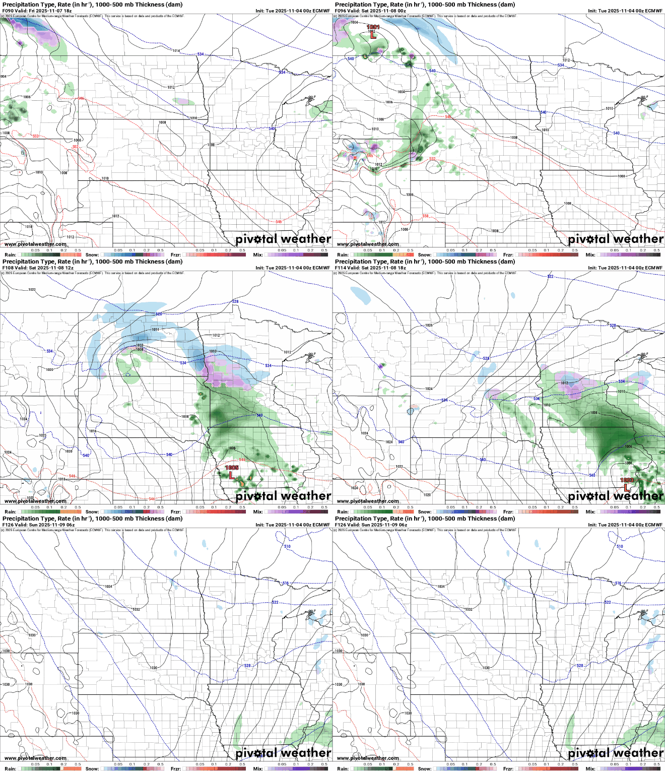
High temperatures both Saturday and Sunday will be in just the 30s, nearly statewide. In fact, Sunday may struggle to get above freezing even in the Twin Cities!

Turn Up Your Support
MPR News helps you turn down the noise and build shared understanding. Turn up your support for this public resource and keep trusted journalism accessible to all.

