
One more mild day with blustery winds before winter weather blows in this weekend
Another clipper brings light rain and snow to northern Minnesota
Go Deeper.
Create an account or log in to save stories.
Like this?
Thanks for liking this story! We have added it to a list of your favorite stories.


Thursday brings one more mild but windy day before a wintry change settles in for the weekend. Another quickly moving clipper system will brush northern Minnesota with light rain and snow.
Mild and breezy with a rain-snow mix north
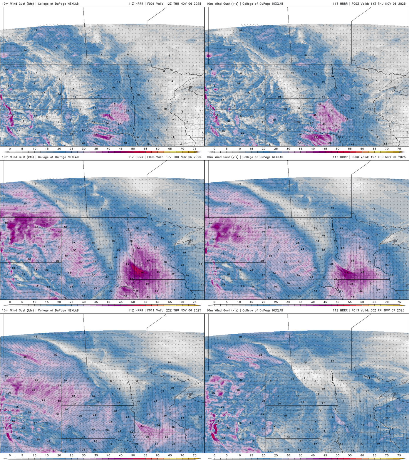
Our clipper train continues to chug along this week, with another fast-moving clipper pushing east from the Dakotas on Thursday. Breezy southerly winds will accompany the system with gusts between 30 and 40 mph, especially across southwestern Minnesota.
Some light precipitation is possible across northern Minnesota, mainly as a rain and snow mix, with very light accumulation expected in the Arrowhead. Farther south, the system may squeeze out a few stray raindrops across eastern Minnesota into western Wisconsin.
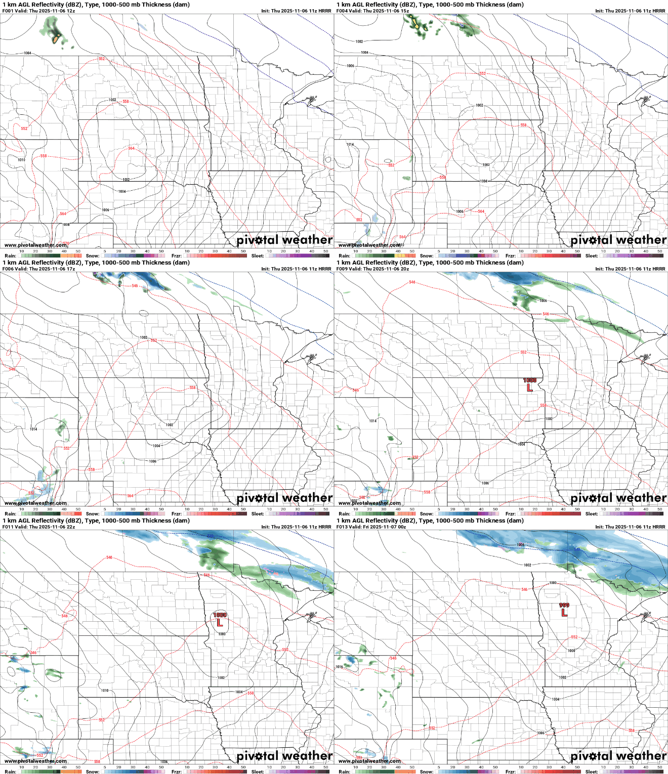
We’ll get one more mild day, with highs reaching the mid-50s in southern Minnesota. Northern Minnesota will be cooler, with highs in the lower to mid-40s due to increased cloud cover and chances for precipitation.
Turn Up Your Support
MPR News helps you turn down the noise and build shared understanding. Turn up your support for this public resource and keep trusted journalism accessible to all.

As the surface low moves east over the Great Lakes on Friday, northwesterly winds will draw in colder Canadian air for the weekend. Highs Friday will return to seasonal levels, reaching the upper 40s in the Twin Cities.

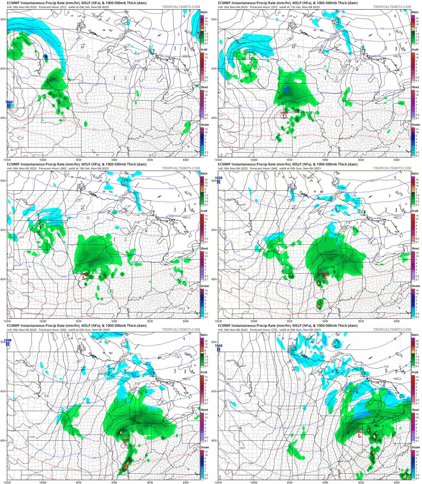
Our latest forecast models suggest our first real taste of winter this weekend.
Another clipper system will track just south of Minnesota, bringing the potential for slushy, accumulating snow to eastern South Dakota, northern Iowa, and parts of southwestern Minnesota.
With surface temperatures still relatively mild, accumulations are expected to be light, around an inch or so.
One thing is certain: It will be a very chilly hunting opener this weekend.


