Late season warmth Friday followed by a cold front this weekend
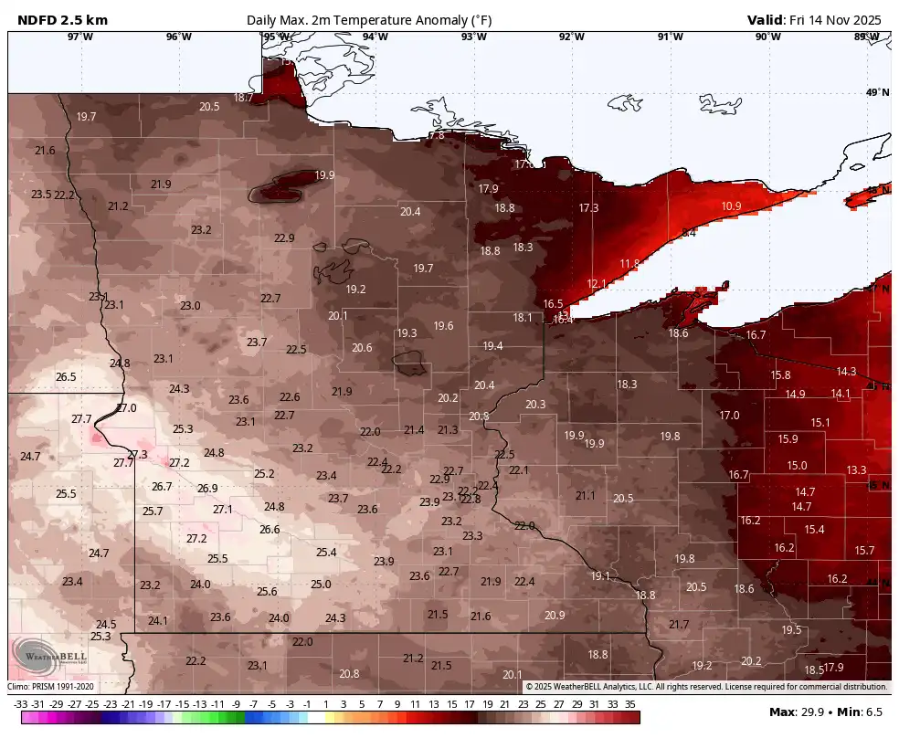
Friday temps 20 to 30 degrees above normal
Go Deeper.
Create an account or log in to save stories.
Like this?
Thanks for liking this story! We have added it to a list of your favorite stories.


Anomalous warmth will peak Friday with highs well into the 60s across southern Minnesota. Some spots in southwestern Minnesota could reach nearly 70 degrees. A cold front moves through early Saturday.
Unusually warm Friday before seasonable temps return
We have a rather warm day on tap across the state for a mid-November Friday. Afternoon highs will be in the low 70s in western Minnesota.
The record high for the date in Marshall is 70 and southwestern Minnesota may be right near that. The record high in the Twin Cities is 71 degrees set in 1990. We’ll likely be just shy of that.

These readings are 20 to 30 degrees above normal for southern Minnesota. On average, the last time we have temperatures in the mid-60s or warmer in the Twin Cities is around Halloween, so these readings are a couple weeks later than normal.
Turn Up Your Support
MPR News helps you turn down the noise and build shared understanding. Turn up your support for this public resource and keep trusted journalism accessible to all.
In fact, only a handful of times have we hit 65 or higher this late or later in the season.
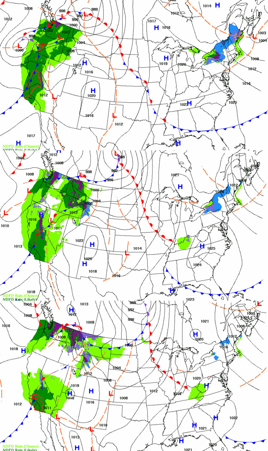
A cold front slides through Friday night into early Saturday, bringing back more seasonable temperatures for Sunday and all of next week.
Unfortunately it will not produce much in the way of rainfall, which is needed especially in north-central Minnesota.
Scattered light rain showers will develop in northwest Minnesota Friday evening into the overnight and as the front drifts south most showers will fizzle out. We may see a few light showers around sunrise early Saturday in the Twin Cities and southern Minnesota.

Highs Saturday will still manage to be the 50s in southern Minnesota with 40s and 30s north. These readings are still 10 degrees above normal in southern Minnesota.

Sunday will be cooler yet with low to mid-40s south and 30s across northern Minnesota. Those temperatures are finally closer to normal but still 2 or 3 degrees above average.

Next week’s temperatures will remain seasonable in the 40s and 30s.
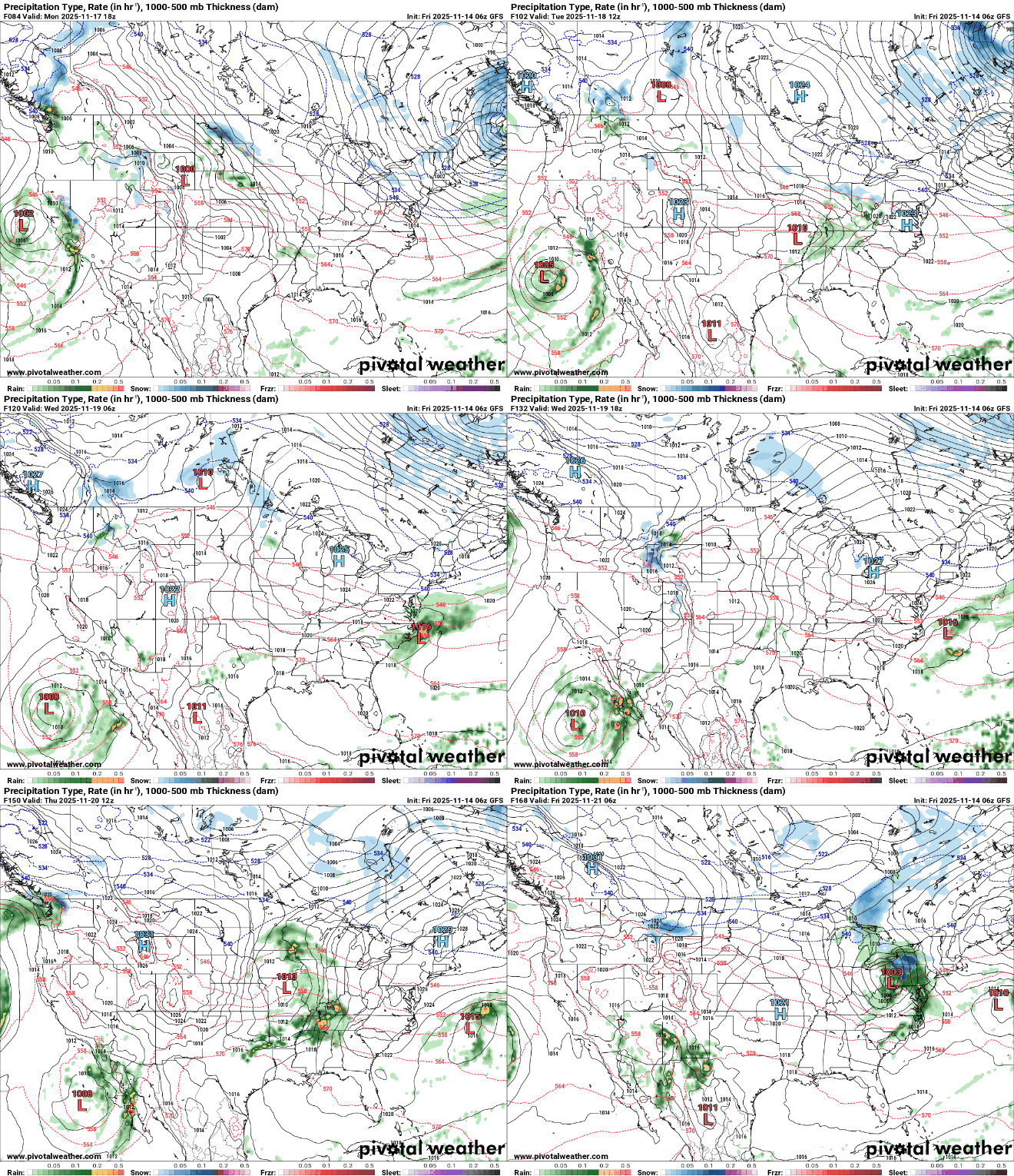
We’re still crossing our fingers to get some moisture, but as of now most systems with any significant precipitation remain mostly south of Minnesota. A couple of systems could graze southern Minnesota late Monday into Tuesday and on Thursday.