
Cold front sweeps in: falling temperatures with blustery northwest winds
From record heat to a 30 degree cooldown
Go Deeper.
Create an account or log in to save stories.
Like this?
Thanks for liking this story! We have added it to a list of your favorite stories.


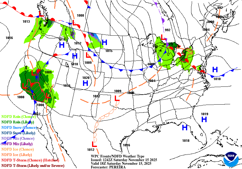
A cold front moved through the area Friday night, ushering in a cooldown that drops today’s highs 20–30 degrees from Friday’s record warmth.
Falling temperatures with gusty northwest winds
After our record-breaking temperatures Friday in the low 70s, Saturday’s temperatures will feel chilly, especially with gusty northwest winds behind a cold front.
Temperatures will gradually fall through the 50s and into the 30s and 40s on Saturday behind the front.
Turn Up Your Support
MPR News helps you turn down the noise and build shared understanding. Turn up your support for this public resource and keep trusted journalism accessible to all.
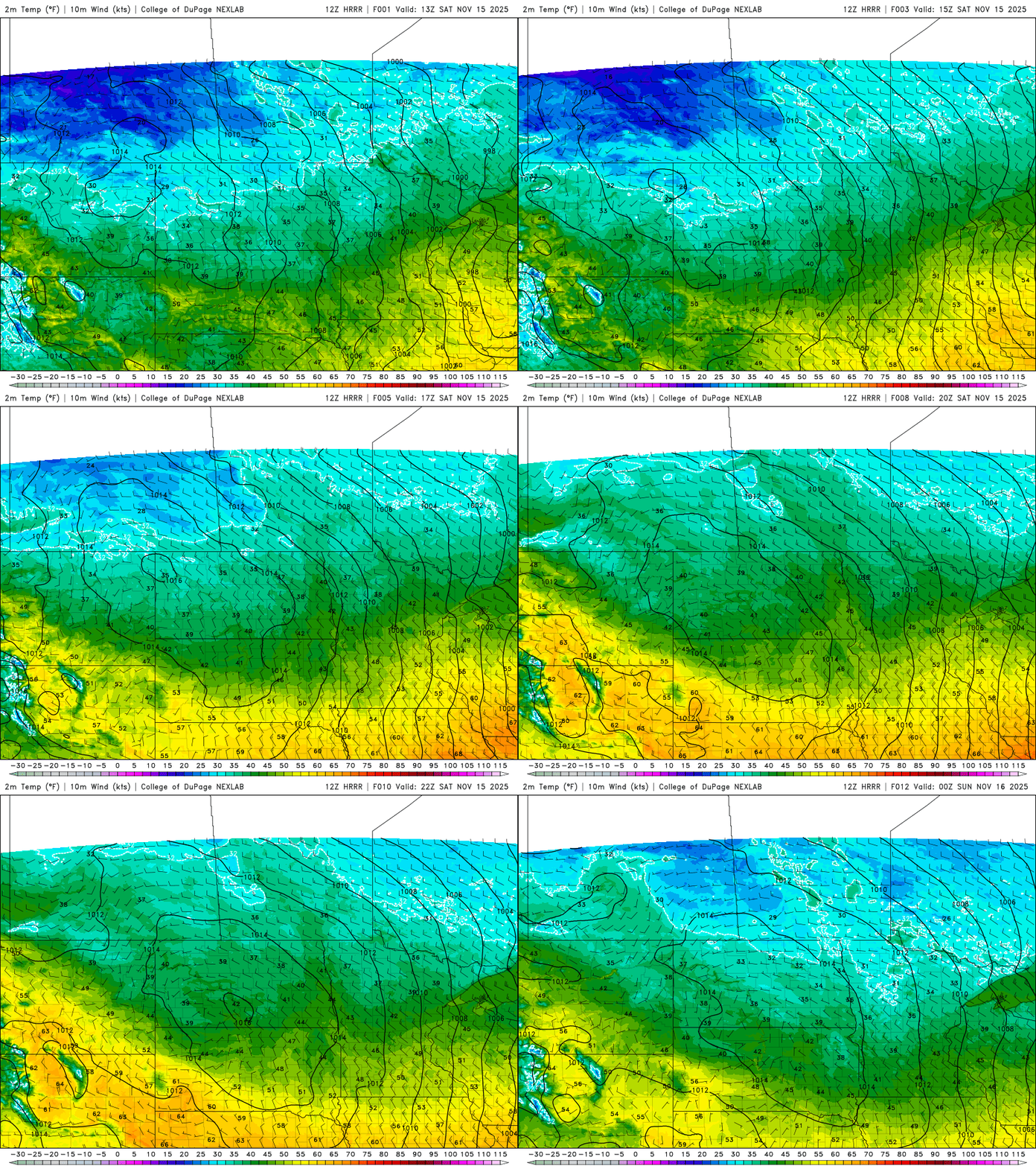
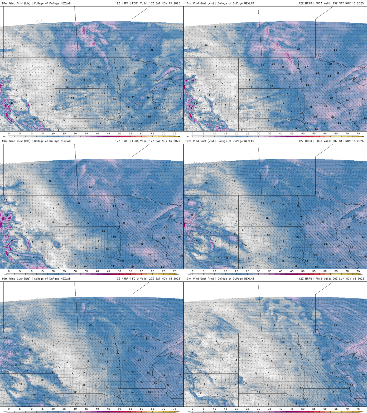
Northwest gusts up to 25–30 mph will add a chill to the day.
Lighter winds and sunshine will dominate Sunday, with seasonal highs in the 30s across northern Minnesota and 40s in the south.

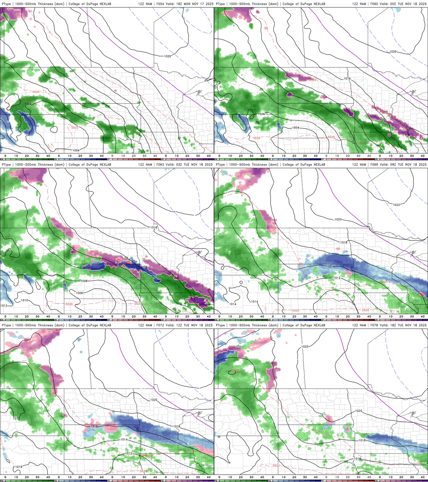
Our next chance for precipitation arrives Monday afternoon into Tuesday morning. The system will mainly impact southern Minnesota, with the potential for light snow totaling less than an inch.
Precipitation may begin as rain as early as Monday afternoon, quickly changing to snow as temperatures fall below freezing after sunset.
Central Minnesota, including the Twin Cities, could see some flurries with this system, depending on how far north the precipitation shield extends.
Temperatures stay seasonal through midweek, with highs in the 30s across northern Minnesota and 40s in the south.

