
Quiet night ahead; comfortable Sunday to follow
Temperatures trending slightly above average

Go Deeper.
Create an account or log in to save stories.
Like this?
Thanks for liking this story! We have added it to a list of your favorite stories.


After winds ease tonight, we head into a quiet and seasonal Sunday, with temperatures trending a bit warmer than what’s typical for mid-November.
Decreasing winds, seasonal lows
Following a warm Friday night, colder air moving in behind the cold front has returned our overnight temperatures to more seasonal values. Expect lows in the lower to mid-20s for northern Minnesota, with upper 20s to just below 32 degrees from the Twin Cities southward.
Our winds will diminish tonight, easing out of the northwest after spending much of Saturday gusting into the 30s.
Turn Up Your Support
MPR News helps you turn down the noise and build shared understanding. Turn up your support for this public resource and keep trusted journalism accessible to all.
Sunday will feature plenty of sunshine and much calmer winds. Temperatures will warm into the mid to upper 30s across northern Minnesota and into the mid-40s to the south. The Twin Cities could reach the upper 40s, with some lower 50s possible in southwestern Minnesota.

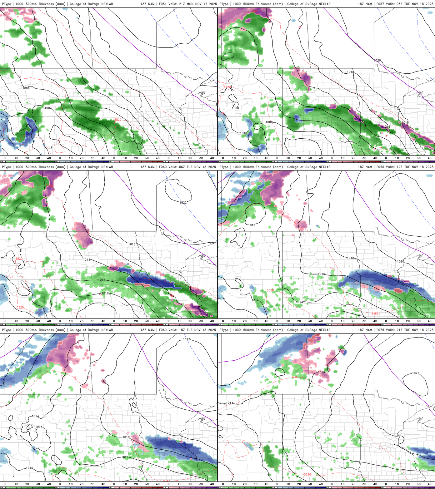
Our next weather system begins organizing over the Upper Midwest on Monday afternoon, bringing a band of light precipitation primarily to southern Minnesota.
Precipitation type remains uncertain, but a slushy inch is possible on roadways by early Tuesday morning. At this point, areas south of Interstate 94 hold the highest chance for light precipitation.
Temperatures will remain slightly above to near average through the week, with highs generally in the 30s and 40s.


