
Complex early-week system with tight rain and snow cutoff
Seasonal temperatures through the work week

Go Deeper.
Create an account or log in to save stories.
Like this?
Thanks for liking this story! We have added it to a list of your favorite stories.


An early-week system is expected to bring a mix of rain and snow, with a very tight cutoff that may lead to big differences over short distances. Behind it, overall dry and seasonable weather will take shape for the remainder of the week.
Wintry mix possible Monday night
A more complicated forecast begins for Monday and Tuesday, involving both rain and snow. A weather disturbance will move into the Central Plains on Monday and into the mid-Mississippi Valley for Tuesday.
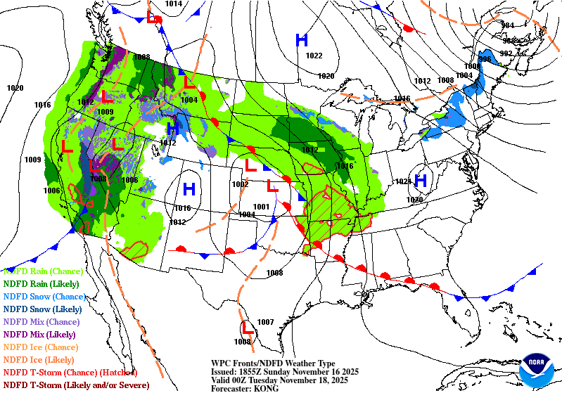
Precipitation from this system will gradually move north into southwestern Minnesota late Monday afternoon, then spread into southern and central Minnesota by Monday night. A sharp cutoff is likely along the northern edge of the precipitation, and this boundary could pass directly through the Twin Cities.
Turn Up Your Support
MPR News helps you turn down the noise and build shared understanding. Turn up your support for this public resource and keep trusted journalism accessible to all.
Latest models indicate a heavier band of snow developing along the Minnesota River Valley into southeastern Minnesota Monday night. Precipitation may start as rain, but cooling after sunset will allow a wintry mix to develop.
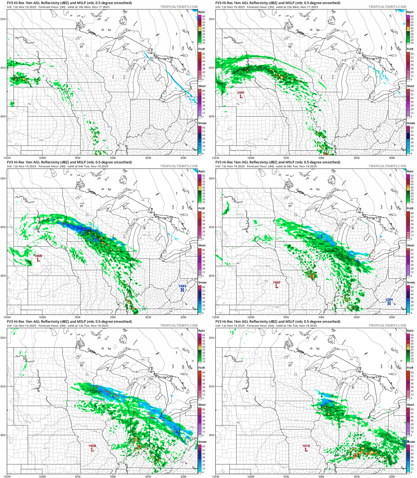
The complexity of this system makes exact snowfall amounts difficult to determine, but with 0.25 to nearly an inch of precipitation to work with, some locations could still see several inches of wet, slushy snow.
Sunday night temperatures will fall into the upper teens across the Arrowhead, the low 20s in northern Minnesota, and the upper 20s to mid-30s farther south. Southwestern Minnesota will remain slightly milder, with increasing high clouds moving in.

Highs on Monday will reach the upper 30s to low 40s in central and northern Minnesota, while southwestern areas can expect temperatures in the upper 40s to around 50 degrees.

After the system moves out early Tuesday, dry and seasonal weather returns, with highs in the 30s and 40s.
Thursday brings a brief warm-up, with temperatures climbing into the upper 40s and low 50s as a major precipitation system stays to our south.

