
Winter storm warnings up north; advisories expanded into Twin Cities
Heavy snow, falling temperatures, gusty winds to hit before Thanksgiving
Go Deeper.
Create an account or log in to save stories.
Like this?
Thanks for liking this story! We have added it to a list of your favorite stories.


Minnesotans are gearing up for a messy pre-holiday system as storm warnings blanket the north while the Twin Cities falls under a winter weather advisory.
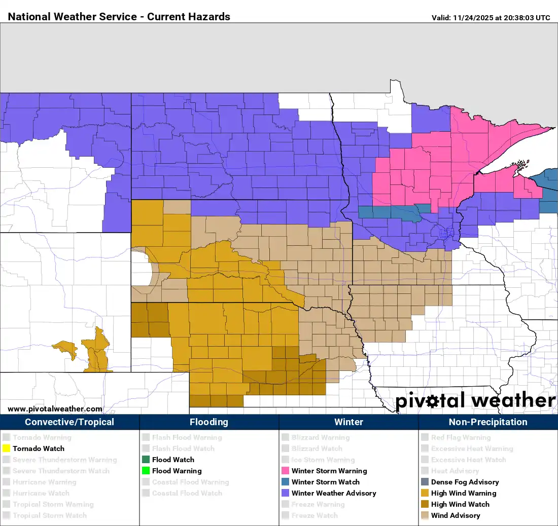
Winter storm warnings and advisories
A powerful winter storm is heading right for Minnesota during the busy holiday week, bringing a mix of warnings up north and winter weather advisories across the metro.
The National Weather Service has upgraded much of northern Minnesota to a winter storm warning, stretching from Becker, Otter Tail, and Douglas counties eastward through Pine and Carlton counties and points north.
The northwestern corner of the state and southern Minnesota are the only areas outside the warning area for now.
Turn Up Your Support
MPR News helps you turn down the noise and build shared understanding. Turn up your support for this public resource and keep trusted journalism accessible to all.
The system will bring a mix of rain and heavy snow showers to the region. Central Minnesota including the Twin Cities will start with mostly rain Tuesday morning, while snow begins in northwestern Minnesota as early as the morning hours.
By Tuesday afternoon, the system will bring in a much colder air mass and rain showers will transition to all snow for areas from St. Cloud south.
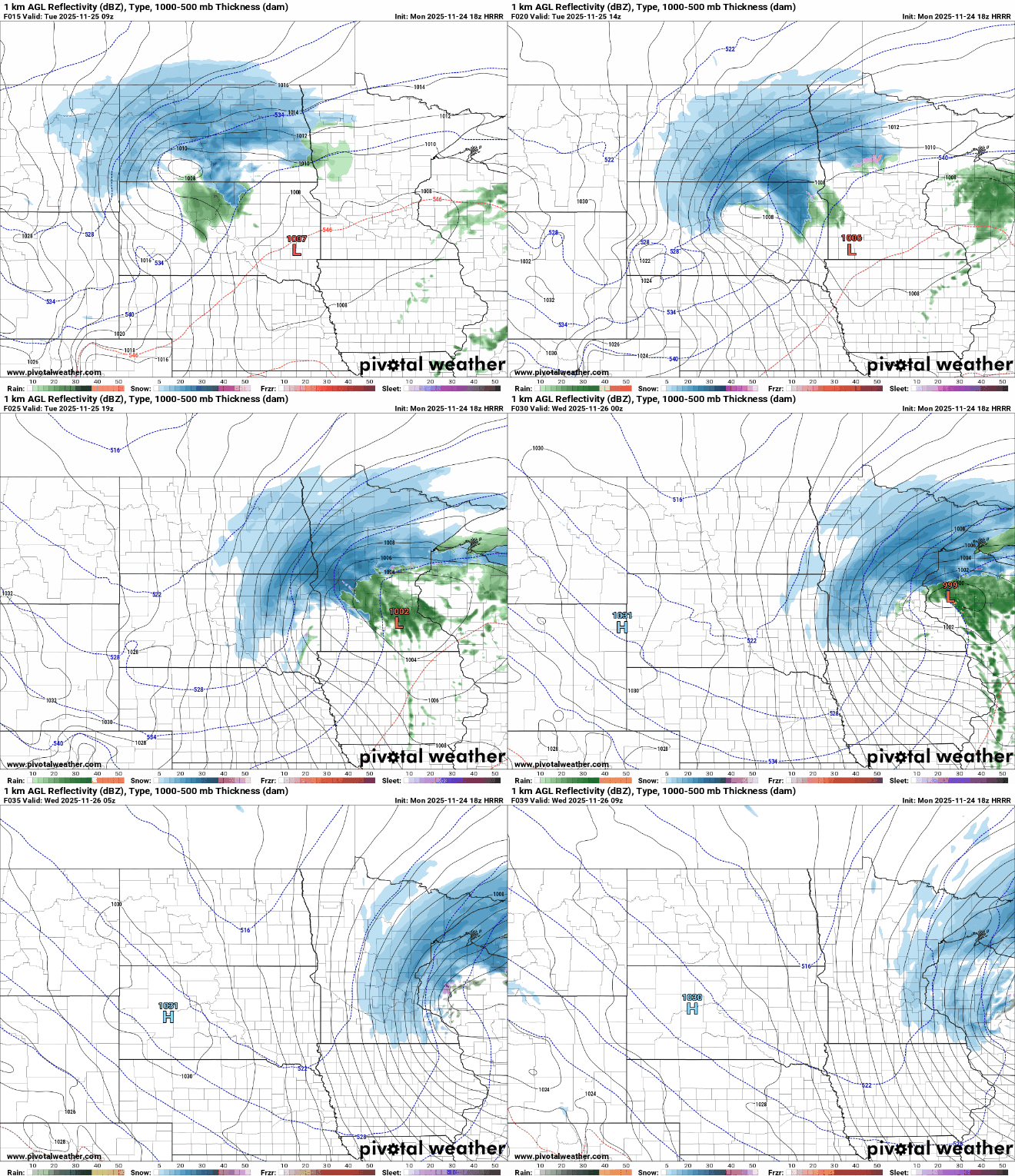
This complex system will produce widely varying snowfall totals, from just a couple of inches from Benson and Willmar east toward the Twin Cities to much heavier amounts along the North Shore.
Duluth is forecast to receive 7 to 11 inches, with 7 to 15 inches possible around the Grand Marais area.
A narrow swath of heavy snow is expected to fall Tuesday night after dark until around midnight Wednesday, tapering off by Wednesday morning.
The heaviest snow band could fall from Moorhead to Bemidji, Brainerd, Grand Rapids and up through the Arrowhead. Snowfall rates of 1 to 2 inches an hour will be possible during the peak of the storm.


