
Winter storm watch, cold air move in after mild Monday
Much colder by Thanksgiving and through next weekend

Go Deeper.
Create an account or log in to save stories.
Like this?
Thanks for liking this story! We have added it to a list of your favorite stories.


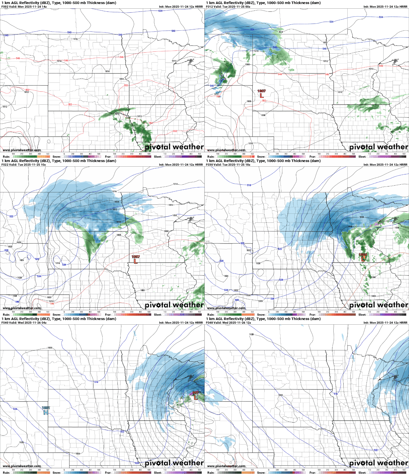
Monday will still be mild but clouds will thicken and showers will develop south late in the day. Snow is expected to develop north into Tuesday and early Wednesday, followed by cold air.
Rain south, snow north developing late Monday
We have one last mild day before the other shoe drops this week. Highs will be near 50 in southern Minnesota to near 40 north. Clouds will increase and thicken up throughout the day Monday.

Rain showers will develop in southern Minnesota late in the day Monday while snow showers will creep into northern Minnesota overnight into Tuesday.
Snow showers will expand across northern Minnesota Tuesday into early Wednesday with rain turning to snow south Tuesday evening.
Turn Up Your Support
MPR News helps you turn down the noise and build shared understanding. Turn up your support for this public resource and keep trusted journalism accessible to all.
A winter storm watch is posted for most of northern Minnesota Tuesday and Wednesday. A winter storm watch is issued when several inches of snowfall and other wintry weather are possible within a 48 hour window.
The Twin Cities is not included in the winter storm watch.
Northern Minnesota will see significant snowfall totals of up to 6 inches or more in some places. We can expect a coating to near 1 to 2 inches in southern Minnesota Tuesday night into Wednesday.

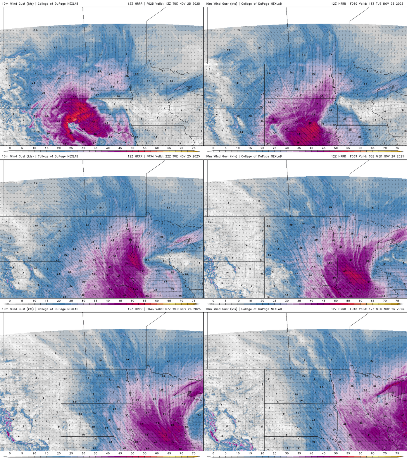
In addition to the rain and snow, winds will start to increase Tuesday in western Minnesota and we’ll all deal with blustery winds late Tuesday into Wednesday as cold air settles in.
On the map below, take a look at the temperatures early Monday morning. It was subzero in parts of the Yukon territory. This is the cold air mass headed our way by mid to late week.

Temperatures will be much colder for the rest of the week after Tuesday. Thanksgiving highs will be subfreezing and we stay below freezing statewide into the weekend and next week.

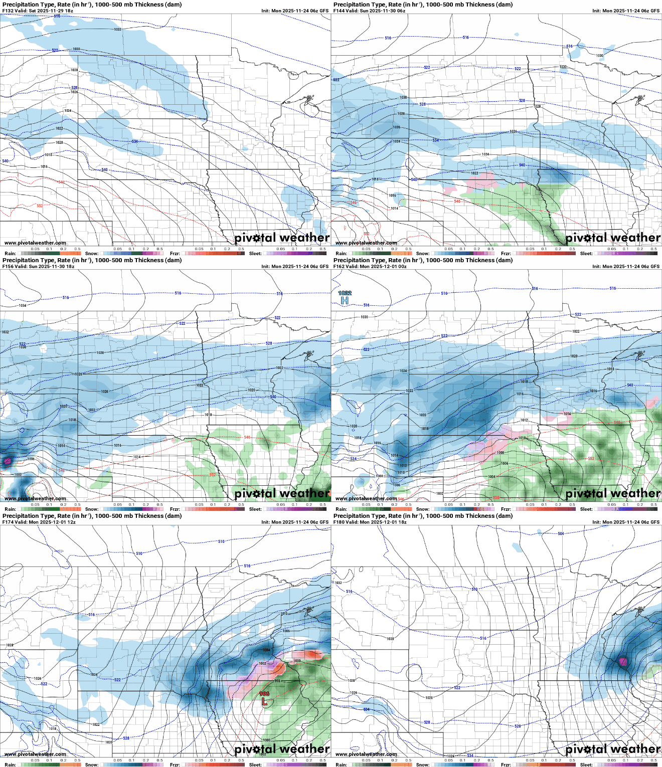
There’s the potential for more wintry weather this weekend that we’re monitoring. The forecast models are all over the place for the storm’s track which will depend on where the coldest air settles in. The storm may stay south if we’re too cold.
What is more certain is that the cold air is sticking around. After temperatures drop below freezing Tuesday evening we stay there for the forecastable future.


