
Minnesota weather: Winter storm set to bring heavy snow, deteriorating conditions
Blizzard conditions in western Minnesota

Go Deeper.
Create an account or log in to save stories.
Like this?
Thanks for liking this story! We have added it to a list of your favorite stories.


Our first winter storm of the season is here, bringing rapidly deteriorating conditions, heavy snow and blizzard conditions.
Transition from rain to snow
Ahead of the storm’s arrival, much of southern and central Minnesota has been dealing with rain and thick fog. But as our temperatures fall through Tuesday evening, that precipitation will transition to snow with the heaviest bands expected to develop overnight into Wednesday.
Steady snow showers have fallen farther north and west since Tuesday morning, resulting in slushy accumulations on grassy surfaces and the first signs of coated roads.

The Twin Cities is forecast to receive moderate to heavy snowfall sometime between 7 p.m. and 10 p.m., with several inches likely by Wednesday morning. Totals of 4 to 6 inches are expected in the north metro, while areas in the south metro may see lighter amounts.
The heaviest snow band continues to trend from Fergus Falls through Brainerd and Duluth and into the Arrowhead region.
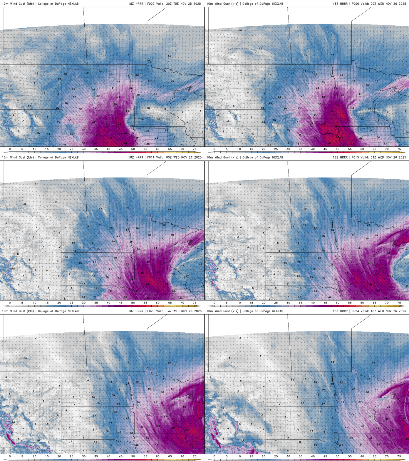
Blizzard conditions will create travel hazards across western and southern Minnesota, where winds will gust over 50 mph. This will cause blowing snow and reduce driving visibility.
Turn Up Your Support
MPR News helps you turn down the noise and build shared understanding. Turn up your support for this public resource and keep trusted journalism accessible to all.

