
Snow showers taper off through Wednesday morning, gusty winds continue
Cold but dry for Thanksgiving
Go Deeper.
Create an account or log in to save stories.
Like this?
Thanks for liking this story! We have added it to a list of your favorite stories.


The season’s first winter storm is nearly behind us. Snow showers taper off quickly early to midmorning but blustery winds continue. Cold air settles in and sticks around.
Snow showers taper off early but gusty winds continue
The first winter storm of the season is nearly in the rearview mirror. Winter storm warnings expire midmorning across eastern Minnesota. Winter weather advisories continue in southeastern Minnesota into midafternoon.
Winter storm warnings continue all day for the North Shore.
We picked up some hefty snowfall totals around the Duluth area. Duluth picked up 10.3 inches with 8.3 inches in Moose Lake.
Turn Up Your Support
MPR News helps you turn down the noise and build shared understanding. Turn up your support for this public resource and keep trusted journalism accessible to all.

The Twin Cities officially picked up 3.1 inches at Minneapolis-St. Paul International Airport. Most metro locations ranged from 1 to 4 inches with closer to 5 in some northern suburbs.

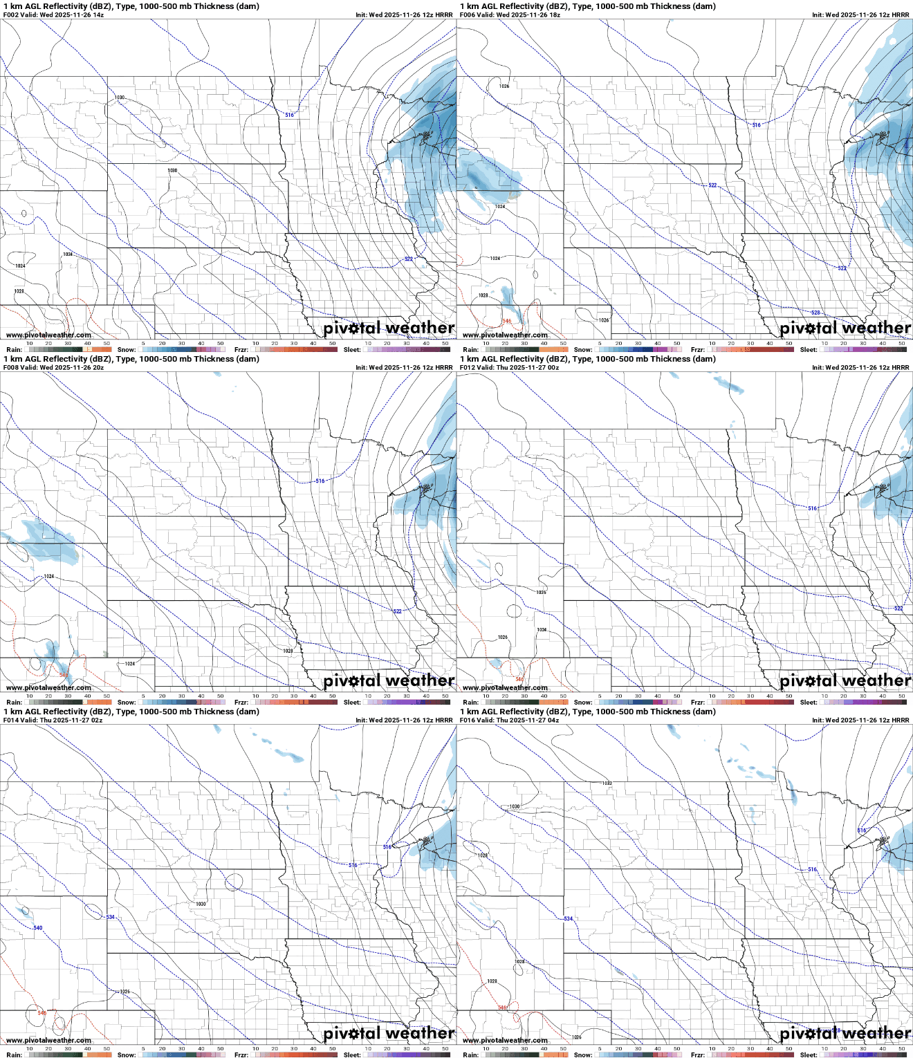
Snow showers will track east and dissipate through the early to midmorning hours across eastern Minnesota into Wisconsin.
Any additional snowfall will be fairly minor, mostly be confined to northeastern and southeastern Minnesota into western Wisconsin.

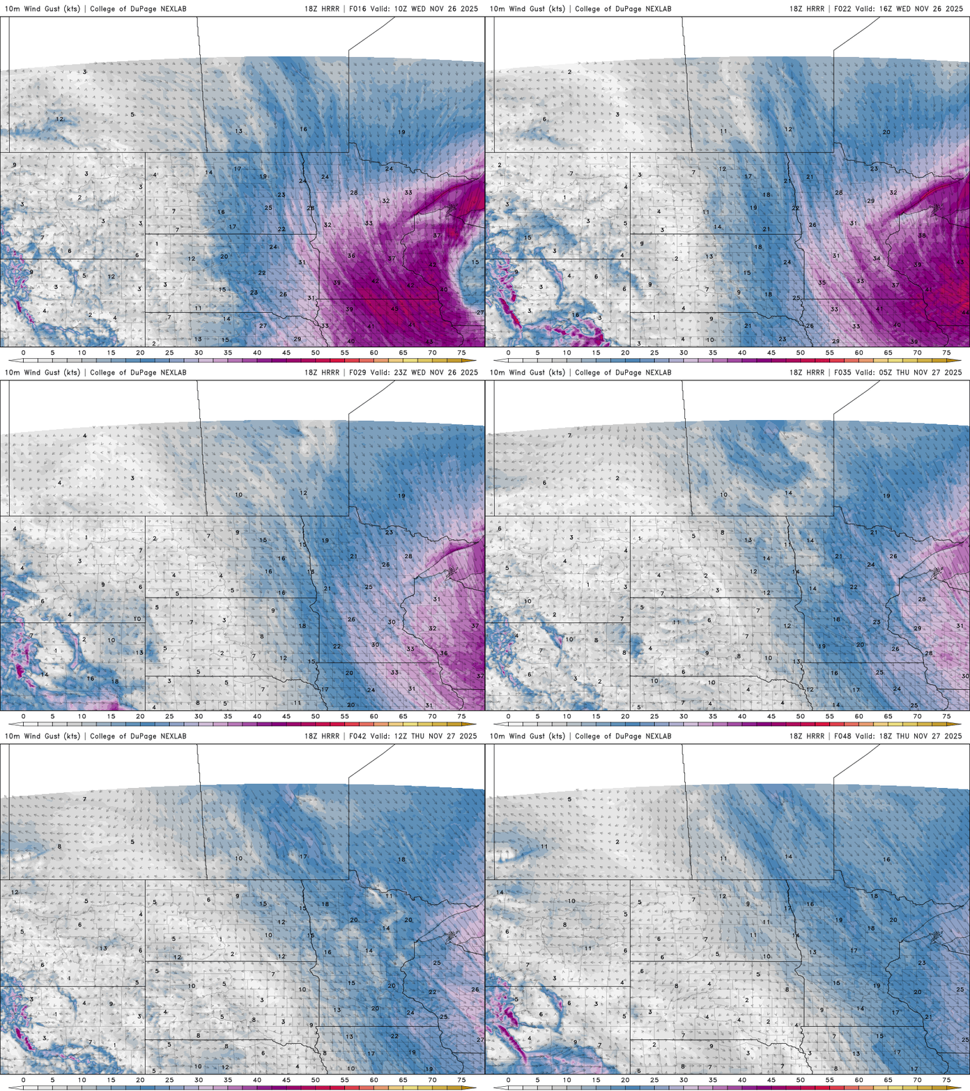
Gusty winds will continue out of the northwest at 15 to 30 mph with gusts as high as 40 mph for some in far southern and southwestern Minnesota. Winds will still be breezy Thursday but not nearly as strong.
Highs Wednesday will be subfreezing statewide. With the winds, it will feel like it’s in the teens and even single digits for some.

Overnight lows will be in the teens mostly and Thanksgiving will see highs mostly in the 20s. The cold air sticks around through the weekend and we’re watching a potential system that may bring some snow to southern Minnesota Saturday.
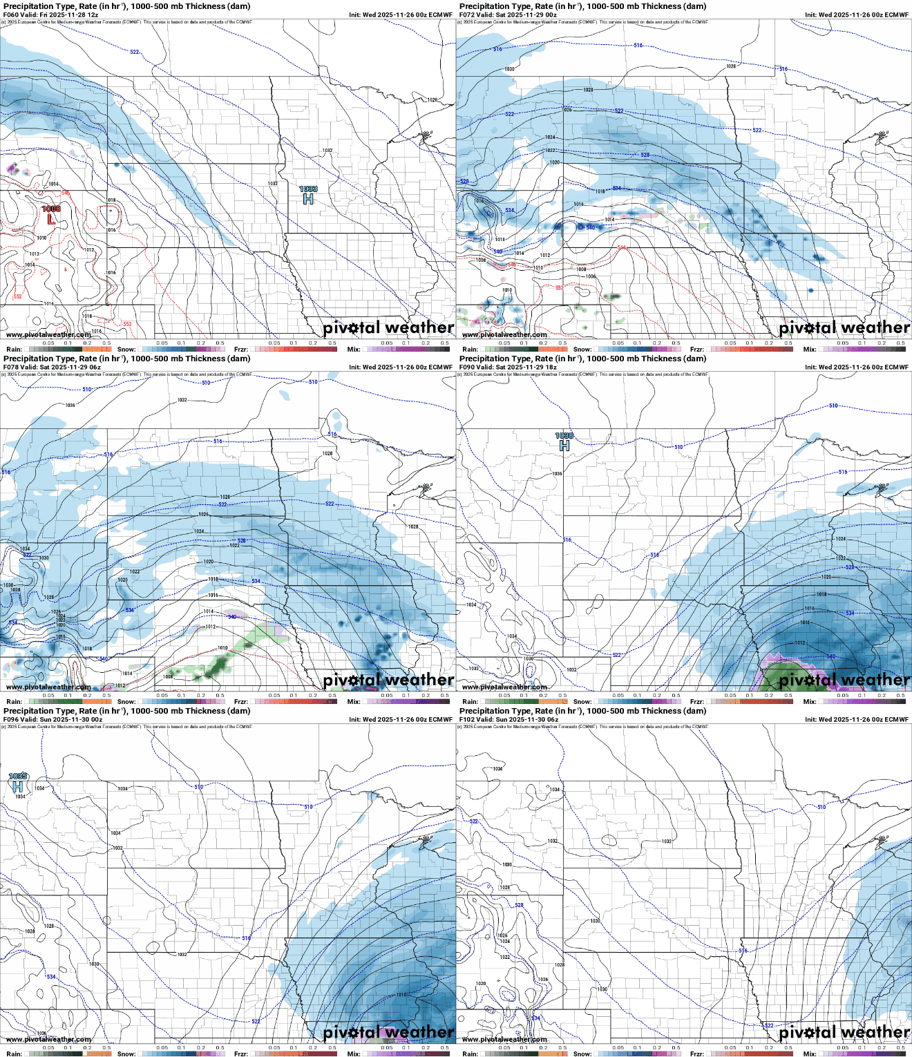
Southern Minnesota could be in for additional snowfall accumulations. Most forecast models keep the heaviest snow in Iowa, southern Wisconsin and Illinois but at least a few inches could fall in southern Minnesota Friday night into Saturday and Saturday night.

Behind that system, even colder air moves in. We could see subzero lows across much of Minnesota early Monday morning with highs only in the teens Monday afternoon.


