
Snowstorm sequel: Heavy snow and difficult travel expected again
Southern Minnesota likely to bear the brunt of the storm's snowfall

Go Deeper.
Create an account or log in to save stories.
Like this?
Thanks for liking this story! We have added it to a list of your favorite stories.


A post-Thanksgiving snowstorm is set to move in just as one of the busiest travel weekends of the year continues. Heavy snow and plunging temperatures will cause some travel disruptions and post-holiday headaches.
Here we go again
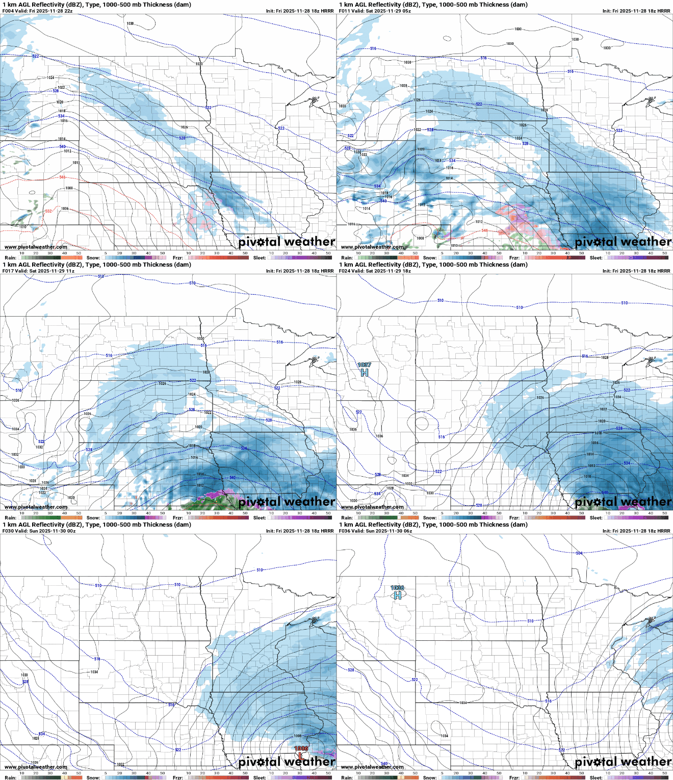
Round two of winter storms is pushing out of the Rockies into the Central Plains, with its unfortunate timing for holiday travel. A slow-moving low-pressure system will move just to our south on Saturday, bringing heavy, accumulating snowfall and a secondary blast of cold air.

Snowfall totals are expected to be heaviest in southern Minnesota, tapering off as you head north. Southern counties could see a widespread 6 to 10+ inches, from Fairmont to Mankato, Albert Lea, and Rochester, extending into western Wisconsin. The Twin Cities area will see varying amounts, with the southern metro forecasted for 3 to 5 inches, and northern and central parts of the metro receiving 2 to 4 inches.
Turn Up Your Support
MPR News helps you turn down the noise and build shared understanding. Turn up your support for this public resource and keep trusted journalism accessible to all.
Once again, the cutoff for snow totals will be abrupt. Areas north of St. Cloud may see only a dusting, while west-central to central Minnesota could receive 1 to 5 inches.
Winter weather advisories and winter storm warnings will go into effect at 6 p.m. Friday and remain in place until midnight Saturday night.

Winds won’t be as strong with this system but are expected to reach 10 to 15 mph, which may cause some blowing and drifting snow, especially in rural areas.
Snow will gradually spread eastward Friday night, with central Minnesota and the Twin Cities seeing a light coating by Saturday morning, and southern areas possibly picking up 1 to 4 inches of accumulation.
A brief lull in the snowfall is expected early Saturday, before another wave of snow moves in late Saturday morning.
Temperatures will once again take a dive with a secondary shot of cold Canadian air, with highs in the teens and lows in the single digits above and below zero.

Sunday and Monday morning will be particularly chilly, with wind chill temperatures in the single digits below zero.


