
Chilly start, warmer finish; snow chances ahead
Another clipper brings snow chances into Friday afternoon
Go Deeper.
Create an account or log in to save stories.
Like this?
Thanks for liking this story! We have added it to a list of your favorite stories.


After a brisk start Thursday, milder air arrives Thursday night ahead of light snow from a fast-moving Friday clipper that could drop several inches across central Minnesota.
Bitter start, warming temperatures
A brief but brisk shock to the system hit Thursday morning as temperatures fell into the single digits below zero with wind chills in the teens to 20s below.

Temperatures will climb gradually during the evening. We'll hit Thursday's daily high at 11 p.m.
Temperatures will continue to warm into Friday with highs in the teens across the north, the 20s through central Minnesota and even some 30s in the southwest.
Turn Up Your Support
MPR News helps you turn down the noise and build shared understanding. Turn up your support for this public resource and keep trusted journalism accessible to all.

It’s been a cold couple of weeks as Twin Cities temperatures have steadily dropped from the mild 40s and 50s before Thanksgiving to the teens and 20s. Friday’s highs will feel relatively mild compared with that recent trend.

Light snow is possible Thursday night across the Arrowhead and along the international border with accumulations of one-half inch to 1 to 2 inches near Sea Gull Lake, Grand Marais and Grand Portage.

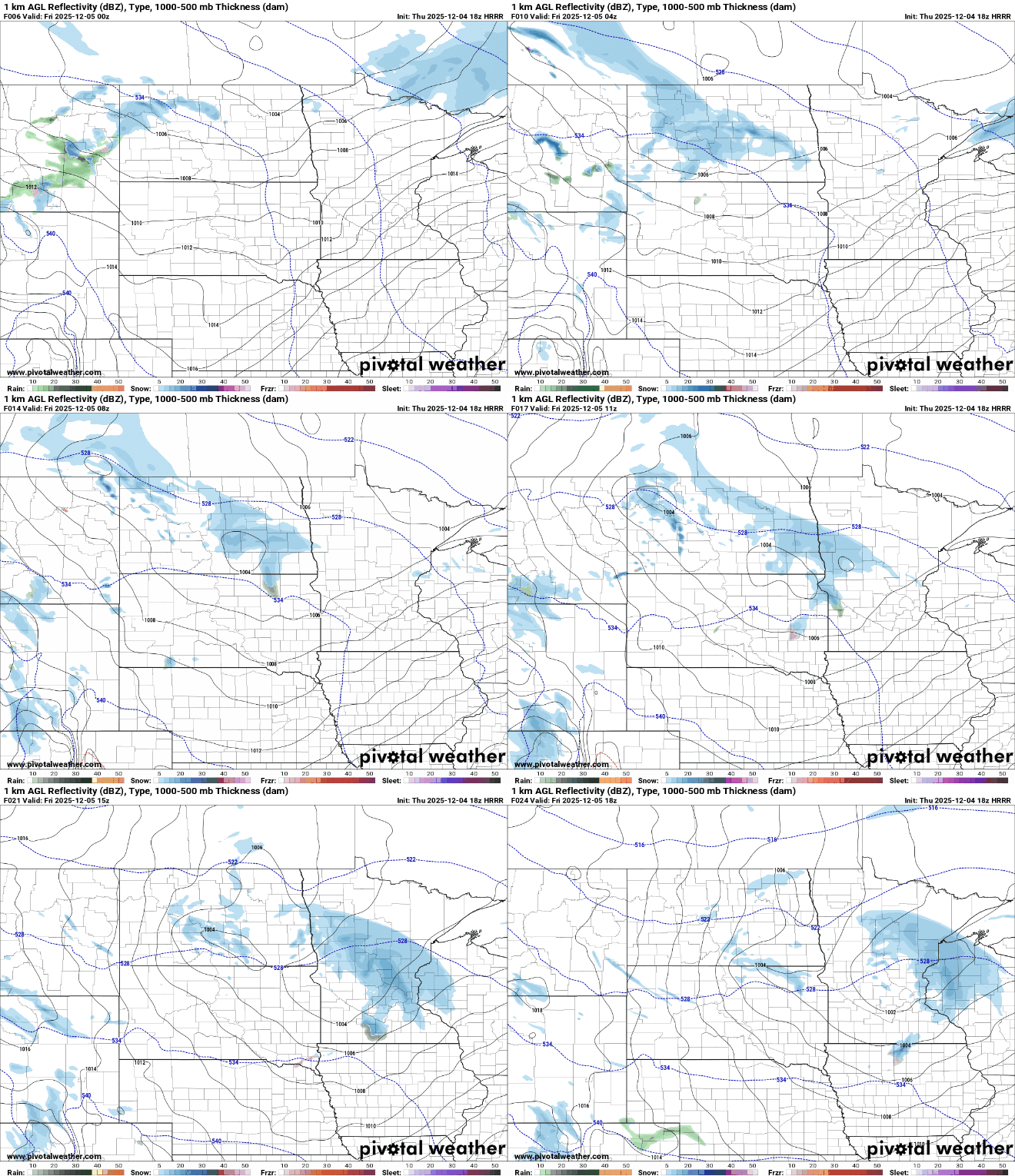
Another clipper system will bring a brief chance of light snow starting in west-central Minnesota by Friday morning and moving east-southeast into the Twin Cities and western Wisconsin by late morning.
Friday’s fast-moving system could bring 1 to 3 inches of snow, mainly along and north of Interstate 94 with precipitation ending by Friday afternoon.

Our active weather pattern continues with another system expected to bring accumulating snow to southwestern Minnesota and northern Iowa Saturday into Saturday night.
This system appears somewhat stronger and could produce several inches of snow, along with falling temperatures.

As Canadian high pressure returns Sunday and Monday, temperatures are expected to drop once again into the single and double digits below zero.

Forecast trends show temperatures gradually returning to seasonal norms, which are in the low 30s by Tuesday.

