
Twin Cities on edge of heavy snow zone as winter storm moves in
Heavy snow and 50 mph winds likely
Go Deeper.
Create an account or log in to save stories.
Like this?
Thanks for liking this story! We have added it to a list of your favorite stories.


A fast-moving winter storm is expected to brush the Twin Cities on Tuesday, putting the metro area on the edge of a narrow band of heavier snow sweeping across central Minnesota. Milder temperatures ahead of the system are expected to complicate the forecast.
Strong clipper brings heavy snow for Tuesday
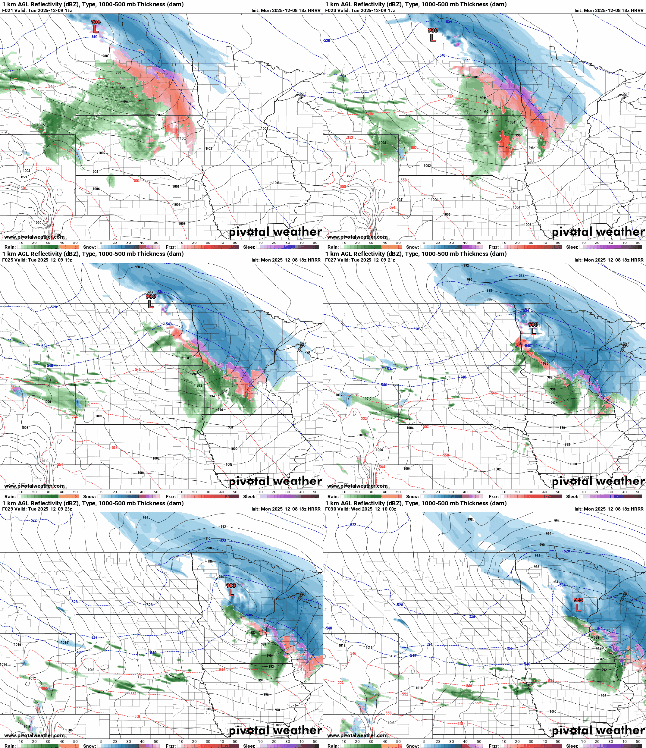
An intense band of snow is expected to sweep across central and eastern Minnesota and western Wisconsin Tuesday afternoon and evening. Warmer temperatures will create a very tight snowfall gradient near the rain–snow line, making snow totals highly variable over very short distances.
Forecast high temperatures on Tuesday are expected to reach the upper 30s to around 40 degrees in southwestern Minnesota, while areas just south of Interstate 94 will see highs near the freezing mark.
Milder temperatures will complicate snowfall totals with some areas receiving mostly rain while nearby cities could see multiple inches of moderate to heavy snow.
Turn Up Your Support
MPR News helps you turn down the noise and build shared understanding. Turn up your support for this public resource and keep trusted journalism accessible to all.

As of Monday afternoon, winter storm watches have been issued from Tuesday afternoon to Tuesday night across northwestern Minnesota along and north of Interstate 94, including the northeastern sections of the Twin Cities.
By Monday evening, the watches are expected to be upgraded to winter storm warnings as the system moves closer.

The latest forecast models show the most intense snow band extending from Detroit Lakes through Little Falls, Brainerd and the northeastern Twin Cities.
But even small shifts in the storm’s track could produce large swings in snowfall totals, particularly in the transition zone near the rain–snow line. A narrow band of 3-6 inches of snowfall is not out of the question when it comes to this system.
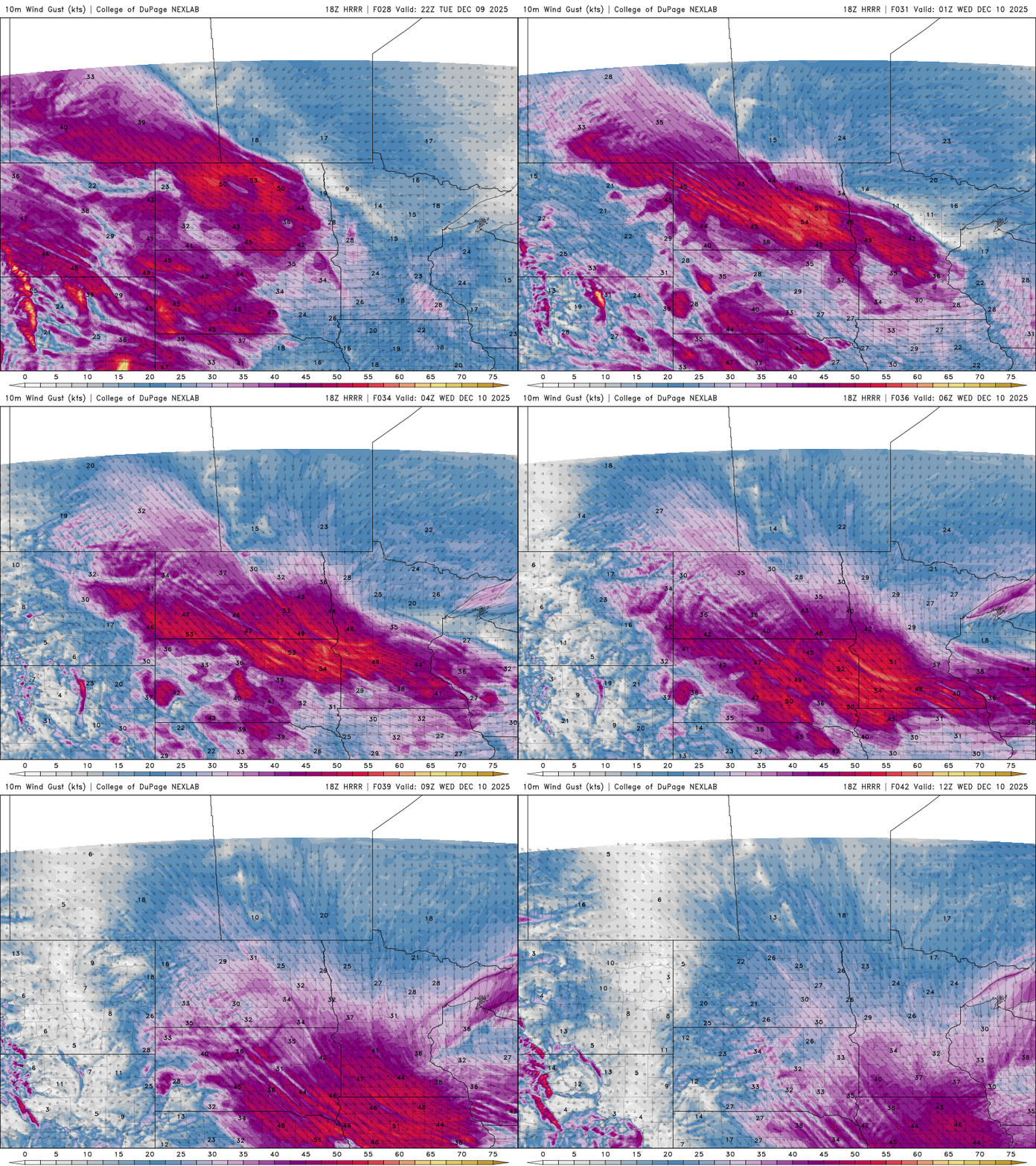
Strong west-northwest winds are expected to develop Tuesday evening across west-central and south-central Minnesota, with gusts up to 50 mph possible. The strongest winds are likely to remain west of the areas receiving the heaviest snowfall.
More changes to the forecast are likely as the storm evolves. We will continue to monitor the system closely and provide updates as needed.

