
Latest winter storm to bring a wintry mix and heavy snow to Minnesota
Colder air moves in later this week
Go Deeper.
Create an account or log in to save stories.
Like this?
Thanks for liking this story! We have added it to a list of your favorite stories.


Our latest winter storm system will bring a mix of precipitation to southern Minnesota with heavy snow in central and northern parts of the state. Colder air follows later in the week.
Winter storm to bring precipitation, heavy snow mix
Warmer air is pushing high temperatures to near freezing or above for southern Minnesota Tuesday with colder air north. The milder air will be a factor in our latest storm system.

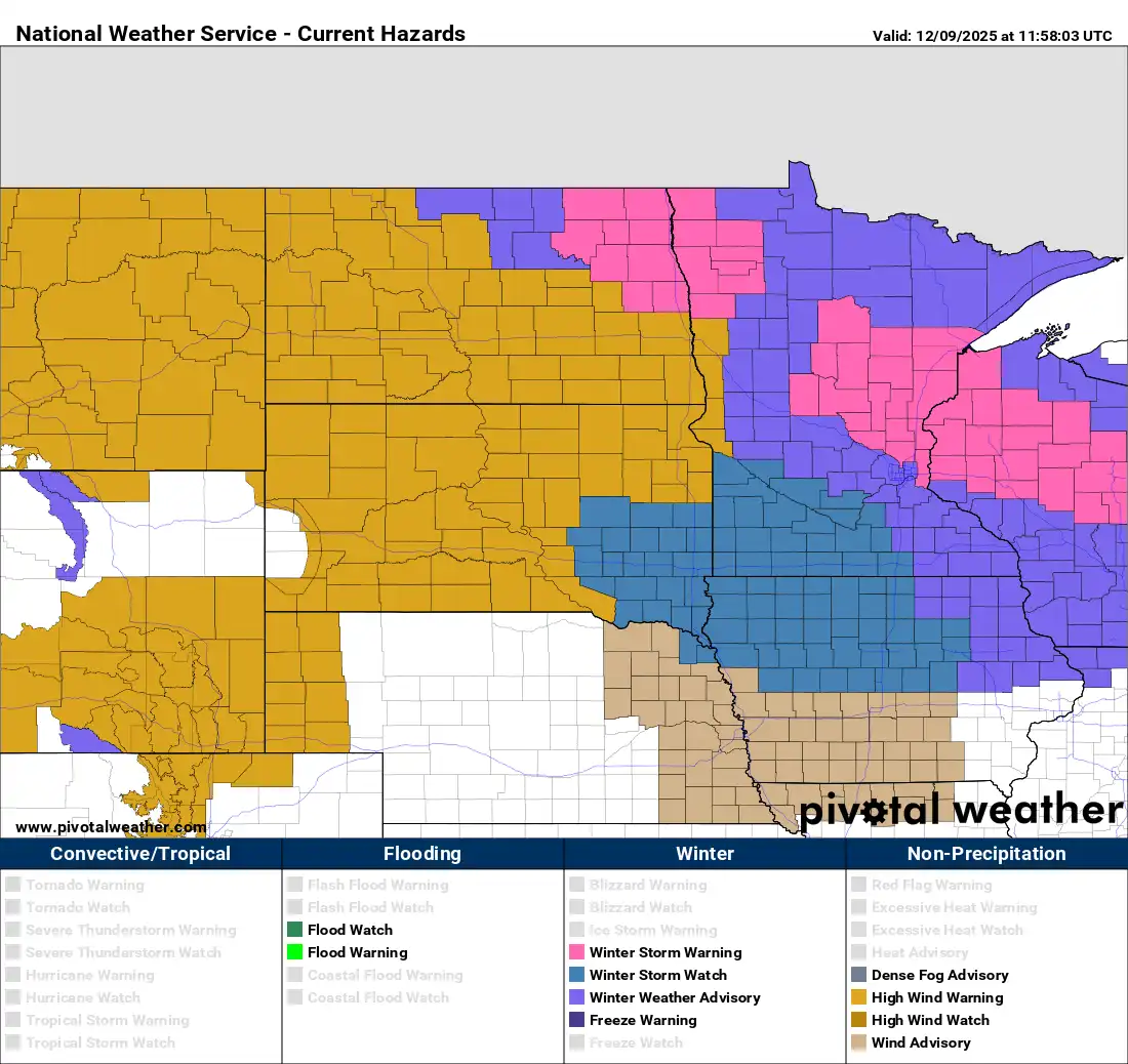
A winter storm warning is posted for much of central Minnesota Tuesday afternoon into Tuesday night with winter weather advisories for much of the rest of the state.
We’ll see a likely mix of precipitation types in southern Minnesota with heavy snow central and north into western Wisconsin.
Turn Up Your Support
MPR News helps you turn down the noise and build shared understanding. Turn up your support for this public resource and keep trusted journalism accessible to all.
A wintry mix of snow, freezing rain and sleet will develop in western Minnesota through the mid to late morning hours Tuesday, reaching the Twin Cities area by midday.
We’ll likely see a mixture of rain, freezing rain, sleet and snow across portions of southern Minnesota for a time. That will complicate the forecast for snowfall in those areas. Most of the precipitation wraps up midevening with lingering snow showers overnight.
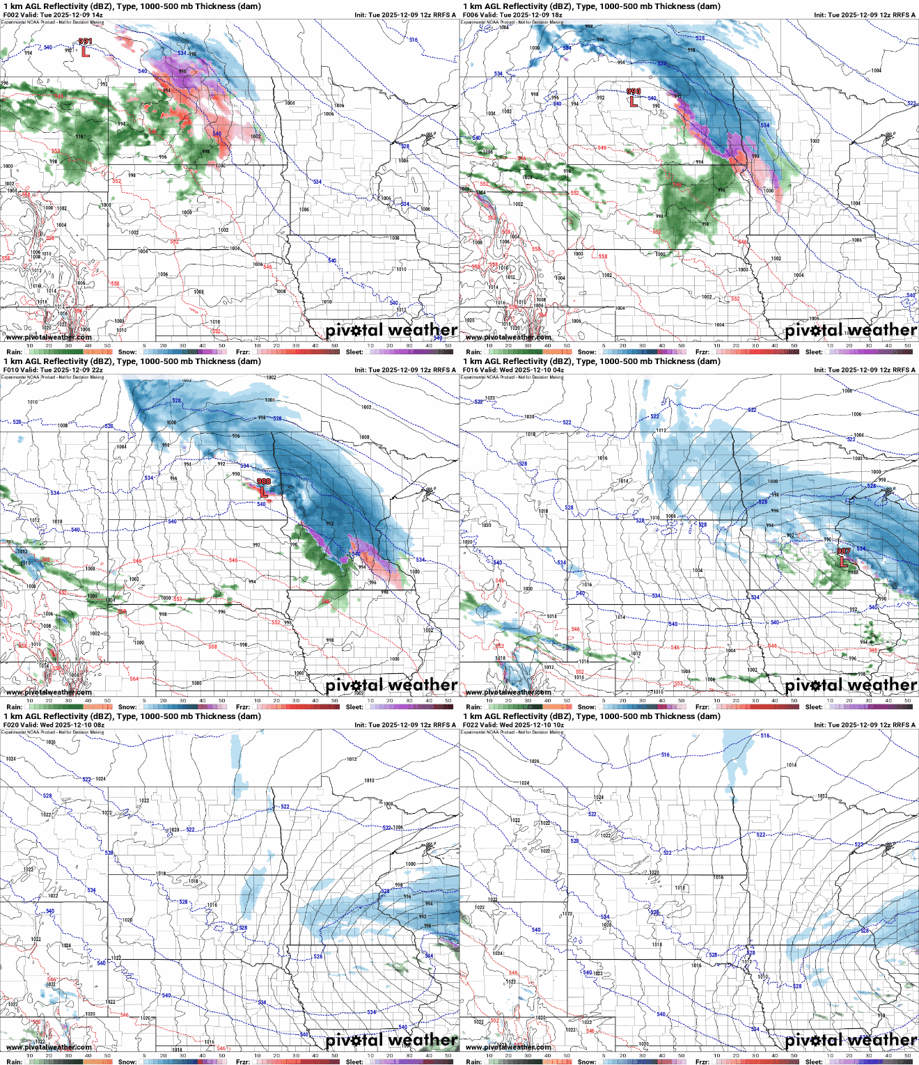
Snow totals will be heaviest just north of where the mixing occurs in central Minnesota. Many areas could see more than 6 inches of fresh snow.

Much of west-central and southern Minnesota could see a light ice accumulation from freezing rain Tuesday midday and afternoon:

The mixed precipitation and warmer temps across southern Minnesota complicate the snowfall forecast.
Here’s an example of one forecast model for raw snowfall output versus accounting for melting and compacting:

This is why Twin Cities area snowfall totals could vary greatly. What we see and what we measure will depend on how much of what precipitation type you get.
Anoka and Washington counties are in the winter storm warning area. The Twin Cities northern suburbs could easily get 3 to 6 inches of snow and while the south metro may see just 1 inch.

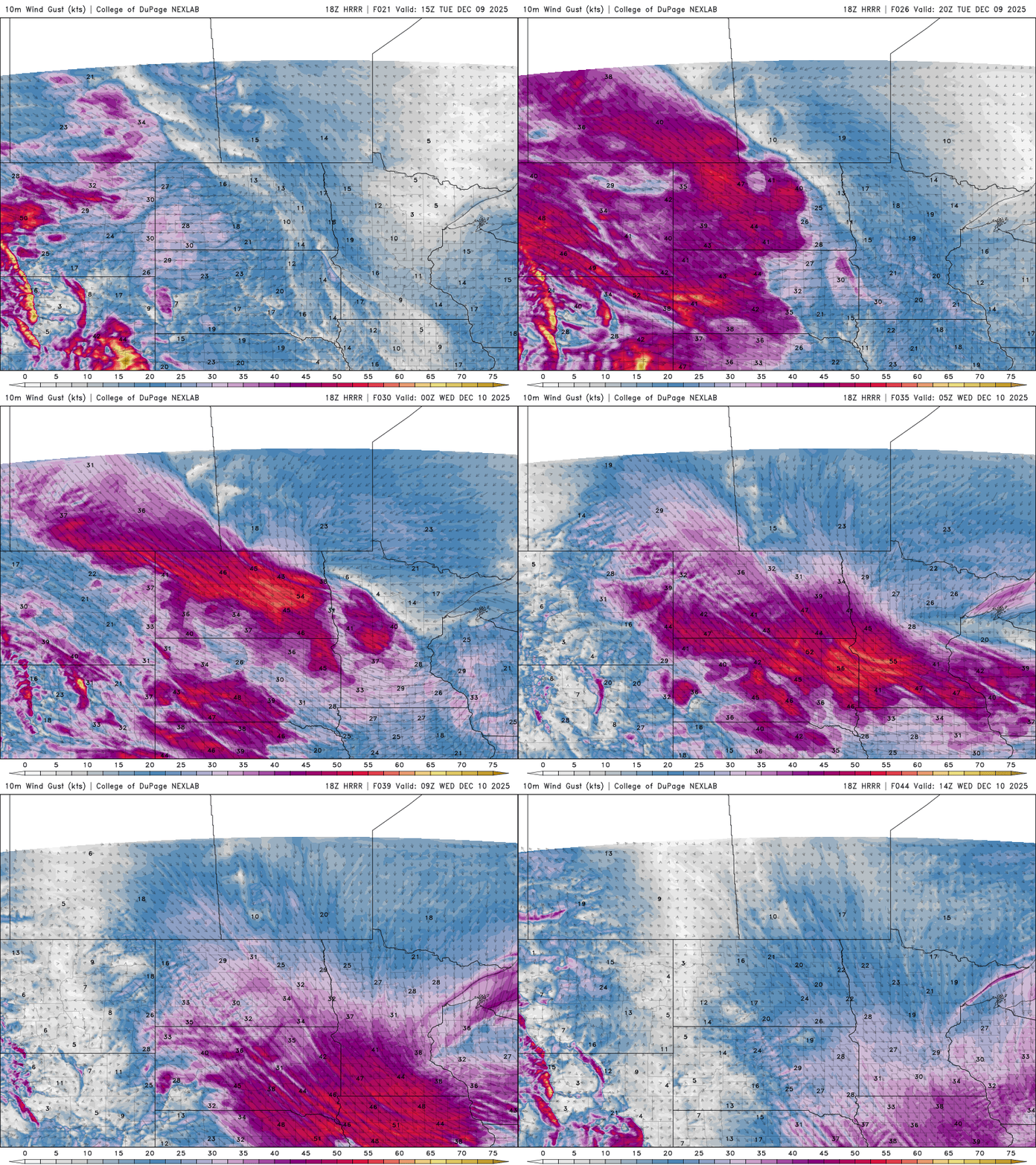
We’ll also see gusty winds develop Tuesday afternoon across western and southern Minnesota into the evening and early overnight Tuesday night. Wind gusts could exceed 50 mph in some areas.
Temperatures will drop to near 20 degrees in the Twin Cities with teens and single digits north and west overnight Tuesday into early Wednesday. Conditions could be icy as a result early Wednesday morning.

Colder air moves in for the rest of the week. We’ll still see highs in the 20s Wednesday but temperatures drop into the teens Thursday and just single digits Friday and Saturday with overnights well below zero.

