
Cooler, breezy Wednesday with more snow possible Thursday
Bitter cold air moves in this weekend
Go Deeper.
Create an account or log in to save stories.
Like this?
Thanks for liking this story! We have added it to a list of your favorite stories.


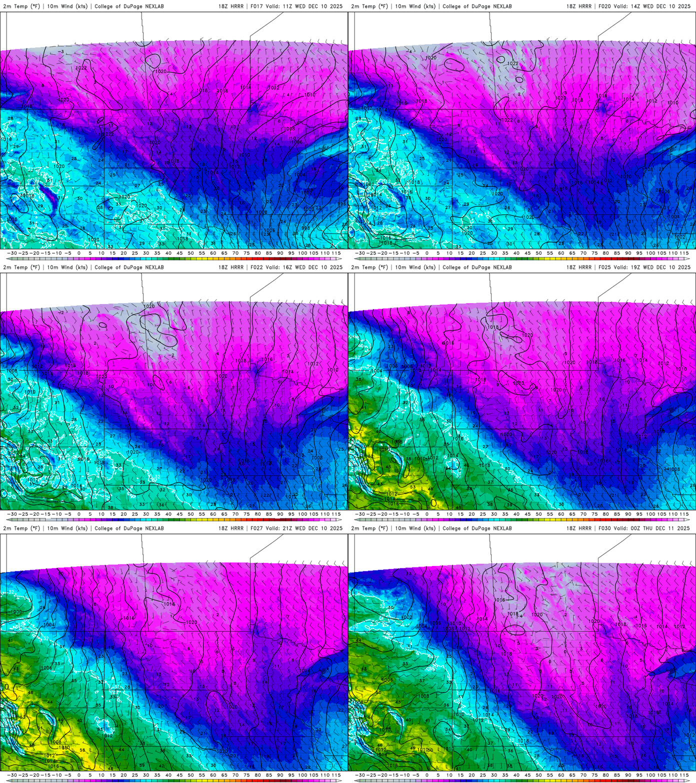
In the wake of our latest winter storm, temperatures will be steady or fall throughout the day Wednesday with blustery northwest winds. We’ll have the chance of more snow Thursday.
Steady to falling temps Wednesday; more snow possible Thursday
We picked up 3.4 inches of snowfall officially Tuesday at Minneapolis-St. Paul International Airport. Most metro totals were in the 3 to 6-inch range.

Grandy, just north of the Twin Cities, saw 6.9 inches; 7 inches fell in Motley. Thief River Falls received 8 inches.

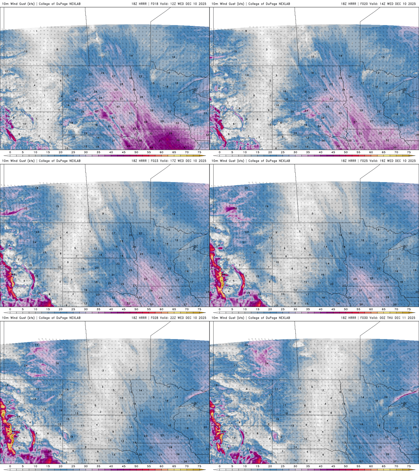
In the wake of our latest winter storm, it’ll be a breezy and cooler day Wednesday. Northwest winds at 10 to 20 mph will push temperatures down.
Turn Up Your Support
MPR News helps you turn down the noise and build shared understanding. Turn up your support for this public resource and keep trusted journalism accessible to all.
Southern Minnesota will see temperatures start in the 20s and slowly fall into the teens by late afternoon and evening Wednesday.
Overnight lows will be in the single digits below zero north to single digits above zero south Wednesday night with partly cloudy skies.

With much of Minnesota being on the cold side of the edge of colder and milder air, we remain in the line of fire for disturbances moving along the jet stream and storm track. More snow showers develop for western and southern Minnesota Thursday morning and afternoon.
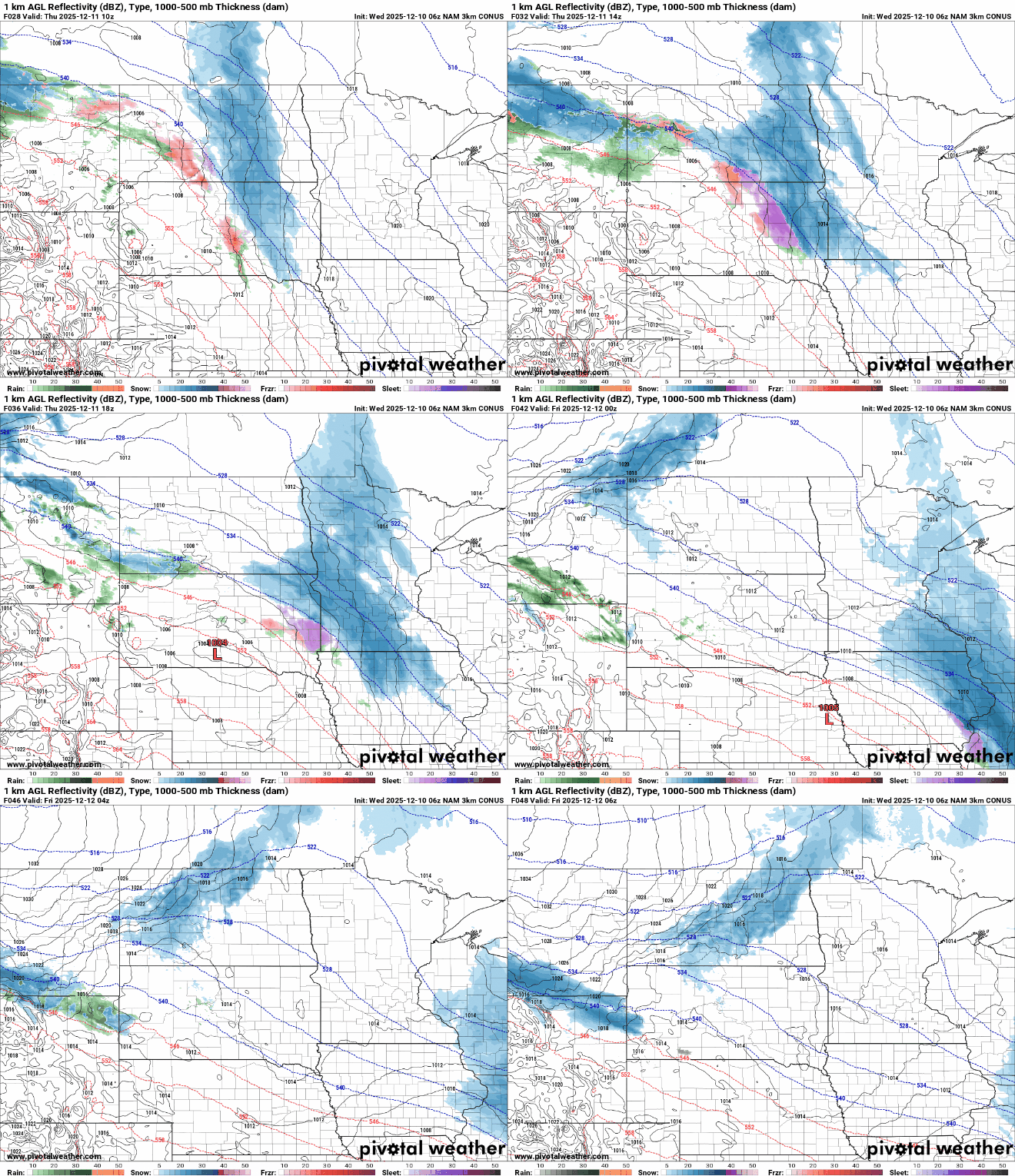
Portions of southern Minnesota can expect another 1 to 3 inches of snowfall accumulation into Thursday.

Southwestern Minnesota could be clipped by more snow Friday into Saturday,
We’re in for some pretty frigid air for the weekend. Saturday high temperatures will be barely above zero in southern Minnesota. Overnight lows Saturday night will be in the teens and 20s below zero across the state into early Sunday morning.

If we reach 12 below zero or colder Saturday night, it’ll be the earliest such cold of that caliber since 1989!

