
Snowpack to lock in extreme cold as arctic air arrives
Brutally cold wind chills expected this weekend

Go Deeper.
Create an account or log in to save stories.
Like this?
Thanks for liking this story! We have added it to a list of your favorite stories.


A surge of the season’s coldest arctic air is set to grip the region this weekend, producing dangerously low wind chills and brutally cold temperatures. The region’s snowpack will only intensify the cold, helping to lock in the frigid conditions.
Snowpack keeps arctic chill at full strength
Our fresh snowpack and deep snow across the region will amplify the coldest air mass of the season. The latest snow and ice chart shows vast snow cover extending from the Upper Midwest all the way to the Arctic Circle.
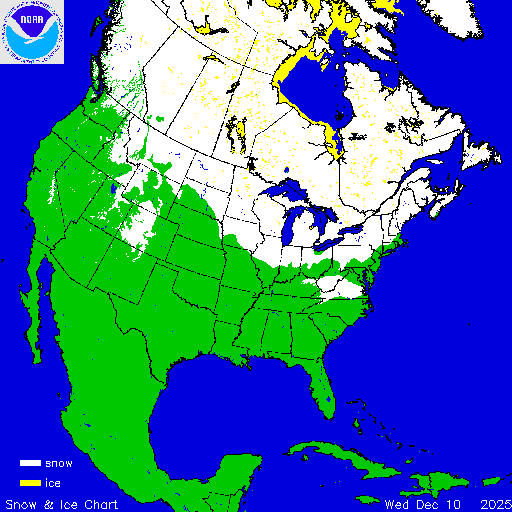
Typically, very cold air masses lose some of their intensity as they move over bare ground, which helps moderate temperatures. But when snow covers the ground, its high reflectivity — its albedo — contributes to greater heat loss, allowing the arctic air to remain brutally cold.

In the Yukon Territory of Canada, surface air temperatures reached around minus 50 degrees on Wednesday. Those extreme temperatures will moderate somewhat as the air mass moves southeast, but it will still bring some of the coldest readings of the season.
Turn Up Your Support
MPR News helps you turn down the noise and build shared understanding. Turn up your support for this public resource and keep trusted journalism accessible to all.

Temperatures are expected to drop below zero late Friday night and remain below zero through late Sunday night.
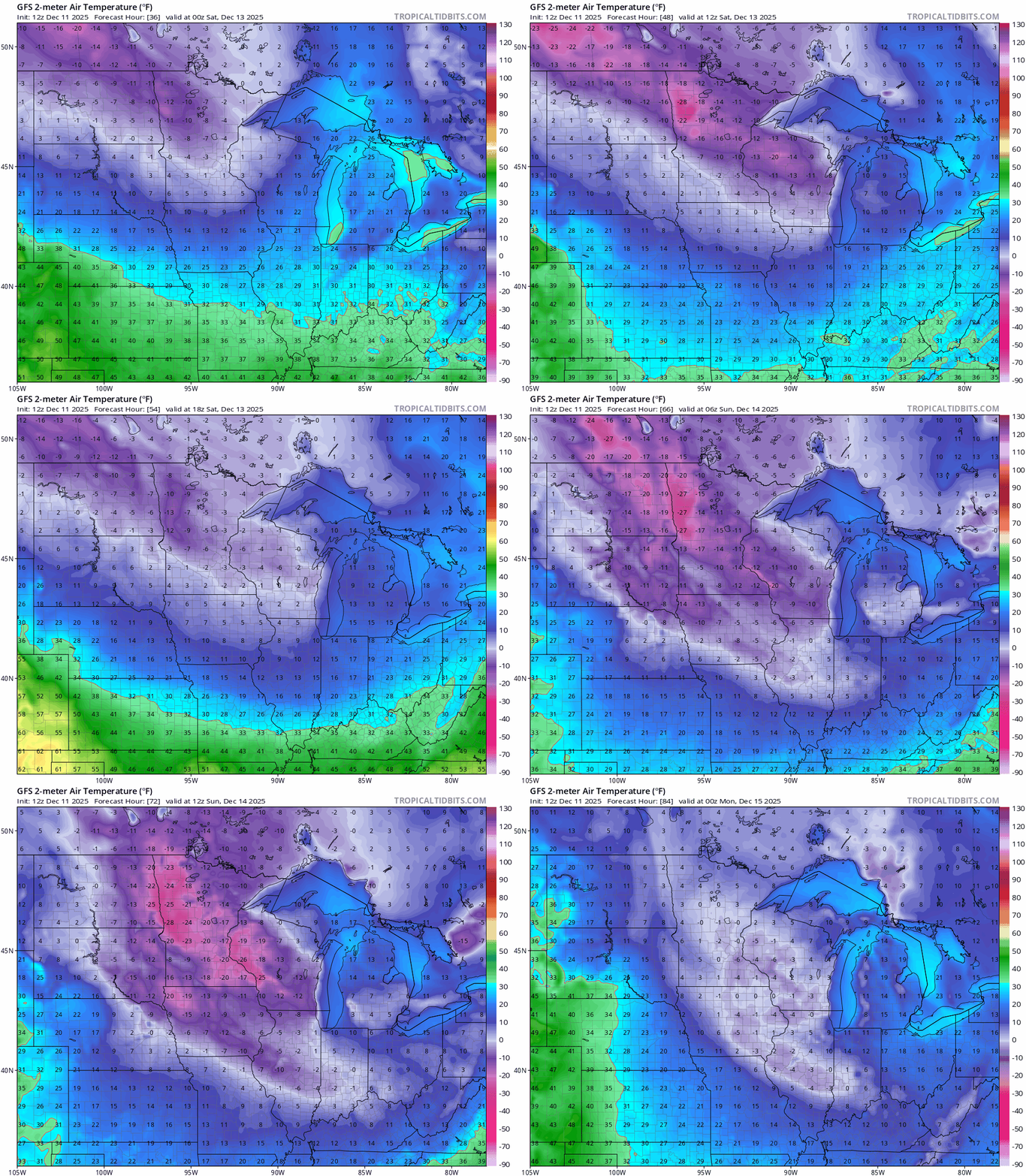
The coldest recorded high temperatures for the Twin Cities last winter occurred on Jan. 19 and 20, when air temperatures remained below zero on both days. Temperatures this extreme are more typical for January and February, not early to mid-December.
Wind chills are expected to drop to a bone-chilling minus 30 to minus 35 degrees by Sunday morning.
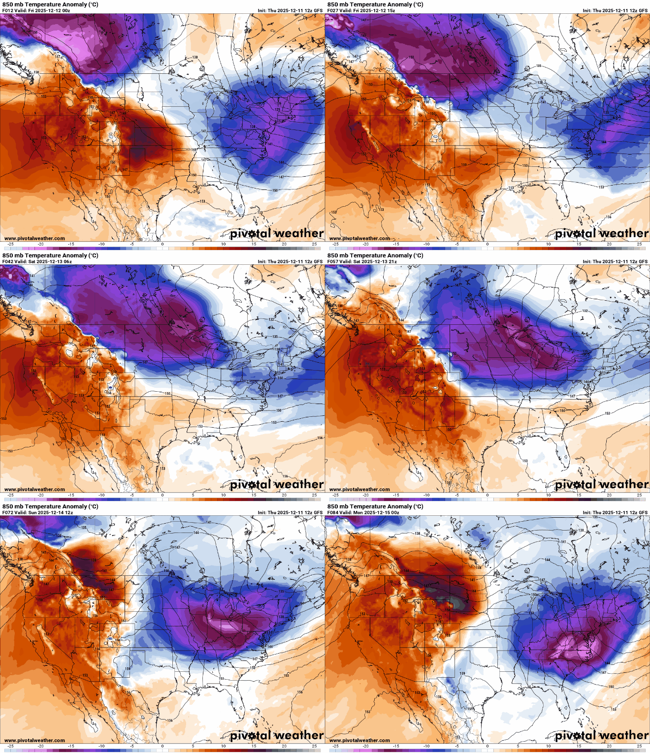
The bright purples and blues on the 850-millibar temperature anomaly map below show the cold air mass moving in for the upcoming weekend.
After the weekend plunge, temperatures are expected to rise to near or above freezing, marking the first thaw in the Twin Cities since Nov. 25.

