
Bundle up for one more day, a big warm-up is ahead
Weather whiplash with a 50 degree temperature swing

Go Deeper.
Create an account or log in to save stories.
Like this?
Thanks for liking this story! We have added it to a list of your favorite stories.


A cold weather advisory remains in effect this morning, with one more bitter start before a dramatic 50-degree warm-up arrives.
Cold weather advisory through Sunday morning; warm-up coming
The coldest air of the season so far will linger for another 24 hours as a gradual, well-deserved warm-up begins. Cold-weather advisories remain in effect across the state through Sunday morning.

Sunday’s temperatures are expected to recover into the single digits above zero, with some teens above zero out west.

Bright sunshine and high pressure will bring quiet conditions through the start of the work week, as a warm Pacific air mass drives a temperature swing of more than 50 degrees across the state. Highs on Tuesday and Wednesday are expected to reach the 40s, marking the first time the Twin Cities have seen above-freezing temperatures since Nov. 25.
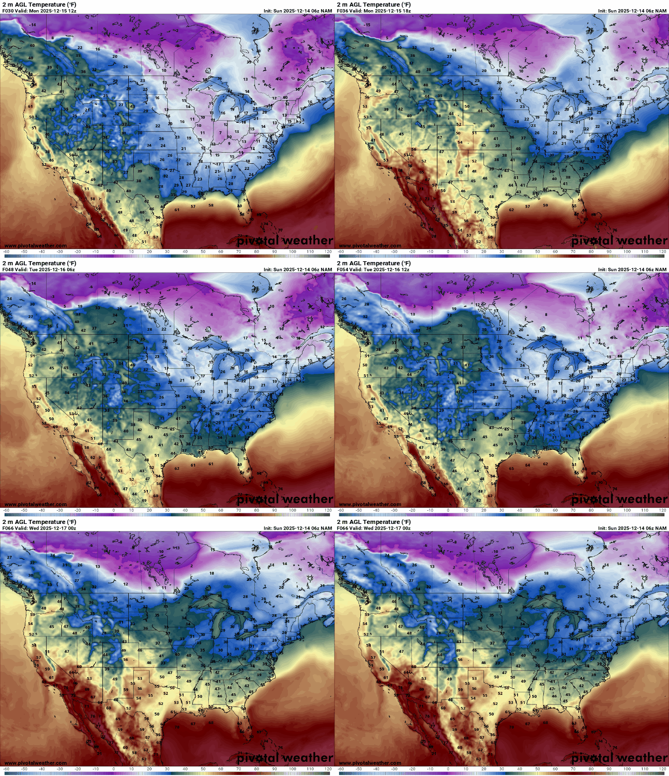
Highs on Monday are expected to recover into the 20s and low 30s in southwestern Minnesota.

The current forecast track for the next weather system takes it along the U.S.-Canada border Wednesday night into Thursday, mainly affecting southern Manitoba, Ontario, and northern Minnesota.

A lot can change between now and then, but with warmer temperatures in place, there is a possibility of a wintry mix. One thing that is certain is very breezy winds behind the system, with gusts of 40 to 50 mph, followed by a brief cool-down late in the week.
Turn Up Your Support
MPR News helps you turn down the noise and build shared understanding. Turn up your support for this public resource and keep trusted journalism accessible to all.

