
Above freezing Tuesday followed by rain, snow late Wednesday
Colder air follows for the end of the week

Go Deeper.
Create an account or log in to save stories.
Like this?
Thanks for liking this story! We have added it to a list of your favorite stories.


Temperatures climb to into the 40s Tuesday for most of Minnesota. Our next system delivers rain and snow late Wednesday into Thursday followed by colder air.
Mild Tuesday; wintry mix Wednesday night
With warmer air aloft, some patchy freezing drizzle and a few spotty freezing rain showers moved across east-central Minnesota into western Wisconsin Tuesday morning. The map below shows radar imagery from earlier, roughly 6 to 8 a.m.
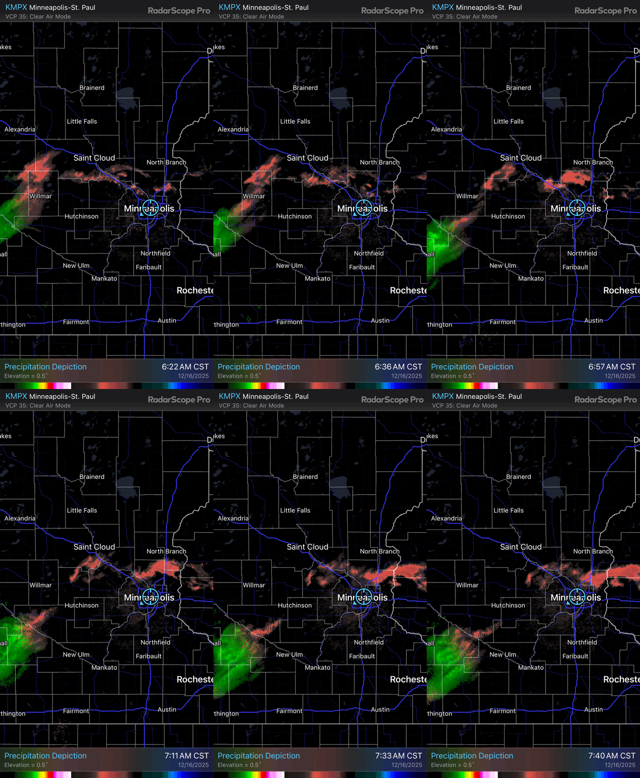
It was a textbook setup for freezing precipitation. Temperatures 2,000 feet above the ground were nearly 50 degrees Tuesday morning while surface temperatures in east-central Minnesota were in the 20s.

We’re in for our first warmer-than-normal day in a few weeks and our first temperatures above freezing for most of Minnesota.
Turn Up Your Support
MPR News helps you turn down the noise and build shared understanding. Turn up your support for this public resource and keep trusted journalism accessible to all.
Afternoon highs will be near or into the low to mid-40s Tuesday for much of Minnesota. Some spots in southwest Minnesota could hit 50-degrees. Those readings are 10 to 20 degrees above normal.

Wednesday will still be mild but with increasing clouds. Highs will be still above normal — in the 30s — for most of the state.

A mix of rain and snow showers develop north late Wednesday into Wednesday night and Thursday with the next system. Central and southern Minnesota will initially see rain showers turning to lingering snow showers for Thursday.
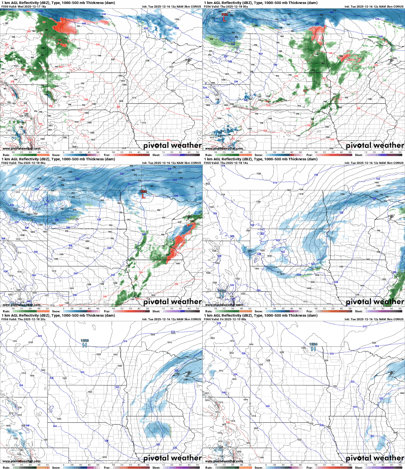
Most snowfall accumulation will occur in northern Minnesota with lighter amounts south into Thursday. There’s the potential for significant accumulation in far northern Minnesota.

The system will be followed by colder air working in Thursday into Friday. While it will be cooler, it will not be the really cold air we’ve seen recently. Lows early Friday will be back below zero but afternoon highs will be seasonable, in the 20s and teens.


