
Still mild Wednesday but wintry weather is returning
Temperatures drop Thursday into the weekend

Go Deeper.
Create an account or log in to save stories.
Like this?
Thanks for liking this story! We have added it to a list of your favorite stories.


Clouds increase Wednesday as the next system brings rain and snow to the region Wednesday night into Thursday. Temperatures will fall Thursday into Friday for the weekend.
Wintry weather set to return after another mild day Wednesday
We’ll squeeze out another fairly mild day Wednesday with highs in the 30s for much of the state — especially central and southern Minnesota — with even a few low 40s in southwestern Minnesota. Clouds will increase through the day.

The increasing cloud cover is a result of the incoming winter storm. Most snow will fall north but much of the state will see some precipitation in one form or another.
A wintry mix of showers will start to develop midday Wednesday in northwestern Minnesota and expand east into the evening, turning to snow north. Central and southern Minnesota will mainly see rain overnight Wednesday night.
Turn Up Your Support
MPR News helps you turn down the noise and build shared understanding. Turn up your support for this public resource and keep trusted journalism accessible to all.
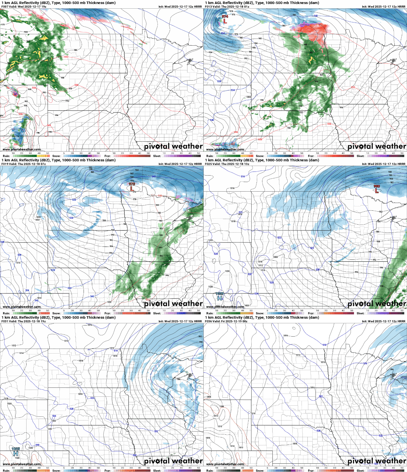
There could even be some light ice accumulations, less than one-tenth of an inch, in northern Minnesota before turning to all snow.

There’s a winter storm watch posted for portions of northern Minnesota for Thursday for the potential for more than several inches of snowfall.
Snowfall will be heaviest along the international border with lighter amounts as you go south. Most of central and southern Minnesota will see less than 1 inch of any snowfall into Thursday.

This system will come with a lot of wind Thursday. Wind gusts will be particularly high in western Minnesota, making for potential blizzard conditions in northwestern Minnesota Thursday.
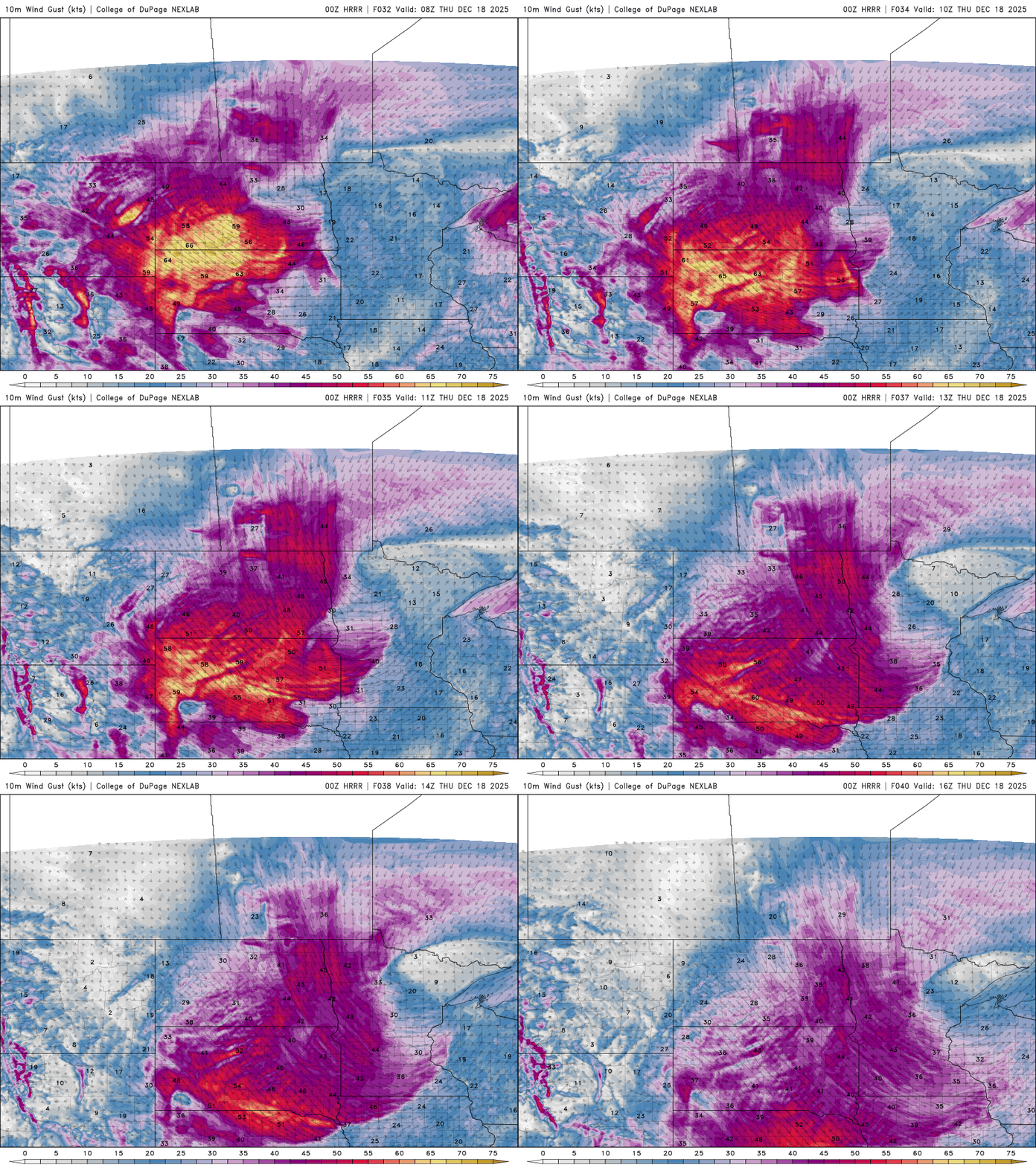
Maximum wind gusts could exceed 50 to 60 mph in portions of western and northwestern Minnesota. Any fresh snow will be really blowing around in open areas.

Temperatures will then fall through the day Thursday. After starting out near freezing in southern Minnesota and the Twin Cities, we’ll fall into the 20s by late afternoon.
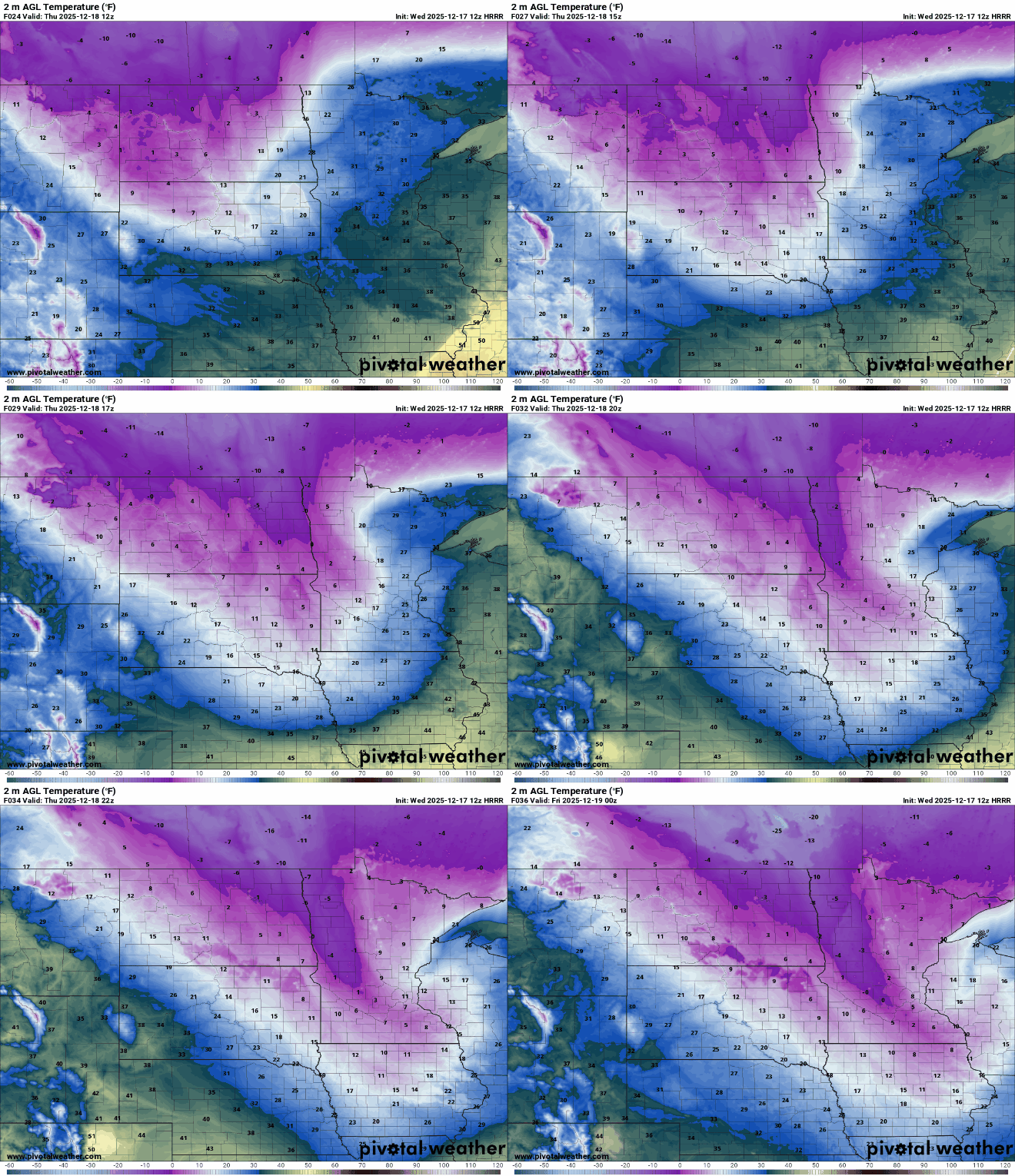
Much of central and northern Minnesota will see subzero low temperatures Thursday night into early Friday morning with single digits above zero in southern Minnesota.
Wind chill values early Friday will range from 5 below zero in southern Minnesota to as cold as 30 below zero in northwestern Minnesota.

The cooler but not terribly frigid air will stick around into the weekend. Highs Friday will be mostly in the 20s and teens with similar readings Saturday and Sunday.


