
Winter blast ahead: Strong winds, accumulating snow and freezing temperatures
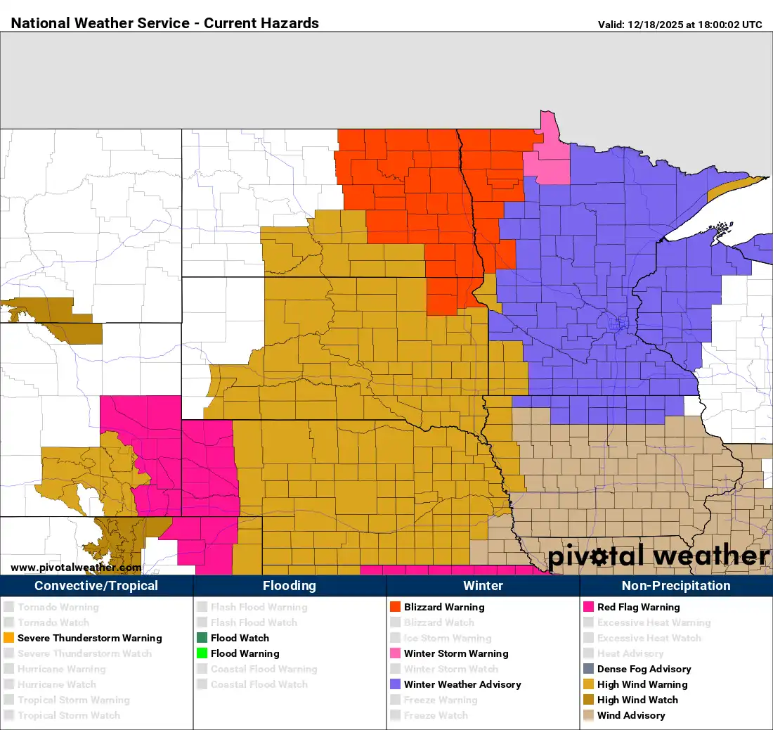
Multiple weather hazards: Blizzard and winter storm warnings, winter weather advisories
Go Deeper.
Create an account or log in to save stories.
Like this?
Thanks for liking this story! We have added it to a list of your favorite stories.


Multiple weather hazards are impacting the region this afternoon, with blizzard and winter storm warnings in effect alongside winter weather advisories. Expect strong winds, blowing snow and rapidly falling temperatures.
Wintry blast through Thursday evening
After several days of above-freezing temperatures and snowmelt, winter is blasting back in on Thursday, reminding us that it’s still December. Multiple winter weather hazards cover the state with blizzard, winter storm and high wind warnings, along with winter weather advisories, in effect through Thursday night.
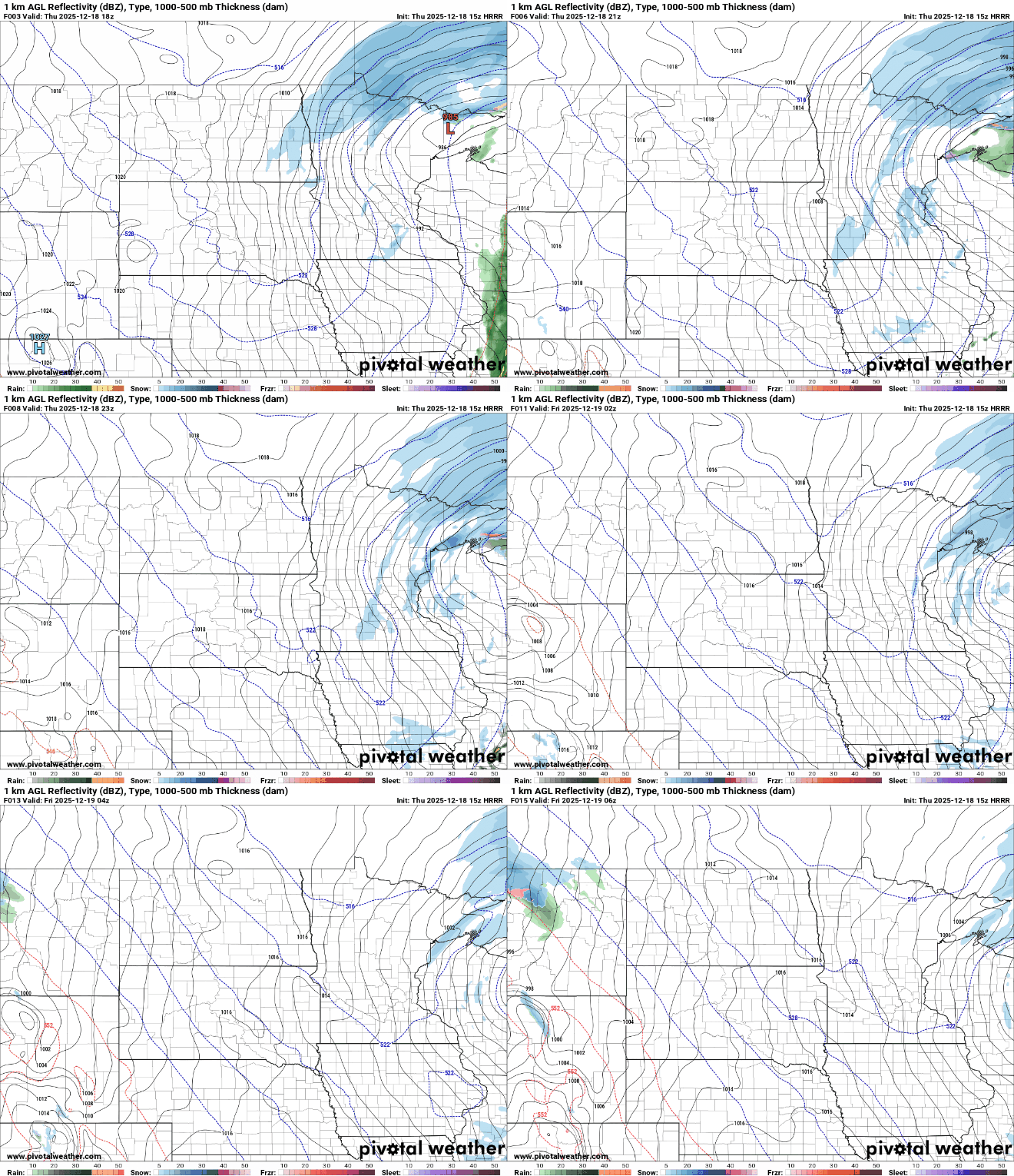
Accumulating snowfall will be largely confined to northeastern Minnesota, where 2 to 6 inches are possible. Farther southeast, totals are expected to remain under 1 inch.

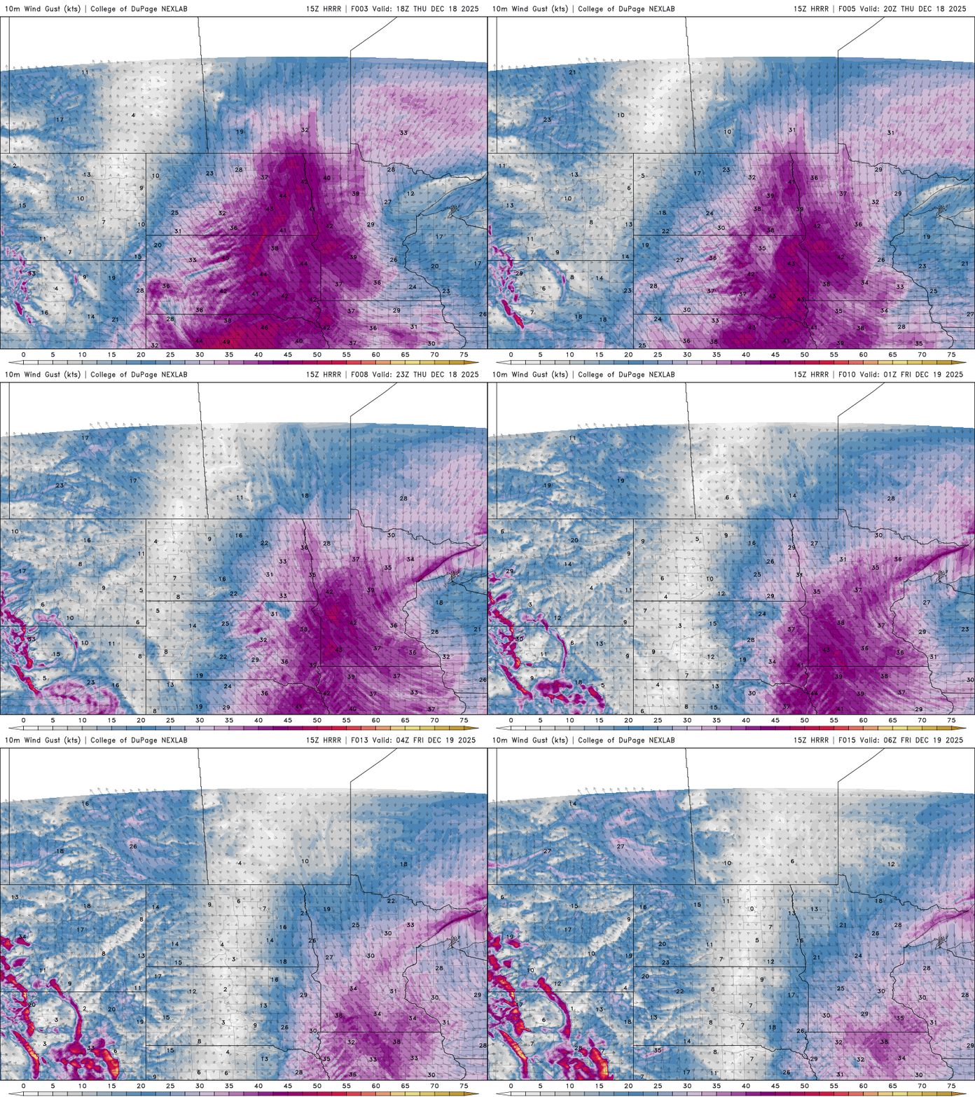
Northwesterly winds have been gusting over 40 mph with some gusts reaching 50 mph. The strong winds are causing blowing snow that can sharply reduce visibility, especially in open and rural areas.

Breezy conditions are expected to continue through Thursday night before easing overnight, though winds could still gust over 30 mph into Friday morning.
One concern is rapidly falling temperatures, which will drop below freezing and could create flash-freeze conditions on wet roads. Temperatures have been falling throughout Thursday and are expected to remain below zero through Friday.

This fast-moving system is expected to clear the state by overnight.
Turn Up Your Support
MPR News helps you turn down the noise and build shared understanding. Turn up your support for this public resource and keep trusted journalism accessible to all.

