
Winter wallop: Falling temps, gusty winds and snow showers
Temperatures will be more seasonable this weekend

Go Deeper.
Create an account or log in to save stories.
Like this?
Thanks for liking this story! We have added it to a list of your favorite stories.


A winter reality check is here. Expect gusty winds, falling temperatures and scattered snow showers Thursday.
Winter advisories in central, NE Minnesota; blizzard warning northwest
Blizzard warnings are posted for northwestern Minnesota with winter weather advisories across central and northeast central Minnesota. There won’t be a lot of snow in central and southern Minnesota, but the winds will reduce visibility with what snow does fall.
Rain showers will track east out of southeastern and northeastern Minnesota with snow developing by midday into the afternoon, evening and overnight into Friday. There could be some intense bursts of snow in northeastern Minnesota.
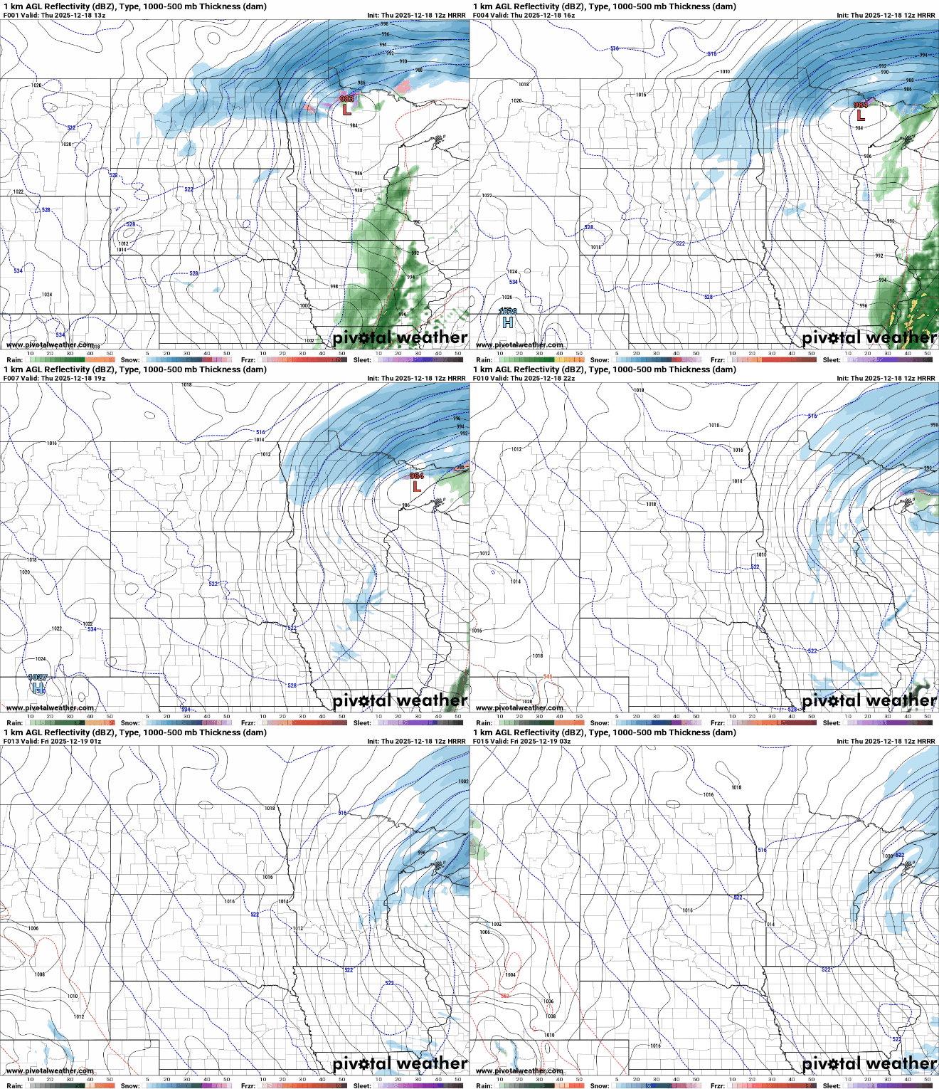
Additional snowfall will be more significant for northern Minnesota where several or more inches could fall. Snow totals in central and southern Minnesota will be 1 inch or less.
Turn Up Your Support
MPR News helps you turn down the noise and build shared understanding. Turn up your support for this public resource and keep trusted journalism accessible to all.

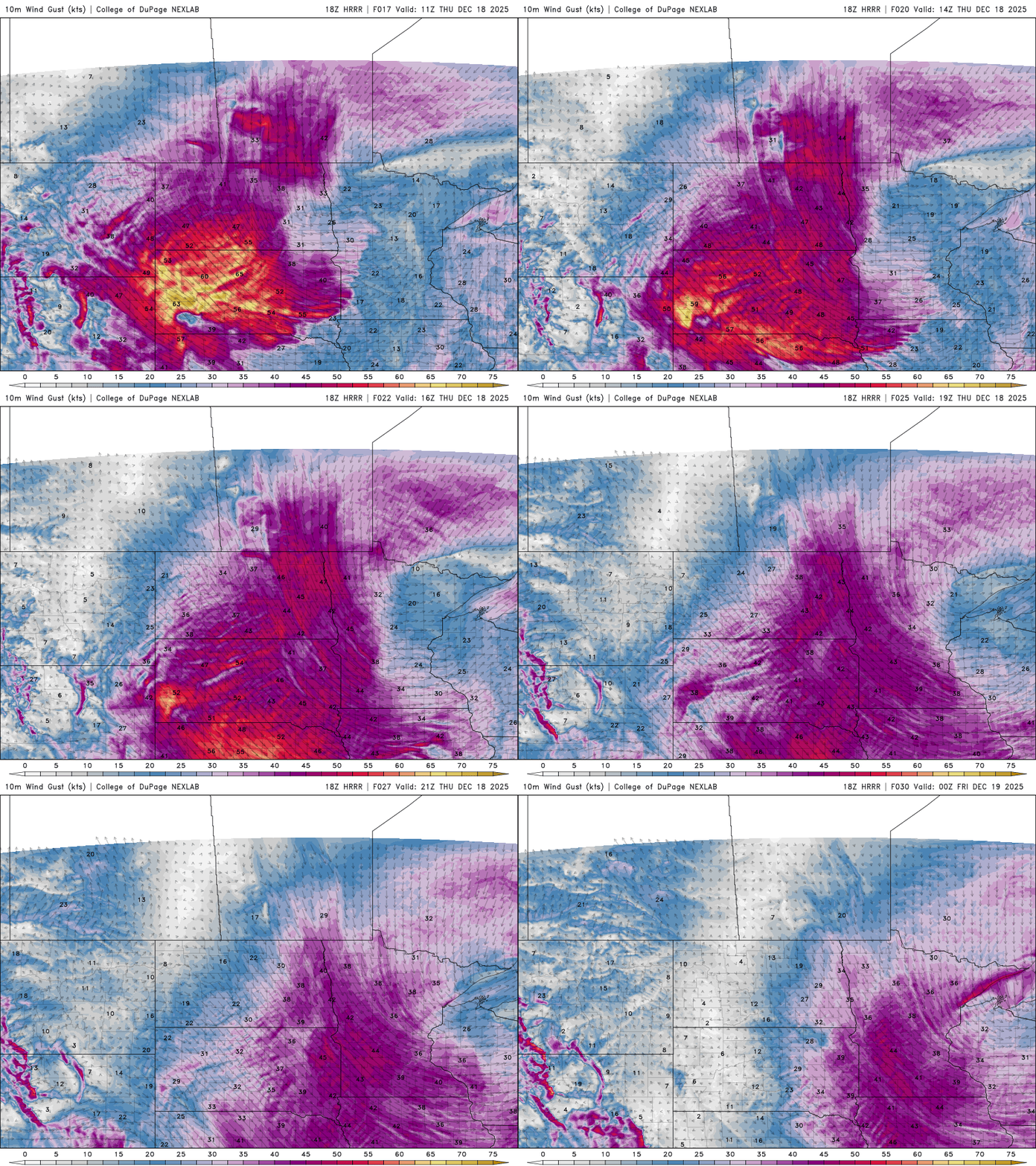
The snow showers will be accompanied by gusty winds developing from the northwest, sustained at 15 to 30 mph with gusts of 40 to 50 mph — even near 60 mph in northwestern Minnesota.
Cold air is moving in on those blustery northwest winds. Temperatures will fall from the 30s into the teens across southern Minnesota from morning to evening and from the teens into subzero territory northwest.
The Twin Cities will likely drop below freezing by late morning-midday. Be aware that a lot of the salt on roadways was washed away by overnight rainfall, so things could get slick quickly.
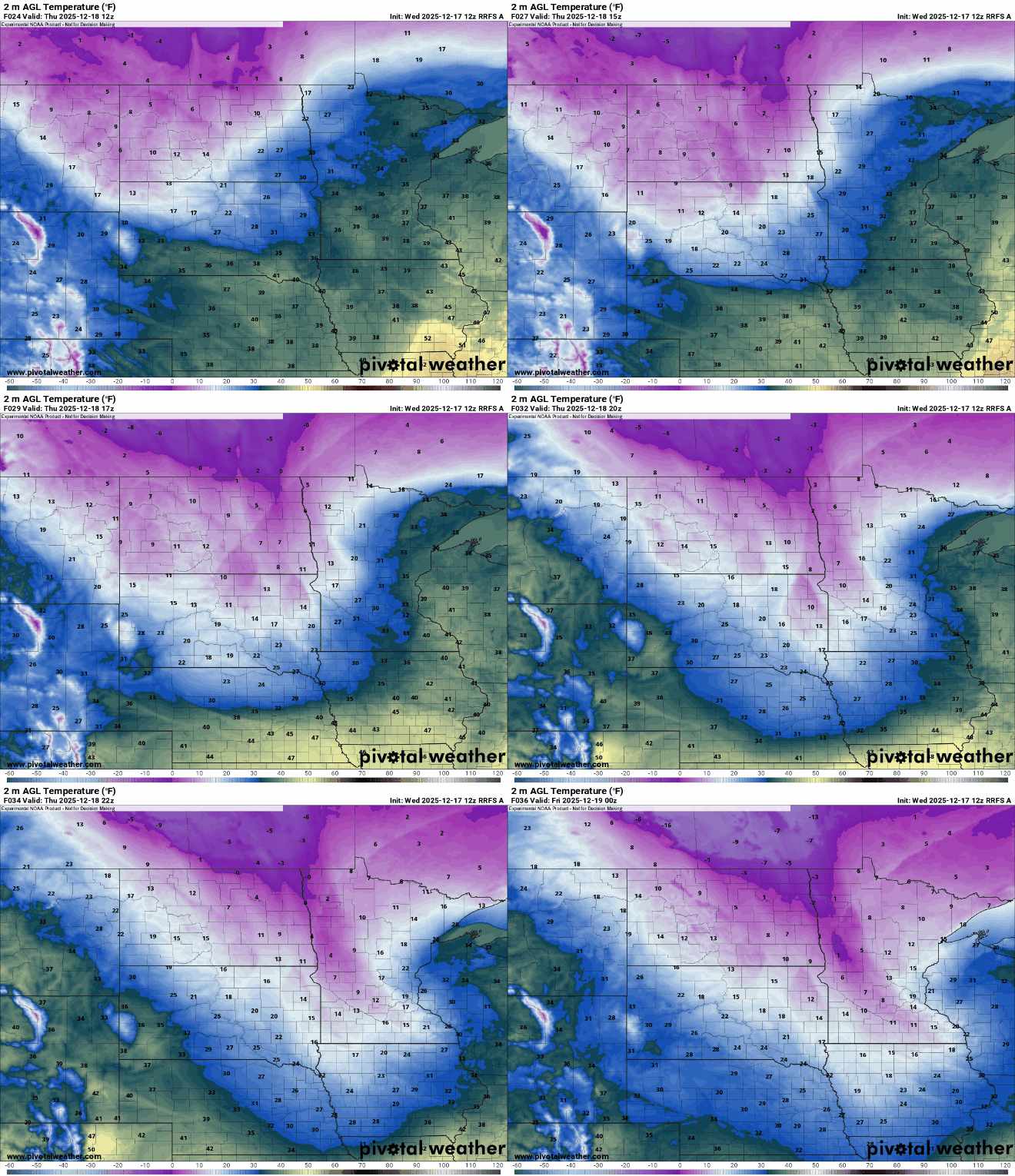
Overnight lows will be subzero for most of central and southern Minnesota Thursday night into early Friday morning. The Twin Cities and far southern Minnesota will stay just above zero.

Friday will bring a mix of clouds and sun and more seasonable temperatures in the 20s south and teens north for most.

We’ll see more scattered snow showers develop in northern Minnesota with a clipper system Friday afternoon into early Saturday.
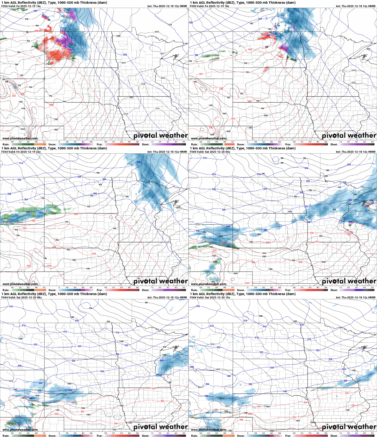
Portions of northern Minnesota could see up to an additional inch of snowfall with pockets of potentially 2 or more inches in the Arrowhead and North Shore.

The weekend will be cool but seasonable. Highs Saturday will be in the teens and 20s and most will be in the teens Sunday with sunshine returning.
Next week brings more temperatures in the 30s with potentially even rain showers by Christmas Day again.

