
Flurries fade as a breezy Saturday takes over
Sunday’s winter solstice brings the shortest day and a warming trend

Go Deeper.
Create an account or log in to save stories.
Like this?
Thanks for liking this story! We have added it to a list of your favorite stories.


Flurries fade early, giving way to a breezy and chilly Saturday, followed by Sunday’s winter solstice, the shortest day of the year, bringing a warming trend.
Another brief round of Arctic air
More roller coaster temperatures are in store for Saturday, with highs peaking early in the day. A cold front moving across the state will usher in falling temperatures and our next brief round of Arctic air. The high temperature map shows northwestern Minnesota with chilly single-digit highs, while milder temperatures in the 20s and 30s linger across southern Minnesota.

Our brief round of light flurries early Saturday is moving east into central Wisconsin as a low-pressure system tracks from southern Ontario toward the Great Lakes.
Turn Up Your Support
MPR News helps you turn down the noise and build shared understanding. Turn up your support for this public resource and keep trusted journalism accessible to all.

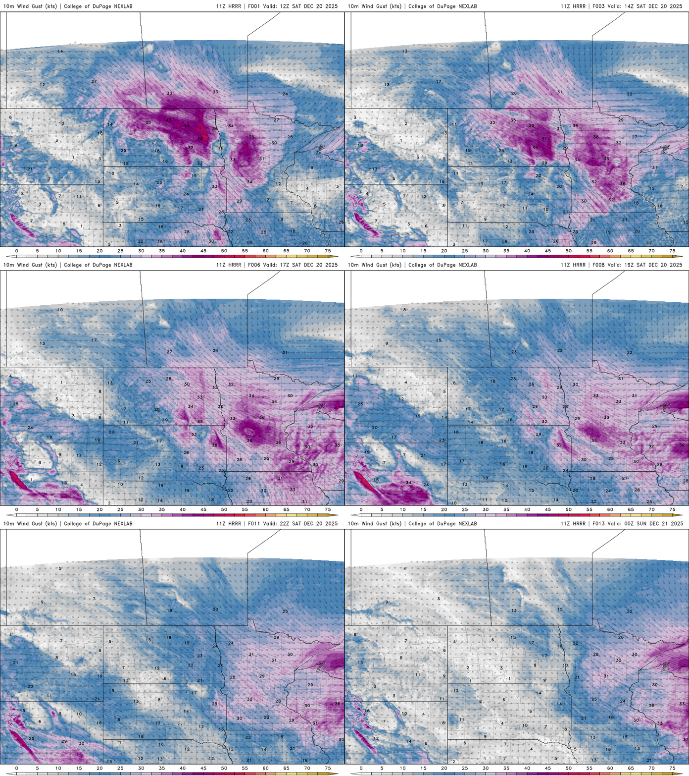
Behind the cold front, winds will come from the west-northwest at 12-25 mph, with gusts as high as 30 to 40 mph.
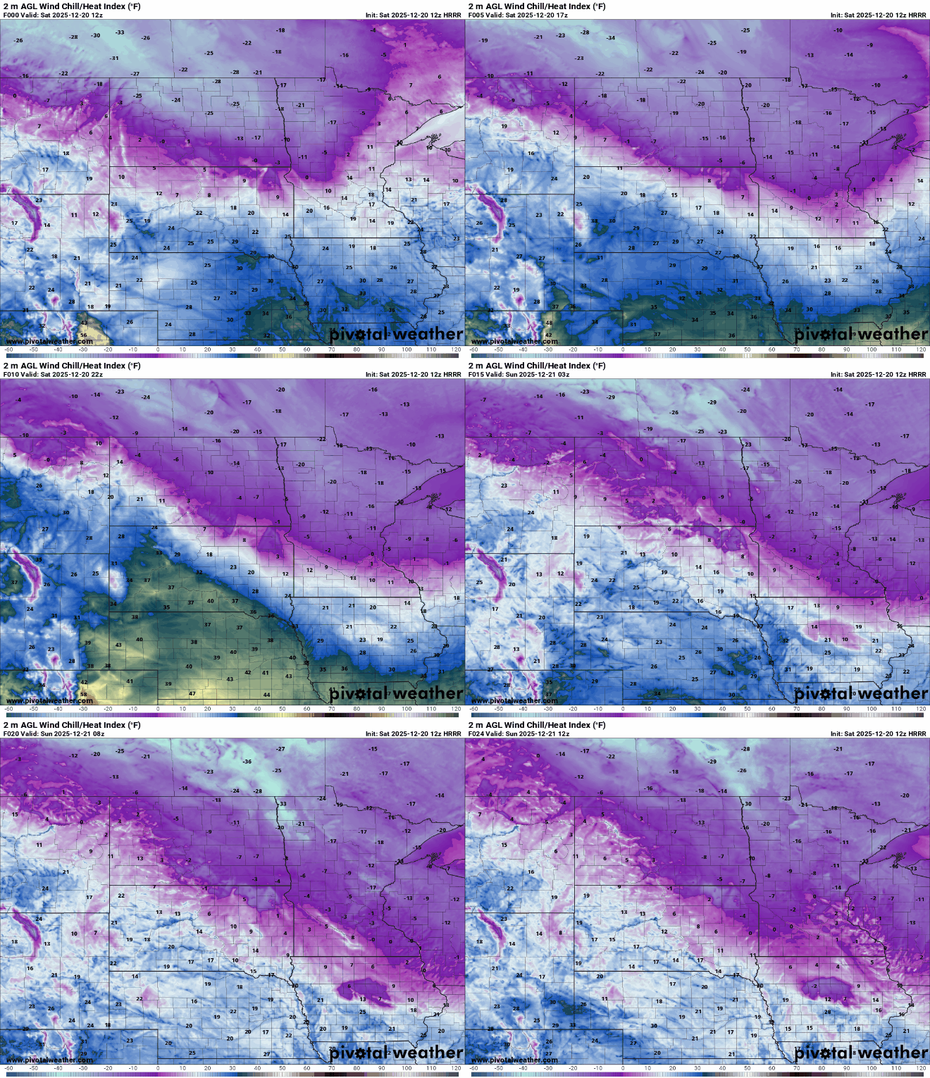
Falling temperatures combined with breezy winds make for a chilly Saturday. Wind chills will drop into the teens and 20s below zero in northern Minnesota, while southern areas will feel like the single digits and teens.
A quiet weekend is expected, with seasonal highs in the mid to upper 20s for the metro area on Sunday. Our next slight chance for precipitation arrives Sunday night into Monday morning as warmer air moves in for the week of Christmas.
Temperatures will climb into the 30s and 40s, with some areas in southwestern Minnesota possibly reaching the 50s where snowpack is minimal. Here’s a look at the forecasted temperatures for the metro area through next week.


