
Slightly cooler Tuesday but more melting ahead
Rain and snow possible Thursday night into Friday

Go Deeper.
Create an account or log in to save stories.
Like this?
Thanks for liking this story! We have added it to a list of your favorite stories.


Temperatures will be nearly steady Tuesday and cooler, but still above normal for southern Minnesota. More melting is on the way Wednesday through Saturday.
Slightly cooler but still above normal Tuesday with more mild days ahead
A weak cold front sort of stalled out over Minnesota Monday night, making for a slightly cooler day Tuesday.
Temperatures will be nearly steady and there will be a big contrast from north to south. Northwestern Minnesota will see temperatures mainly in the single digits while southern Minnesota will remain in the low 30s.

The melting continues Wednesday for southern Minnesota as afternoon highs once again climb above freezing. Southwestern Minnesota will likely see highs in the mid-40s with mid-30s in the Twin Cities and subfreezing temperatures north.
Turn Up Your Support
MPR News helps you turn down the noise and build shared understanding. Turn up your support for this public resource and keep trusted journalism accessible to all.

Christmas will be a mild one. Highs will be in the 40s in southwestern Minnesota thanks to a lack of snow cover with highs near 35 in the Twin Cities and readings in the 20s for most of northern Minnesota.
It looks like we’ll barely pull off a white Christmas in the Twin Cities with about 1 inch of snow cover then (the official definition is 1 inch of snow cover).

How a cool, wet California is making for a mild week in Minnesota
It might seem odd, but the cool, wet, stormy weather on the West Coast this week is helping to keep Minnesota and the entire central United States quite mild.
It is actually quite common that we have the opposite pattern in the central U.S. to that of the West Coast. When it’s relatively warm and dry there, we tend to be colder and potentially stormier and wetter in the central U.S., this is what happened the first half of December.
California got extended summer while we were cold and snowy. Now, the script is flipped.
California has numerous flood watches and warnings as a big Pacific storm slams the coast bringing cool, wet weather. This helps prop up warmth ahead of it in the central part of the U.S. to the east coast.

This makes for a wavy jet stream pattern. Overall the jet stream, which is the main storm track and dividing line between colder and warmer air masses, will be riding just north of Minnesota. We call this an upper-level ridge pattern.
The East Coast will see mostly a trough pattern as fast-moving upper-level winds move around the storm systems.
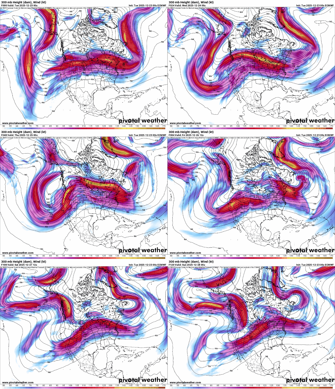
Until this pattern flips again, we’ll be milder than normal overall. There will be a couple of hiccups in this pattern, namely a couple below-normal days for temperatures Sunday and Monday.
Wintry mix possible late Thursday and Saturday
We’re still monitoring the next disturbance that will likely bring rain to southern Minnesota Thursday night into Friday morning with a wintry mix north turning to snow showers. Another weak disturbance could bring more rain and snow showers Saturday ahead of colder air.
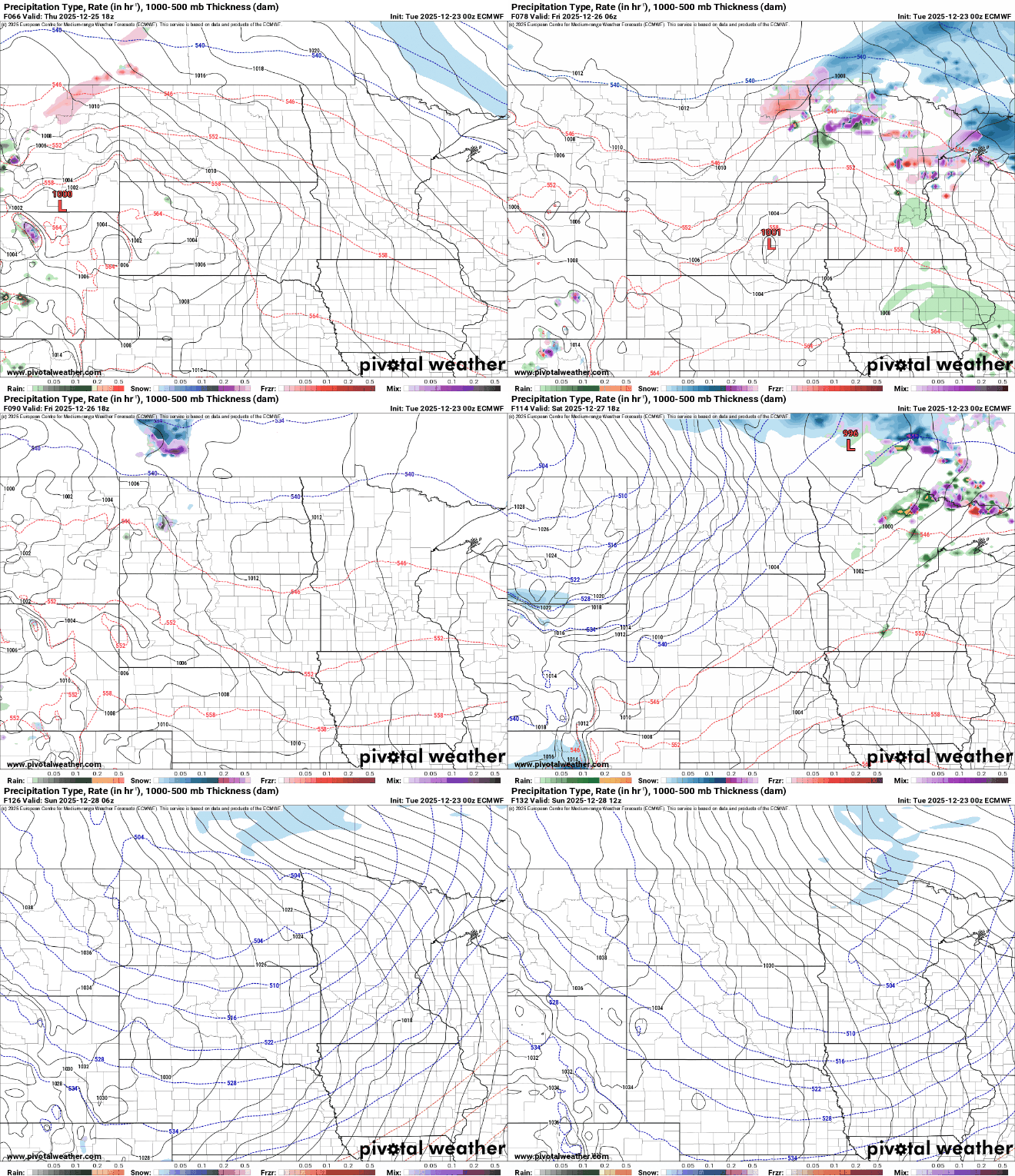
The most likely recipient of snowfall accumulations will be limited to northeastern Minnesota into Friday. Up to several inches of snow could fall deep into the Arrowhead into Friday morning.

A shot of colder air is expected by the second half of the weekend. Highs by Sunday and Monday will be in the teens south and single digits north with sunshine.

