
Silent night? Not quite: Fog, drizzle and warm temperatures create a tricky forecast
White Christmas chances fade for parts of the state

Go Deeper.
Create an account or log in to save stories.
Like this?
Thanks for liking this story! We have added it to a list of your favorite stories.


Dreams of a white Christmas are fading for parts of the state as fog, drizzle and warmer temperatures set the stage for a tricky Christmas Day forecast.
Not so silent night
Our forecast models are all singing the same carol: Expect widespread low clouds across the state on Christmas Eve, lingering through Christmas Day.
Southwestern Minnesota, south of the Minnesota River Valley, will see the brunt of the drizzle and fog. Visibility could drop near zero in some areas through Christmas morning. Drizzle and foggy conditions are expected for Christmas Eve travel.
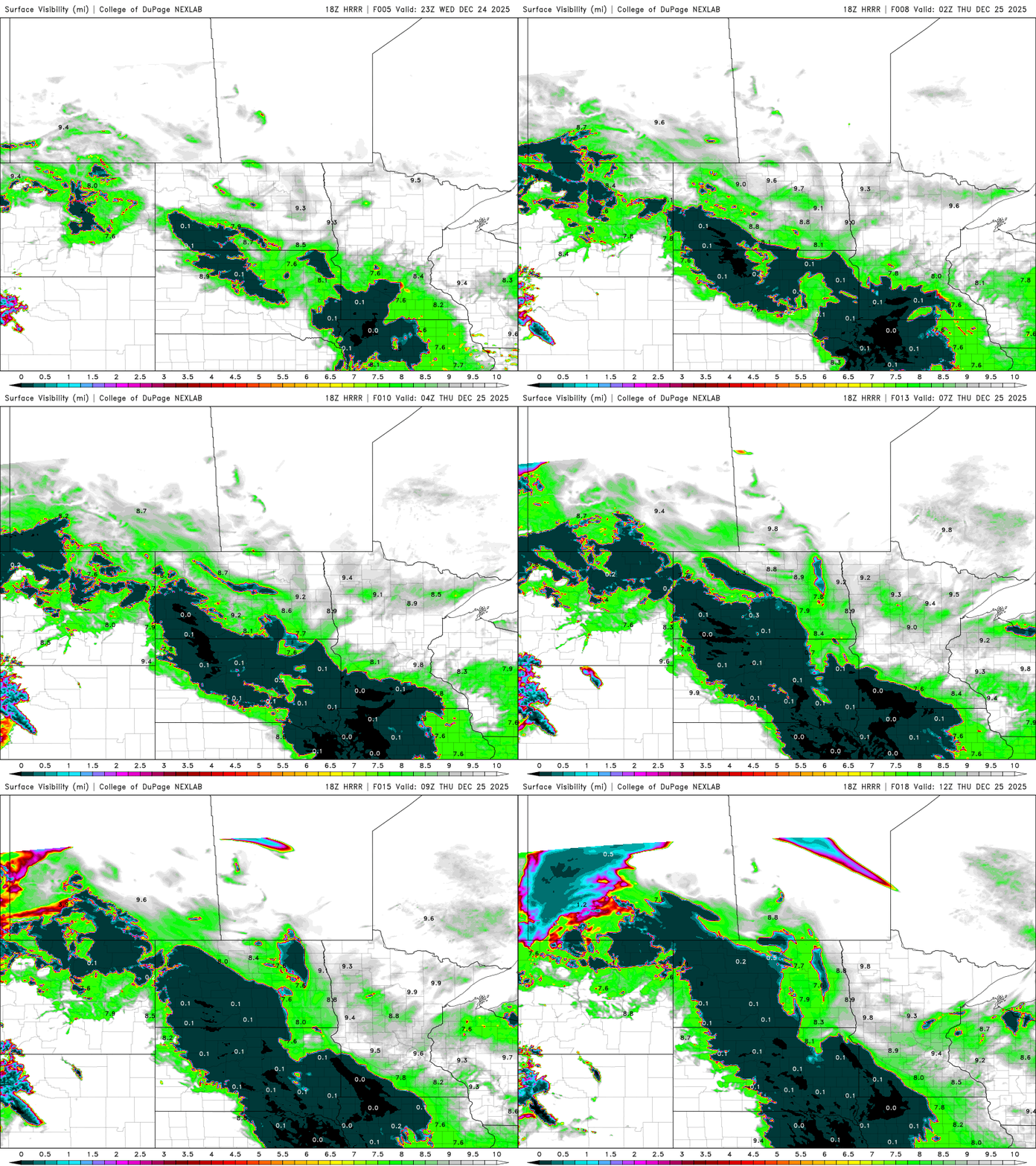
There is a dense fog advisory for the southwestern counties like Pipestone, Rock, Nobles, Murray, Jackson, Cottonwood and Lincoln until 9 a.m. Christmas Day. Looks like even Santa will need to turn on the fog lights for his sleigh!
Turn Up Your Support
MPR News helps you turn down the noise and build shared understanding. Turn up your support for this public resource and keep trusted journalism accessible to all.

Low temperatures dipping just below freezing in southwestern Minnesota could lead to some freezing fog, so conditions will need to be monitored closely. Northern and central Minnesota will see chilly lows in the single digits and low teens, while the milder air stays south of Interstate 94.

Warm temperatures continue for Christmas Day, with highs in the 20s in northern Minnesota and 30s in the south. The warmest Christmas days in the Twin Cities were 2023, with a high of 54 degrees, and 1994, with a high of 45 degrees.

With warmer temperatures and lingering moisture, very gloomy and drizzly days are ahead. There is potential for some light ice accumulation Christmas afternoon and evening through Friday, mainly in central Minnesota, north of Interstate 94.

Any accumulating snowfall will stay confined to Cook County at the tip of the Arrowhead, where greater than 3 inches is possible.

White Christmas — for some
The past three days of temperatures in the 30s and 40s across central and southern Minnesota have significantly reduced our snowpack. A white Christmas requires at least 1 inch of snow on the ground, and the Twin Cities will just barely meet that mark. Snow depth has dropped dramatically, from 10 inches on December 12 to only 2 inches Christmas Eve.
Areas around the southwestern part of the state are already seeing bare ground, with meaningful snowpack largely limited to the northernmost regions.

Based on more than 124 years of snow depth records for the Twin Cities, a white Christmas, defined as at least one inch of snow on the ground, occurs about 71 percent of the time.

There are no major winter snowstorms in the forecast heading into the New Year to help improve our already dismal snowpack.
The next clipper system will move through Saturday, likely bringing rain and snow showers to the area, followed by colder temperatures and breezy winds Sunday into Monday.

