Have yourself a foggy little Christmas with freezing drizzle possible
Winter weather advisories for the northern half of the state

Go Deeper.
Create an account or log in to save stories.
Like this?
Thanks for liking this story! We have added it to a list of your favorite stories.


A foggy and gloomy Christmas Day is unfolding across much of the region, with freezing drizzle potentially adding icy travel concerns, especially across the northern half of the state.
Foggy start to Christmas
If you were hoping for a bright and cheerful Christmas morning, the weather had other plans. A foggy and gloomy Christmas Day is unfolding across much of the region, with dense fog already settled over southern Minnesota. A dense fog advisory continues until noon for southwestern and south central Minnesota.

Even though the dense fog advisory expires at noon, skies will remain gray, and low clouds currently over southern Minnesota are expected to spread northward by late morning.
Winter weather advisories and potential icy travel
Some locations north of Interstate 94 could see a glaze of ice, potentially up to one-tenth of an inch in the worst-case scenario, though most areas will end up with only a few hundredths of an inch. That’s still enough to make roads and sidewalks slippery.
Turn Up Your Support
MPR News helps you turn down the noise and build shared understanding. Turn up your support for this public resource and keep trusted journalism accessible to all.
A winter weather advisory will begin later Thursday afternoon in west-central Minnesota and Thursday evening in western Wisconsin, lasting through Friday morning.
The best chance for drizzle and icing comes late this evening through early Friday.

Forecast models show light precipitation late Thursday afternoon, with freezing drizzle expected mainly in northern Minnesota, and drizzle south of Interstate 94. Ice accumulation will be spotty and sparse at times.
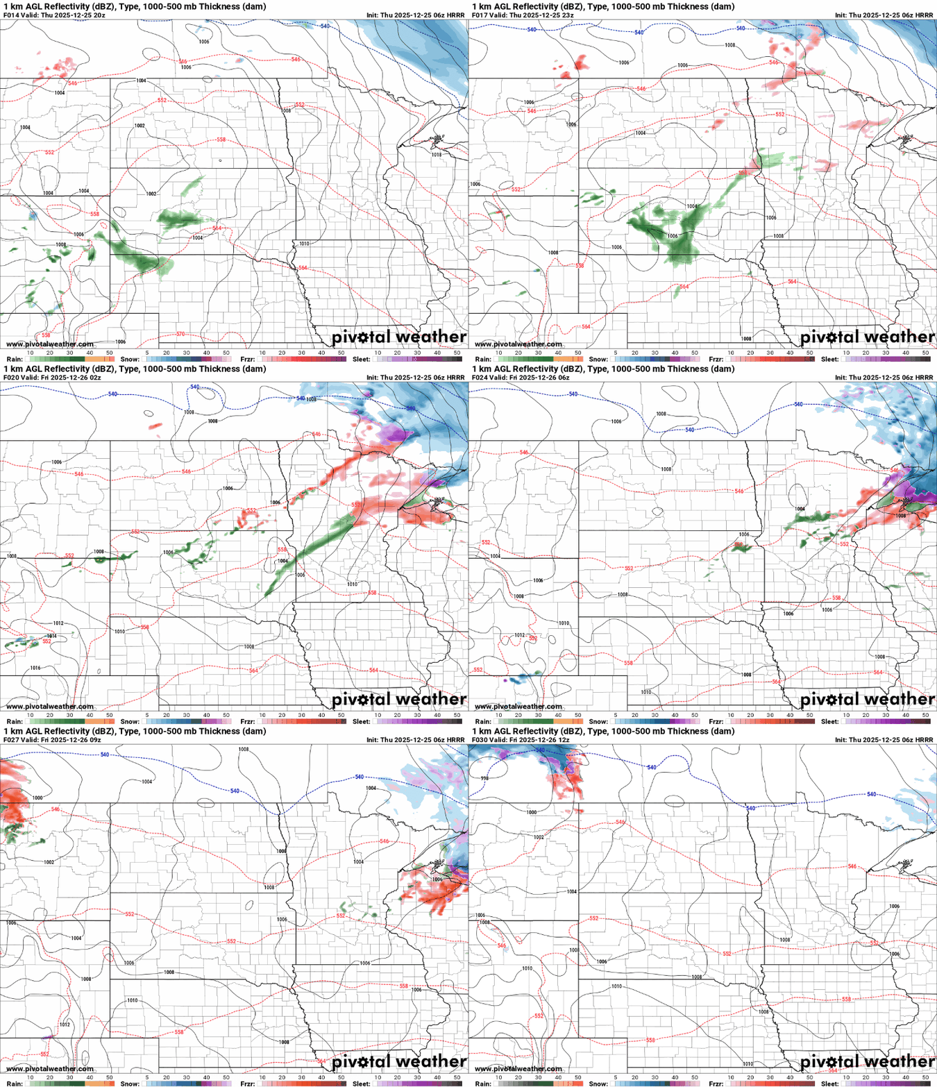
Precipitation will transition to snow Thursday night, but accumulations will be limited to the northeastern part of the state. Grand Marais could see 2–3 inches, Grand Portage 3–6 inches, while areas like Ely and Hibbing are expected to receive less than an inch.

Warmer temperatures are expected across the state, with the lower 30s stretching through the Red River Valley in northwestern Minnesota and the 40s in southwestern Minnesota.
The Arrowhead region will see highs in the mid-20s. These warmer temperatures could inhibit the formation of ice, meaning only a thin coating may develop on untreated surfaces.

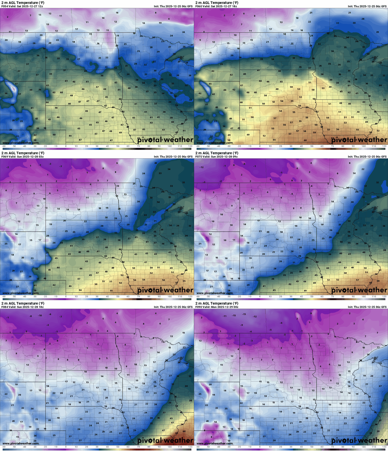
Friday and Saturday look unseasonably warm for late December, with highs in the lower 40s and overnight lows near freezing. While it will dry out, mostly cloudy skies will keep the gloomy mood going all weekend.
A more dramatic shift arrives Sunday morning, when a potent Arctic front will plunge the region back into true Upper Midwest winter. Temperatures will drop quickly, with lows near zero by early Monday. Northwest winds of 15–25 mph, gusting up to 40 mph, will make it feel 10–20 degrees below zero.